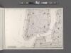
Maps of Jersey City
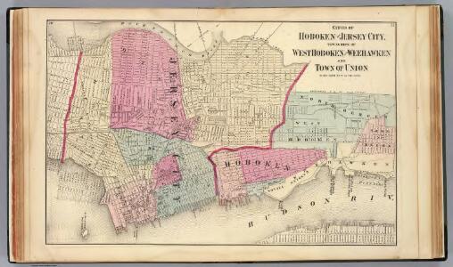
Hoboken, Jersey City.
1 : 19200 Beers, F. W. (Frederick W.)
Greenwich Village, West Village, Little Italy. (cont.)
From District 2
Map of New York, Brooklyn, Jersey City& c.
from Atlas of the Hudson River Valley from New York city to Troy, including a section of about 8 miles in width. Published by Watson & co. Compiled from official records and careful surveys, under the supervision of F. W. Beers.
Dutch Era Land Grants in Stokes Iconography sheet with Greenwich Village & Lower Manhattan.
from Manhattan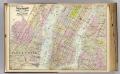
1 New York, Brooklyn, Jersey City.
1 : 18300 Watson, Gaylord
Topographical atlas of the city of New York, including the annexed territory showing original water courses and made land. / prepared under the direction of Egbert L. Viele.
From Topographical atlas of the city of New York, including the annexed territory showing original water courses and made land
Map of the city of New York, 1850 / drawn for D.T. Valentine's Manual 1850, by G. Hayward.
from Manhattan
New map of that part of the city of New York south from 20th Street on the Hudson & 35th Street on the East River : showing the position of Greenwich, Washington and West Streets on the Hudson River, and Pearl, Water, Front, Cherry & Tompkins Sts. on the
from Manhattan
Road from Philadelphia to New York. (Maps) 14 and 15.
1 : 63360 Moore, S.S.
New York (City).
1 : 24000 Goodrich, S.G.
New York.
1 : 24000 Bradford, Thomas G.
Jersey City, V. 1, Double Page Plate No. 40 [Map bounded by E. 40th St., New York Bay, E. 21st St.] / compiled under the direction of and published by G.M. Hopkins Co.
From V. 1
Plan Of New York &c.
1 : 31300 Mitchell, Samuel Augustus
Plan of the city of New York in North America : surveyed in the years 1766 & 1767 / B. Ratzer, lieutt. in His Majestys 60th or Royal American Regt. ; Thos. Kitchin, sculpt., engraver to His Late Royal Highness, the Duke of York, &c.
From Manhattan
New-York.
from The American traveller ; or, Guide through the United States, containing brief notices of the several states, cities, principal towns, canals and rail roads, etc. ; with tables of distances by stage, canal and steam boat routes ... by H.S. Tanner.
Plan of New York
1 : 2000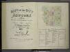
[Volume 7 Index Map.]
from Maps of the city of New York / surveyed under directions of insurance companies of said city.
Topographical atlas of the City of New York / by Egbert L. Viele.
from Topographical atlas of the city of New York, / including the annexed territory showing original water courses and made land / prepared under the direction of Egbert L. Viele.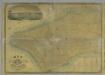
Map of the City of New York.
from Manhattan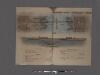
Hudson River Vehicular Tunnel [Holland Tunnel]
From Manhattan
[Volume 6 Index Map.]
from Maps of the city of New York / surveyed under directions of insurance companies of said city.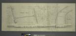
Project for a submarine rail way between New-York and Jersey-City / by Jérôme Wenmaekers.
from Whole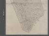
Map of New York City from Battery to 60th Street.
From Manhattan
Map of New York City, south of 46th St. : showing new arrangement of docks, piers, and water frontage, also soundings and former high water line
1 : 7200 Dripps, M. (Matthew) Matthew Dripps
Map of the City of New-York with part of Brooklyn and Williamsburgh : population in the year 1850: 450,000 inhabitants.
from Manhattan
This actual map and comparative plans showing 88 years growth of the City of New York : is inscribed to the citizens by the proprietor, David Longworth / G.B. King sc. N.Y. 1817 ; engraved by Jas. D. Stout.
from Manhattan
[Maps of the 14, 15, 16, 17, 20, 21 assembly districts and 23 & 24 Wards of New York City.]
From Manhattan
Map of Brookland Ferry. Extracted from: Stiles, Henry Reed. A History of the city of brooklyn. V.1.
From Brooklyn
Use District Map Section No. 12
from Use district map / City of New York, Board of Estimate and Apportionment.