Maps of Secaucus
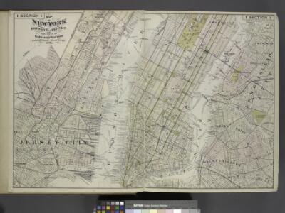
Map of New York, Brooklyn, Jersey City& c.
from Atlas of the Hudson River Valley from New York city to Troy, including a section of about 8 miles in width. Published by Watson & co. Compiled from official records and careful surveys, under the supervision of F. W. Beers.
Citizens and Travelers' Guide map in, to, and from the City of New York and adjacent places.
From Manhattan
Map of the City of New York with the adjacent cities of Brooklyn & Jersey City, & the village of Williamsburg.
From Manhattan
Amap of the city and county of New York, with the adjacent cities of Brooklyn and Jersey City, and the village of Williamsburg: with a street directory of the city of New York.
From Manhattan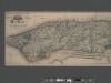
Sanitary and topographical map of the City and Island of New York ; prepared for the Council of Hygeine and Public Health of the Citizens Association under the direction of Egbert L. Viele, Topographical Engineer.
From Manhattan
New York City south of 93rd Street.
From Manhattan
The Great metropolis in 1804.
from Manhattan
Map Of New York and Vicinity.
1 : 23000 Dripps, Matthew
[New York City elevated Railroads.]
From Manhattan
Hagstrom's Map of lower New York City, House Number and Subway Guide.
From Manhattan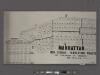
Manhattan, 1910 census tabulation tracts.
From Manhattan
Plan of the city of New York and of the island : as laid out by the commissioners, altered and arranged to the present time / engraved by J.F. Morin.
from Manhattan
Dutch Era Land Grants in Stokes Iconography sheet with Greenwich Village & Lower Manhattan.
from Manhattan
New York and vicinity
1 : 42240 Breese, Samuel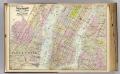
1 New York, Brooklyn, Jersey City.
1 : 18300 Watson, Gaylord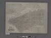
Map of the city of New York showing the original high water line and the location of the different farms and estates.
From Manhattan
Map of the city of New York, 1850 / drawn for D.T. Valentine's Manual 1850, by G. Hayward.
from Manhattan
Nostrands map of New York house numbers and subway guide. Ohman Map Co.
1 : 16000 Nostrand, George J.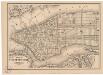
Map of the city of New York
1 mapa. Datat a partir de 1900 aproximadament. D. Appleton & Co.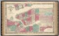
New York City.
1 : 20000 Johnson, A.J.
Map of the city of New York : with street directory showing house-numbers, hotels, churches, banks, theatres, ferries, house-car, steam and elevated R.R'ds, &c
1 : 12670 Dripps, M. (Matthew) M. Dripps
New York City, Brooklyn, Jersey City, Hoboken.
1 : 30000 Colton, G.W.
New York City, Brooklyn, Jersey City, Hoboken.
1 : 30000 Colton, G.W.
Fire Chart of the Borough of Manhattan, N.Y.
From Manhattan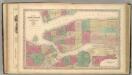
New York (City).
1 : 20600 Colton, G.W.
New York (City) and Brooklyn.
1 : 32000 Johnson, A.J.
Topographical map of New York City, County and vicinity, showing old farm lines, etc. Based on Radell's and other official surveys, drawings and modern surveys.
From Manhattan
New York City, Brooklyn, Jersey City, Hoboken.
1 : 30000 Colton, G.W.
New York City, Brooklyn, Jersey City, Hoboken.
1 : 749000 Colton, G. Woolworth