Project
Community
News
My maps
Cataloged map
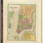
New York.
Full title:
New York.
Publisher:
Wiley and Putnam.
Physical Size:
20 x 30 cm
Map scale:
1:24 000
History