Maps of West New York
Map of Brookland Ferry. Extracted from: Stiles, Henry Reed. A History of the city of brooklyn. V.1.
From Brooklyn
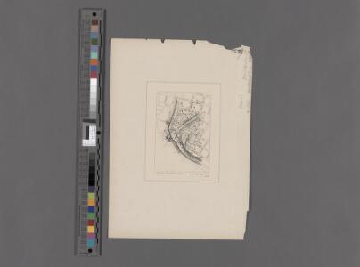
Map of the city of New-York extending northward to Fiftieth St. / surveyed and drawn by John F. Harrison, C.E.
from Manhattan
Plan Of New York &c.
1 : 31300 Mitchell, Samuel Augustus
Map of the city of New York, shewing the original high water line and the location of the different farms and estates
Common Council
City of New York.
1 : 17000 Tanner, Henry S.
Plan von New York
1 : 2000 New York (New York) Bibliographisches Institut
Plan von der Stadt New-York.
from Manhattan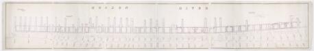
[Map of wharves and piers on North River from Battery Place to Hammond Street] / Edwin Smith, city surveyor, New York, November 1850.
from Manhattan
West Street [from Battery Park to Barrow Street.]
From Manhattan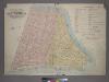
Outline & Index Map of Volume One, Atlas of New York City, Borough of Manhattan: Battery to Fourteenth Street.
from Atlas of the city of New York, borough of Manhattan. From actual surveys and official plans / by George W. and Walter S. Bromley.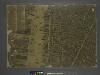
The city of New York / Will L. Taylor, chief draughtsman.
from Whole
Plan of the city of New-York : the greater part from actual survey made expressly for the purpose (the rest from authentic documents)
1 : 7300 Poppleton, Thomas H Prior & Dunning
A new map of the city of New York : comprising all the late improvements, compiled and corrected from authentic documents.
from Manhattan
City of New-York
1 : 12500 Burr, David H., 1803-1875 Edward Walker
Map of the city of New York.
from Manhattan
Outline and Index Map of Atlas of New York City.
from Atlas of the borough of Manhattan, city of New York.
Map showing the old high water lines along the shores of Brooklyn & New York together the the pier lines as established by law.
From Manhattan
City of New York, 1843.
from The cerographic atlas of the United States. By Sidney E. Morse, A.M., and Samuel Breese, A.M.
Plan of the city of New-York : the greater part from actual survey made expressly for the purpose (the rest from authentic documents) / by Thos. H. Poppleton, city surveyor ; P. Maverick sc. Newark.
from Manhattan
"Where all the Village meet to eat" - An accurate and detailed map of Greenwich Village and Environment.
From Manhattan
City of New-York.
1 : 17000 Mitchell, Samuel Augustus
Block distribution of children of 4 to 18 years of age for Chelsea and Greenwich for 1910.
From Manhattan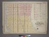
Outline and Index Map of Volume Two, Atlas of New York City, Borough of Manhattan. 14th Street to 59th Street.
from Atlas of the city of New York, borough of Manhattan. From actual surveys and official plans / by George W. and Walter S. Bromley.
The Firemen's guide : a map of the City of New-York, showing the fire districts, fire limits, hydrants, public cisterns, stations of engines, hooks & ladders, hose carts, &c.
from Manhattan
Plan of the city of New-York : the greater part from actual survey made expressly for the purpose (the rest from authentic documents) / by Thos. H. Poppleton, city surveyor ; P. Maverick sc. Newark.
from Manhattan
Plan of the city of New-York : with the recent and intended improvements / drawn from actual survey by William Bridges, city surveyor, A.D. 1807 ; engraved by Peter Maverick.
from Manhattan
Financial District map of New York City. Aero view of financial distrct above map.
From Manhattan
The city of New York drawn from actual surveys as furnished by the several city surveyors
1 : 2350 [s.n.]
Topographical Atlas Of The City Of New York
1 : 12000 Viele, Egbert L.