Maps of Union City

New map of that part of the city of New York south from 20th Street on the Hudson & 35th Street on the East River : showing the position of Greenwich, Washington and West Streets on the Hudson River, and Pearl, Water, Front, Cherry & Tompkins Sts. on the
from Manhattan
Plan Of New York &c.
1 : 31300 Mitchell, Samuel Augustus
New-York.
from The American traveller ; or, Guide through the United States, containing brief notices of the several states, cities, principal towns, canals and rail roads, etc. ; with tables of distances by stage, canal and steam boat routes ... by H.S. Tanner.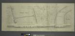
Project for a submarine rail way between New-York and Jersey-City / by Jérôme Wenmaekers.
from Whole
[Volume 6 Index Map.]
from Maps of the city of New York / surveyed under directions of insurance companies of said city.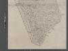
Map of New York City from Battery to 60th Street.
From Manhattan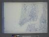
Use District Map Section No. 12
from Use district map / City of New York, Board of Estimate and Apportionment.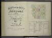
[Volume 7 Index Map.]
from Maps of the city of New York / surveyed under directions of insurance companies of said city.
Hudson River Vehicular Tunnel [Holland Tunnel]
From Manhattan
Plan of the city of New York in North America : surveyed in the years 1766 & 1767 / B. Ratzer, lieutt. in His Majestys 60th or Royal American Regt. ; Thos. Kitchin, sculpt., engraver to His Late Royal Highness, the Duke of York, &c.
From Manhattan
[Maps of the 14, 15, 16, 17, 20, 21 assembly districts and 23 & 24 Wards of New York City.]
From Manhattan
Plan of Weehawken township.
from Combined atlas of the State of New Jersey and the County of Hudson : from actual survey, official records & private plans / by and under the direction of G. M. Hopkins ...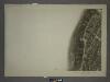
8C - N.Y. City (Aerial Set).
from Sectional aerial maps of the City of New York / [photographed and assembled under the direction of the chief engineer, July 1st, 1924].
Map of Brookland Ferry. Extracted from: Stiles, Henry Reed. A History of the city of brooklyn. V.1.
From Brooklyn
Plan of Weehawken Township.
1 : 9600 Hopkins, G.M.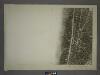
12A - N.Y. City (Aerial Set).
from Sectional aerial maps of the City of New York / [photographed and assembled under the direction of the chief engineer, July 1st, 1924].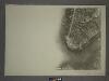
12C - N.Y. City (Aerial Set).
from Sectional aerial maps of the City of New York / [photographed and assembled under the direction of the chief engineer, July 1st, 1924].
8A - N.Y. City (Aerial Set).
from Sectional aerial maps of the City of New York / [photographed and assembled under the direction of the chief engineer, July 1st, 1924].
[Volume 1 Index Map]
from Maps of the city of New York.
West Street [from Battery Park to Barrow Street.]
From Manhattan
A plan of the city of New-York & its environs : to Greenwich, on the North or Hudsons River, and to Crown Point, on the East or Sound River, shewing the several streets, publick buildings, docks, fort & battery, with the true form & course of
from Charts and maps
[Volume 2 Index Map]
from Maps of the city of New York.
Area District Map Section No. 12; Area district map / City of New York, Board of Estimate and Apportionment.
from Area district map / City of New York, Board of Estimate and Apportionment. New York (N.Y.). Board of Estimate and Apportionment,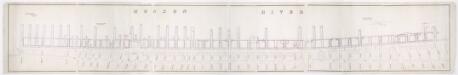
[Map of wharves and piers on North River from Battery Place to Hammond Street] / Edwin Smith, city surveyor, New York, November 1850.
from Manhattan
Key
From Atlas 107. Vol. 1, 1894.
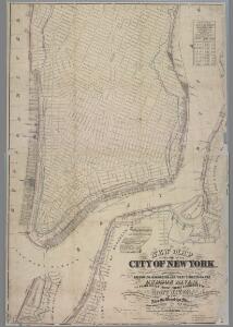
Map of the city of New-York extending northward to Fiftieth St. / surveyed and drawn by John F. Harrison, C.E.
from Manhattan
Map showing the high and low water mark and the original city grants of lands under water made to various parties from 1686 to 1873, extending from Battery to Fifty-first Street, Hudson and East Rivers, New York City, also the several pier and bulkhead l
from Whole
Map showing the high and low water mark and the original city grants of lands under water made to various parties from 1686 to 1873, extending from Battery to Fifty-first Street, Hudson and East Rivers, New York City, also the several pier and bulkhead l
from Whole
Financial District map of New York City. Aero view of financial distrct above map.
From Manhattan