Cataloged map
New-York.
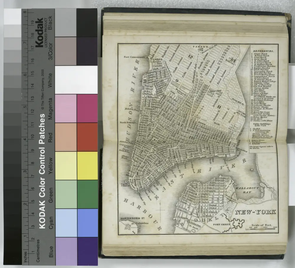

Full title:New-York.
Depicted:1836
Physical Size:20 x 30 cm
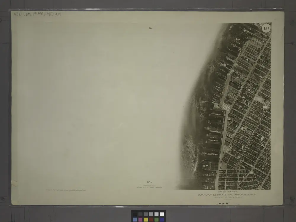
8C - N.Y. City (Aerial Set).
1924
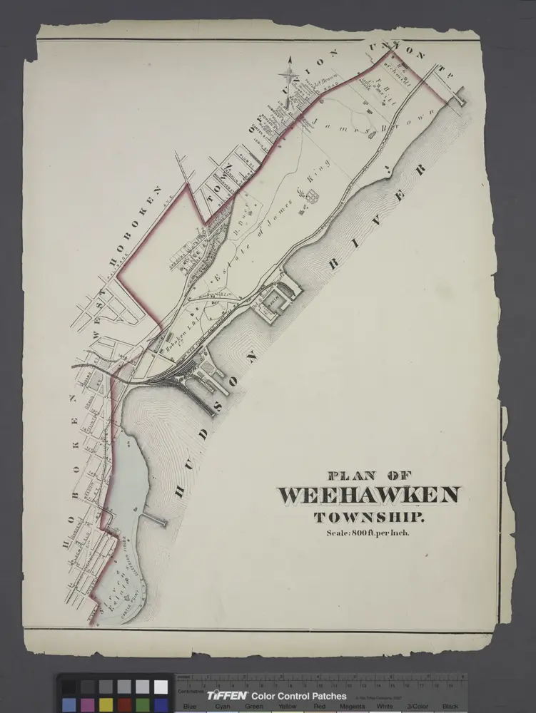
Plan of Weehawken township.
1873
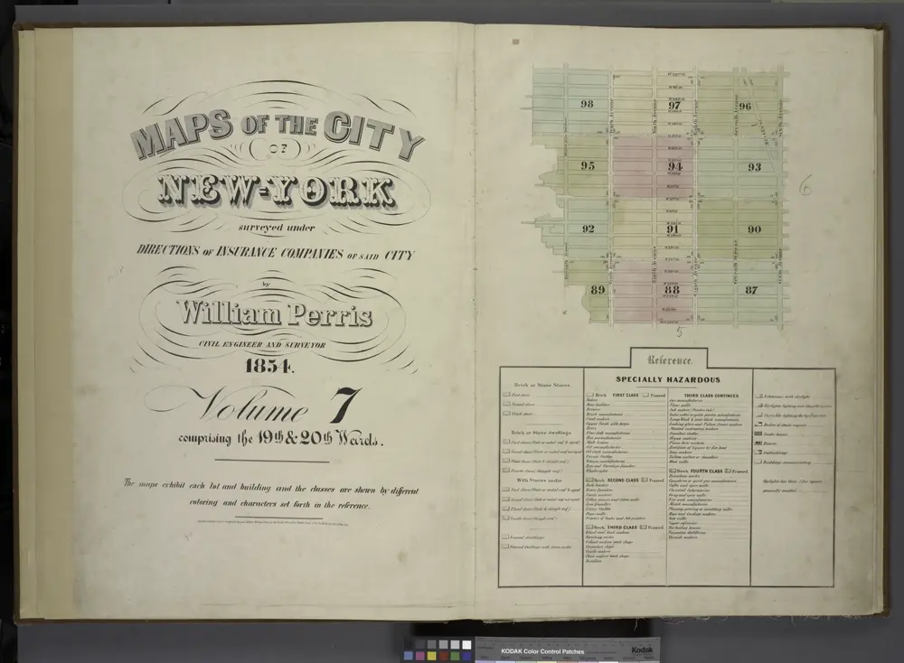
[Volume 7 Index Map.]
1854
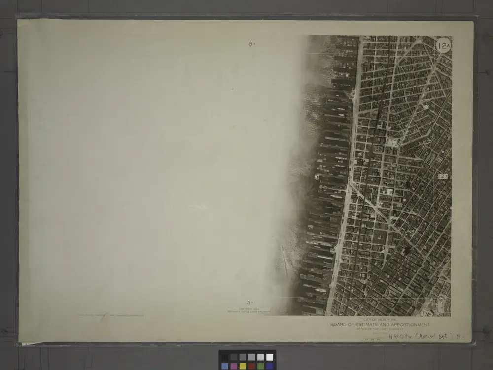
12A - N.Y. City (Aerial Set).
1924
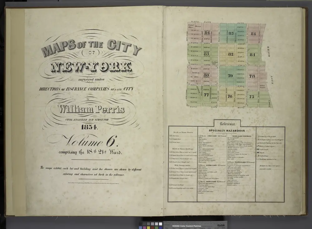
[Volume 6 Index Map.]
1854
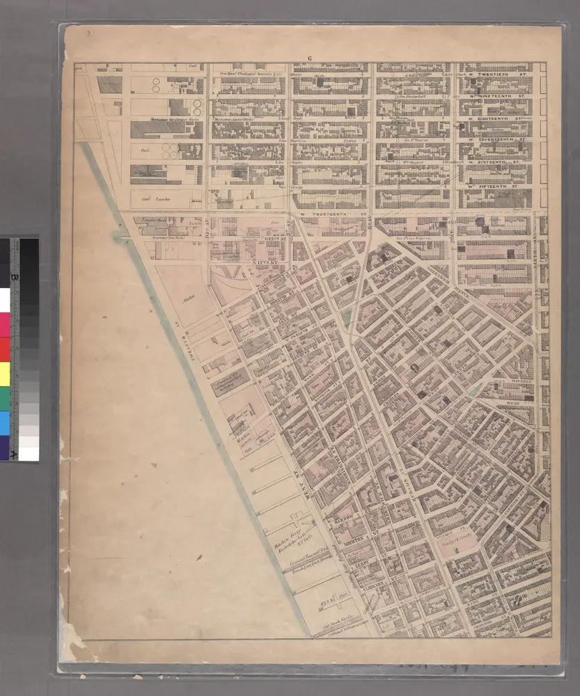
Sheet 6: [Bounded by W. Twentieth Street, Sixth Avenue, Carmine Street, Bleecker Street, Hancock Street, W. Houston Street, Varick Street, Charlton Street, Hudson Street, King Street, West Street and 10th Avenue.]
1867
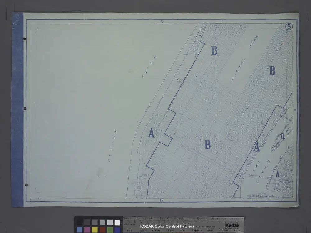
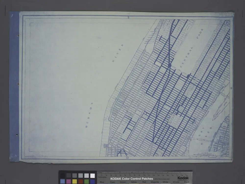
Area District Map Section No. 8
1916
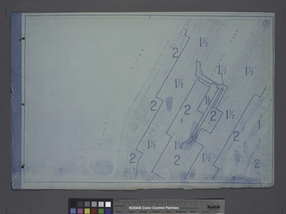
Height District Map Section No. 8
1916
Use District Map Section No. 8
1916
Map of New York City, south of 46th St. : showing new arrangement of docks, piers, and water frontage, also soundings and former high water line
1877
Dripps, M. (Matthew)
1:7k