Maps of Metropolitan France

Gallia IIII. Nova Tabula [Karte], in: Geographia universalis vetus et nova complectens Claudii Ptolemaei Alexandrini enarrationis libros VIII, S. 311.
1 Karte aus Atlas Münster, Sebastian [und Ptolemaeus, Claudius]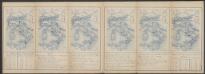
Gallia IIII. Nova Tabula [Karte], in: Claud. Ptolemaeus. Geographia lat. cum mappis [...], S. 341.
1 Karte aus Atlas Münster, Sebastian [und Ptolemaeus, Claudius]
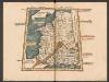
Tercia Europe Tabula [Karte], in: [Clavdii Ptholomei Cosmographi ...], S. 254.
1 Karte aus Atlas Nicolaus Germanus [und Ptolemaeus, Claudius]
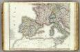
Western Europe.
1 : 7303000 Fisher, Richard Swainson
Tabula Europae III. [Karte], in: Geographia universalis vetus et nova complectens Claudii Ptolemaei Alexandrini enarrationis libros VIII, S. 228.
1 Karte aus Atlas Münster, Sebastian [und Ptolemaeus, Claudius]
Tabula Europae III. [Karte], in: Claud. Ptolemaeus. Geographia lat. cum mappis [...], S. 260.
1 Karte aus Atlas Münster, Sebastian [und Ptolemaeus, Claudius]
Tercia Europe Tabula [Gallia] [Karte], in: Claudii Ptolemei viri Alexandrini mathematice discipline philosophi doctissimi geographie opus [...], S. 157.
1 Karte aus Atlas Waldseemüller, Martin [und Ptolemaeus, Claudius] Übelin, Georg
Tabula Moderna Gallie [Karte], in: Claudii Ptolemei viri Alexandrini mathematice discipline philosophi doctissimi geographie opus [...], S. 242.
1 Karte aus Atlas Waldseemüller, Martin [und Ptolemaeus, Claudius] Übelin, Georg
Map of France, Spain, and Portugal; Switzerland in cantons [inset]; Island of Corsica [inset].
from Mitchell's new general atlas, containing maps of the various countries of the world, plans of cities, etc., embraced in fifty-three quarto maps., forming a series of eighty four maps and plans, together with valuable statistical tables.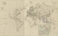
XI. Charte für die allgemeine Geschichte von der Selbstregierung Ludwig XIV. bis auf den österreichischen Erbfolgekrieg : d.i. von 1661 bis 1740 n. Christus
Entworfen von F.W. Benicken A. Falger gr. Weimar : im Verlage des L. Industrie-Comptoirs
Jak vzniká mapa
A new and exact map of France divided into all its provinces and acquisitions, ...
from The world described, or, A new and correct sett of maps : shewing the kingdoms and states in all the known parts of the earth, with the principal cities, and most considerable towns in the world ... / ... by Herman Moll, geographer ...
[Ethnographische Karte von Europa]
Zweiter Band, enthaltend in vier Abtheilungen die Vertheilung der Organismen: 5. Pflanzen-Geographie, 6. Thier-Geographie, 7. Anthropographie, 8. Ethnographie Humboldt, Alexander von Verlag von Justus Perthes
Carte aéronautique de France
Service Géographique de l'Armée
A new and accurate map of France with its aquisitions / composed from the latest surveys assited by the most approved maps & charts & regulated by astrol. Observations by Eman. Bowen
Bowen, Emmanuel
Der Sieg im Westen [Victory in the West]
Europe 3.
1 : 3850000 Brue, Adrien Hubert, 1786-1832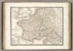
France 1789, 1813.
1 : 3700000 Lapie, M. (Pierre), 1779-1850
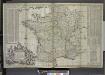
France.
from A new systeme of the mathematicks: containing I. Arithmetick, as well natural and decimal, as in species, or the principles of algebra. II. Practical geometry, together with the first six books of Euclid's Elements, as also the eleventh and twelfth, symbo
Carte pour l'intelligence de l'histoire d'Angleterre
1 Karte : Kupferdruck ; 26 x 26 cm, Bildgrösse 35 x 46 cm Châtelain s.n.
30-31. Francia, France.
1 : 3000000 Touring club italiano
Frankreich
Allgemeiner Atlas [Walch, Johannes] im Verlag bei Johannes Walch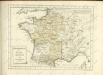

[Frankreich nach dem Friedensschluss von Paris vom 30. Mai 1814, in Départements eingetheilt]
Neuester Schul-Atlas Walch, Johann im Verlag bei Joh. Walch
Carte de la France protestante / dressée sous la dir. de la Commission des Publications de la Fédération Protestante de France ; dressée par L. Hermann
1 : 1500000 Hermann, L.; Fédération Protestante de France. Commission des Publications Paris : Fischbacher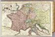
France &c.
1 : 2400000 Brue, Adrien Hubert, 1786-1832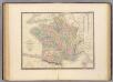
France.
1 : 3000000 Andriveau-Goujon, J.
Frankreich und Umgebungen von Paris
Hand-Atlas über alle Theile der Erde nach dem neuesten Zustande und über das Weltgebäude Stieler, Adolf bei Justus Perthes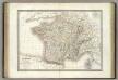
![Gallia IIII. Nova Tabula [Karte], in: Geographia universalis vetus et nova complectens Claudii Ptolemaei Alexandrini enarrationis libros VIII, S. 311.](https://images-2.georeferencer.com/images/iiif/464241066936/full/,300/0/native.jpg)

