Maps of Metropolitan France

Tercia Europe Tabula [Karte], in: [Clavdii Ptholomei Cosmographi ...], S. 254.
1 Karte aus Atlas Nicolaus Germanus [und Ptolemaeus, Claudius]
Tabula Europae III. [Karte], in: Geographia universalis vetus et nova complectens Claudii Ptolemaei Alexandrini enarrationis libros VIII, S. 228.
1 Karte aus Atlas Münster, Sebastian [und Ptolemaeus, Claudius]
Tabula Europae III. [Karte], in: Claud. Ptolemaeus. Geographia lat. cum mappis [...], S. 260.
1 Karte aus Atlas Münster, Sebastian [und Ptolemaeus, Claudius]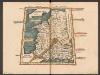
Tercia Europe Tabula [Gallia] [Karte], in: Claudii Ptolemei viri Alexandrini mathematice discipline philosophi doctissimi geographie opus [...], S. 157.
1 Karte aus Atlas Waldseemüller, Martin [und Ptolemaeus, Claudius] Übelin, Georg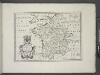
France, and parts adjoining.
from A new sett of maps both of antient and present geography : wherein not only the latitude and longitude of many places are corrected according to the latest observations, but also the most remarkable differences of antient and present geography may be quickly discern'd by a bare inspection or comparing of correspondent maps, which seems to be the most natural and easy method to lead young students (for whose use the work is principally intended) unto a competent knowledge of the geographical science : together with a geographical treatise particularly adapted to the use and design of these maps / by Edward Wells, M.A. and student of Christ-Church, Oxon.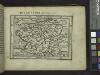
Gallia.
from Abraham Ortelius his epitome of the theater of the worlde / nowe latlye ... renewed and augmented ... by Micheal Coignet, mathematitian of Antwarpe.
Orbis Romani pars occidentalis, auspiciis serenissimi principis Ludovici Philippi Aurelianorum ducis publici juris facta
1 : 4300000
Westeuropa 1922
Westeuropa Kunz, Andreas ; Treiling, Thomas
Westeuropa 1957
Westeuropa Kunz, Andreas ; Treiling, Thomas
Západní Evropa při konci XIV. věku

Westeuropa 1848
Westeuropa Kunz, Andreas ; Röss, Wolf ; Johnen, Bettina ; Moeschl, Joachim Robert
Westeuropa 1820
Westeuropa Kunz, Andreas ; Röss, Wolf ; Johnen, Bettina ; Moeschl, Joachim Robert
Westeuropa 1937
Westeuropa Kunz, Andreas ; Treiling, Thomas
Westeuropa 1890
Westeuropa Kunz, Andreas ; Röss, Wolf ; Johnen, Bettina ; Moeschl, Joachim Robert
Westeuropa 1914
Westeuropa Kunz, Andreas ; Röss, Wolf ; Johnen, Bettina ; Moeschl, Joachim Robert
Westeuropa 1812
Westeuropa Kunz, Andreas ; Treiling, Thomas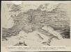
Stannard & Son's, panoramic birds-eye view of France & Prussia and the surrounding countries likely to be involved in the War, with the railways & startegic positions of each army, & the great fortresses of the Rhine provinces
1 : 1
Carte des routes de postes de l'Empire francais du royaume d'Italie et de la Confédération du Rhin
Evropa západní Tardieu, Pierre François
Westeuropa 1839
Westeuropa Kunz, Andreas ; Röss, Wolf ; Johnen, Bettina ; Moeschl, Joachim Robert
Westeuropa 1830
Westeuropa Kunz, Andreas ; Röss, Wolf ; Johnen, Bettina ; Moeschl, Joachim Robert
Westeuropa 1861
Westeuropa Kunz, Andreas ; Röss, Wolf ; Johnen, Bettina ; Moeschl, Joachim Robert
Westeuropa 1871
Westeuropa Kunz, Andreas ; Röss, Wolf ; Johnen, Bettina ; Moeschl, Joachim Robert
Westeuropa 1789
Westeuropa Kunz, Andreas ; Treiling, Thomas
Westeuropa 1797
Westeuropa Kunz, Andreas ; Treiling, Thomas
Orbis Romani Pars Occidentalis.
1 : 10137600 Lucas, Fielding Jr.
Gallia IIII. Nova Tabula [Karte], in: Claud. Ptolemaeus. Geographia lat. cum mappis [...], S. 341.
1 Karte aus Atlas Münster, Sebastian [und Ptolemaeus, Claudius]
Westeuropa 1949
Westeuropa Kunz, Andreas ; Treiling, Thomas
Europa zur Zeit Napoleons
Europa Napoleon I., Frankreich, Kaiser
Westeuropa 1867
Westeuropa Kunz, Andreas ; Röss, Wolf ; Johnen, Bettina ; Moeschl, Joachim Robert
![Tercia Europe Tabula [Karte], in: [Clavdii Ptholomei Cosmographi ...], S. 254.](https://images-2.georeferencer.com/images/iiif/571879804660/full/,300/0/native.jpg)

