Maps of Metropolitan France
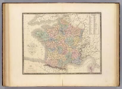
France.
1 : 3000000 Andriveau-Goujon, J.
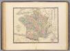
France.
1 : 3000000 Lapie, M. (Pierre), 1779-1850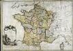
La France
1 Karte : Kupferdruck ; 54 x 77 cm Brion de la Tour; Le Campion; Le Campion chez les Campions freres rue St. Jacques à la ville de Rouen no. 8
Le Royaume De France, distingué suivant l'estendue de Toutes Ses Provinces Et Ses Acquisitions, dans l'Espagne, dans l'Italie, dans l'Allemagne [...] [Karte], in: Atlas nouveau, contenant toutes les parties du monde [...], Bd. 1, S. 74.
1 Karte aus Atlas Sanson, Nicolas Jaillot, Alexis Hubert und Mortier, Pieter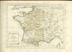

Frankreich und Umgebungen von Paris
Hand-Atlas über alle Theile der Erde nach dem neuesten Zustande und über das Weltgebäude Stieler, Adolf bei Justus Perthes
A new and accurate map of France with its aquisitions / composed from the latest surveys assited by the most approved maps & charts & regulated by astrol. Observations by Eman. Bowen
Bowen, Emmanuel
Gallia Vetus, Ad Iul Caesaris Commentaria [...] [Karte], in: Le théâtre du monde, ou, Nouvel atlas contenant les chartes et descriptions de tous les païs de la terre, Bd. 2, S. 182.
1 Karte aus Atlas Blaeu, Willem Janszoon und Blaeu, Joan Blaeu, Willem Janszoon
Nouvelle carte itinéraire de la France par départements et divisions militaires ...
From France
Gallia Vetus, Ad Iul Caesaris Commentaria [Karte], in: Theatrum orbis terrarum, sive, Atlas novus, Bd. 2, S. 187.
1 Karte aus Atlas Blaeu, Joan Blaeu, Willem Janszoon
Gallia Vetus, Ad Iulii Caesaris commentaria [...] [Karte], in: Theatrum orbis terrarum, S. 371.
1 Karte aus Atlas Ortelius, Abraham
[Frankreich nach dem Friedensschluss von Paris vom 30. Mai 1814, in Départements eingetheilt]
Neuester Schul-Atlas Walch, Johann im Verlag bei Joh. Walch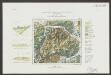
Gallia Le Royaume De France. [Karte], in: Le théâtre du monde, ou, Nouvel atlas contenant les chartes et descriptions de tous les païs de la terre, Bd. 2, S. 10.
1 Karte aus Atlas Blaeu, Willem Janszoon und Blaeu, Joan Blaeu, Willem Janszoon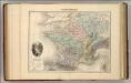
France Physique.
1 : 3700000 Migeon, J.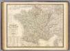
France physique, politique.
1 : 2350000 Andriveau-Goujon, J.
Gallia Vetus, Ad Iul Caesaris Commentaria, ex Conatibus Geographicis Abrah Ortelii. [Karte], in: Novus Atlas, das ist, Weltbeschreibung, Bd. 2, S. 189.
1 Karte aus Atlas Blaeu, Joan Blaeu, Willem Janszoon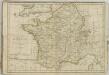

Gallia Vetus, Ad Iulij Caesaris commentaria. [Karte], in: Theatrum orbis terrarum, S. 467.
1 Karte aus Atlas Ortelius, Abraham Vrients, Jan Baptista
Gallia [Karte], in: Gerardi Mercatoris Atlas, sive, Cosmographicae meditationes de fabrica mundi et fabricati figura, S. 213.
1 Karte aus Atlas Mercator, Gerhard Montanus, Petrus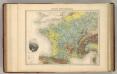
France Hypsometrique.
1 : 3700000 Migeon, J.
Frankreich
Hypsometrischer Atlas Ziegler, Jakob Melchior Topogr. Anstalt v. J. Wurster u. Comp.
Tabula Moderna Gallie [Karte], in: Claudii Ptolemei viri Alexandrini mathematice discipline philosophi doctissimi geographie opus [...], S. 242.
1 Karte aus Atlas Waldseemüller, Martin [und Ptolemaeus, Claudius] Übelin, Georg
Le Royaume De France. [Karte], in: Novus Atlas, das ist, Weltbeschreibung, Bd. 2, S. 18.
1 Karte aus Atlas Blaeu, Joan Blaeu, Willem Janszoon
Sprachkarte von Frankreich.
1 : 3700000 Berghaus, Heinrich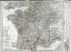
Carte de la France
1 Karte : Kupferdruck ; 55 x 66 cm Poirson; Jean chez Jean M.d d'estampes r. St. Jean de Beauvais n.o 10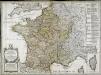
La France
1 Karte : Kupferdruck ; 49 x 67 cm Fortin; Robert de Vaugondy; Arrivet chez Fortin ing.r pour les globes et sphères rue de la Harpe près celle du Foin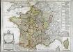
La France
1 Karte : Kupferdruck ; 49 x 67 cm Delamarche; Robert de Vaugondy; Arrivet chez Delamarche géographe rue du Foin St. Jacques au collège de M.e Gervais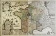
La France
1 Karte auf 2 Blättern : Kupferdruck ; 59 x 92 cm Inselin; Jaillot chez le Sr. Jaillot géographe ordinaire du roy quay et a coté des grands Augustins
Frankreich
Geographischer Atlas über alle Theile der Erde Ziegler, Jakob Melchior Verlag von Dietrich Reimer