Maps of Metropolitan France
France.
1 : 3000000 Lapie, M. (Pierre), 1779-1850
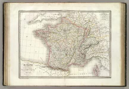
France.
1 : 3000000 Andriveau-Goujon, J.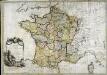
La France
1 Karte : Kupferdruck ; 54 x 77 cm Brion de la Tour; Le Campion; Le Campion chez les Campions freres rue St. Jacques à la ville de Rouen no. 8
Le Royaume De France, distingué suivant l'estendue de Toutes Ses Provinces Et Ses Acquisitions, dans l'Espagne, dans l'Italie, dans l'Allemagne [...] [Karte], in: Atlas nouveau, contenant toutes les parties du monde [...], Bd. 1, S. 74.
1 Karte aus Atlas Sanson, Nicolas Jaillot, Alexis Hubert und Mortier, Pieter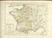

Frankreich und Umgebungen von Paris
Hand-Atlas über alle Theile der Erde nach dem neuesten Zustande und über das Weltgebäude Stieler, Adolf bei Justus Perthes
Gallia Vetus, Ad Iulii Caesaris commentaria [...] [Karte], in: Theatrum orbis terrarum, S. 371.
1 Karte aus Atlas Ortelius, Abraham
Nouvelle carte itinéraire de la France par départements et divisions militaires ...
From France
[Frankreich nach dem Friedensschluss von Paris vom 30. Mai 1814, in Départements eingetheilt]
Neuester Schul-Atlas Walch, Johann im Verlag bei Joh. Walch

Gallia Vetus, Ad Iul Caesaris Commentaria [...] [Karte], in: Le théâtre du monde, ou, Nouvel atlas contenant les chartes et descriptions de tous les païs de la terre, Bd. 2, S. 182.
1 Karte aus Atlas Blaeu, Willem Janszoon und Blaeu, Joan Blaeu, Willem Janszoon
Carte de France
1 Karte : Kupferdruck ; 54 x 65 cm Klinger J. G. Klinger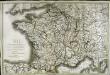
Carte de France
1 Karte : Kupferdruck ; 51 x 77 cm Brion de la Tour; Basset; Basset chez Basset m.d d'estampes rue St. Jacques au coin de celle des Mathurins
Carte de la France protestante / dressée sous la dir. de la Commission des Publications de la Fédération Protestante de France ; dressée par L. Hermann
1 : 1500000 Hermann, L.; Fédération Protestante de France. Commission des Publications Paris : Fischbacher
Gallia Vetus, Ad Iul Caesaris Commentaria [Karte], in: Theatrum orbis terrarum, sive, Atlas novus, Bd. 2, S. 187.
1 Karte aus Atlas Blaeu, Joan Blaeu, Willem Janszoon
La France 843 a 987.
1 : 5800000 Houze, Antoine Philippe
A new and accurate map of France with its aquisitions / composed from the latest surveys assited by the most approved maps & charts & regulated by astrol. Observations by Eman. Bowen
Bowen, Emmanuel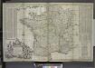
A new and exact map of France divided into all its provinces and acquisitions, ...
from The world described, or, A new and correct sett of maps : shewing the kingdoms and states in all the known parts of the earth, with the principal cities, and most considerable towns in the world ... / ... by Herman Moll, geographer ...
Gallia Vetus Ad Iulii Caesaris commentaria. [Karte], in: Gerardi Mercatoris et I. Hondii Newer Atlas, oder, Grosses Weltbuch, Bd. 2, S. 152.
1 Karte aus Atlas Mercator, Gerhard und Hondius, Jodocus Jansson, Jan
Gallia Vetus Ad Iulii Caesaris commentaria. [Karte], in: Novus atlas absolutissimus, Bd. 4, S. 23.
1 Karte aus Atlas Janssonius Offizin
Gallia Vetus, Ad Iulij Caesaris commentaria. [Karte], in: Theatrum orbis terrarum, S. 467.
1 Karte aus Atlas Ortelius, Abraham Vrients, Jan Baptista
Gallia Le Royaume De France. [Karte], in: Le théâtre du monde, ou, Nouvel atlas contenant les chartes et descriptions de tous les païs de la terre, Bd. 2, S. 10.
1 Karte aus Atlas Blaeu, Willem Janszoon und Blaeu, Joan Blaeu, Willem Janszoon
Tabula Moderna Gallie [Karte], in: Claudii Ptolemei viri Alexandrini mathematice discipline philosophi doctissimi geographie opus [...], S. 242.
1 Karte aus Atlas Waldseemüller, Martin [und Ptolemaeus, Claudius] Übelin, Georg
Charte von Frankreich in Departements eingetheilt
1 : 2500000 Francie Joh. Walch

Frankreich
Allgemeiner Atlas [Walch, Johannes] im Verlag bei Johannes Walch
Frankreich
Carte des Gaules.
1 : 6000000 Malte-Brun, Conrad, 1775-1826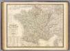
France physique, politique.
1 : 2350000 Andriveau-Goujon, J.