Maps of Metropolitan France

Frankreich und Umgebungen von Paris
Hand-Atlas über alle Theile der Erde nach dem neuesten Zustande und über das Weltgebäude Stieler, Adolf bei Justus Perthes
La France
1 Karte : Kupferdruck ; 54 x 77 cm Brion de la Tour; Le Campion; Le Campion chez les Campions freres rue St. Jacques à la ville de Rouen no. 8
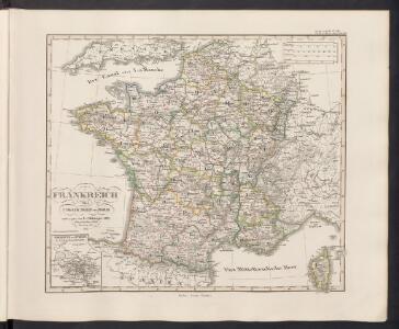
[Frankreich nach dem Friedensschluss von Paris vom 30. Mai 1814, in Départements eingetheilt]
Neuester Schul-Atlas Walch, Johann im Verlag bei Joh. Walch
Nouvelle carte itinéraire de la France par départements et divisions militaires ...
From France
Gallia Vetus, Ad Iulii Caesaris commentaria [...] [Karte], in: Theatrum orbis terrarum, S. 371.
1 Karte aus Atlas Ortelius, Abraham
France.
1 : 3000000 Lapie, M. (Pierre), 1779-1850

Frankreich
Allgemeiner Atlas [Walch, Johannes] im Verlag bei Johannes Walch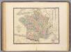
France.
1 : 3000000 Andriveau-Goujon, J.
La France 843 a 987.
1 : 5800000 Houze, Antoine Philippe
Gallia Vetus, Ad Iulij Caesaris commentaria. [Karte], in: Theatrum orbis terrarum, S. 467.
1 Karte aus Atlas Ortelius, Abraham Vrients, Jan Baptista
Gallia Vetus, Ad Iul Caesaris Commentaria [...] [Karte], in: Le théâtre du monde, ou, Nouvel atlas contenant les chartes et descriptions de tous les païs de la terre, Bd. 2, S. 182.
1 Karte aus Atlas Blaeu, Willem Janszoon und Blaeu, Joan Blaeu, Willem Janszoon
Le Royaume De France, distingué suivant l'estendue de Toutes Ses Provinces Et Ses Acquisitions, dans l'Espagne, dans l'Italie, dans l'Allemagne [...] [Karte], in: Atlas nouveau, contenant toutes les parties du monde [...], Bd. 1, S. 74.
1 Karte aus Atlas Sanson, Nicolas Jaillot, Alexis Hubert und Mortier, Pieter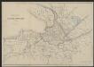
Gallia Vetus Ad Iulii Caesaris commentaria. [Karte], in: Gerardi Mercatoris et I. Hondii Newer Atlas, oder, Grosses Weltbuch, Bd. 2, S. 152.
1 Karte aus Atlas Mercator, Gerhard und Hondius, Jodocus Jansson, Jan
Frankreich
Adolf Stieler's Handatlas über alle Theile der Erde und über das Weltgebäude Stieler, Adolf Justus Perthes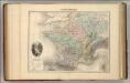
France Physique.
1 : 3700000 Migeon, J.
Gallia Vetus, Ad Iul Caesaris Commentaria [Karte], in: Theatrum orbis terrarum, sive, Atlas novus, Bd. 2, S. 187.
1 Karte aus Atlas Blaeu, Joan Blaeu, Willem Janszoon
Gallia [Karte], in: Gerardi Mercatoris Atlas, sive, Cosmographicae meditationes de fabrica mundi et fabricati figura, S. 213.
1 Karte aus Atlas Mercator, Gerhard Montanus, Petrus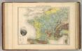
France Hypsometrique.
1 : 3700000 Migeon, J.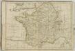

Jak vzniká mapa

Frankreich

Frankreich
1 Karte : Kupferdruck ; 18 x 22 cm Walch zu finden bey Ioh. Walch
Carte de France
1 Karte : Kupferdruck ; 54 x 65 cm Klinger J. G. Klinger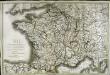
Carte de France
1 Karte : Kupferdruck ; 51 x 77 cm Brion de la Tour; Basset; Basset chez Basset m.d d'estampes rue St. Jacques au coin de celle des Mathurins
Gallia Vetus, Ad Iul Caesaris Commentaria, ex Conatibus Geographicis Abrah Ortelii. [Karte], in: Novus Atlas, das ist, Weltbeschreibung, Bd. 2, S. 189.
1 Karte aus Atlas Blaeu, Joan Blaeu, Willem Janszoon
Gallia Vetus Ad Iulii Caesaris commentaria. [Karte], in: Novus atlas absolutissimus, Bd. 4, S. 23.
1 Karte aus Atlas Janssonius Offizin
Frankreich
Geographischer Atlas über alle Theile der Erde Ziegler, Jakob Melchior Verlag von Dietrich Reimer
Galliae supra omnes in hac forma editiones locupletißima et exatißima descriptio. [Karte], in: Gerardi Mercatoris et I. Hondii Newer Atlas, oder, Grosses Weltbuch, Bd. 2, S. 16.
1 Karte aus Atlas Mercator, Gerhard und Hondius, Jodocus Jansson, Jan