Maps of Metropolitan France

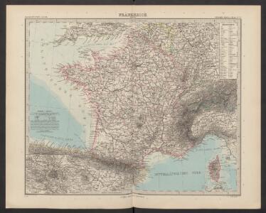
Frankreich
Adolf Stieler's Handatlas über alle Theile der Erde und über das Weltgebäude Stieler, Adolf Justus Perthes
Frankreich und Umgebungen von Paris
Hand-Atlas über alle Theile der Erde nach dem neuesten Zustande und über das Weltgebäude Stieler, Adolf bei Justus Perthes
Frankreich
Geographischer Atlas über alle Theile der Erde Ziegler, Jakob Melchior Verlag von Dietrich Reimer
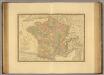
Frankreich
Allgemeiner Atlas [Walch, Johannes] im Verlag bei Johannes Walch
Frankreich
Hypsometrischer Atlas Ziegler, Jakob Melchior Topogr. Anstalt v. J. Wurster u. Comp.
[Frankreich nach dem Friedensschluss von Paris vom 30. Mai 1814, in Départements eingetheilt]
Neuester Schul-Atlas Walch, Johann im Verlag bei Joh. Walch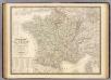
France physique, politique.
1 : 2350000 Andriveau-Goujon, J.
La France 843 a 987.
1 : 5800000 Houze, Antoine Philippe
[Neuer Atlas der ganzen Erde nach den neuesten Bestimmungen ... : IX.] Frankreich
Berichtigt und ergänzt im Jahr 1830 von Dr. F.W. Streit Leipzig : J.C. Hinrichs'sche Buchhandlung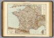
France.
1 : 3000000 Andree, Richard; Times (London, England)
Frankreich
Geographischer Atlas über alle Theile der Erde Ziegler, Jakob Melchior Verlag von Joh. Wurster um Comp.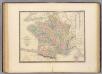
France.
1 : 3000000 Andriveau-Goujon, J.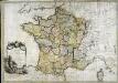
La France
1 Karte : Kupferdruck ; 54 x 77 cm Brion de la Tour; Le Campion; Le Campion chez les Campions freres rue St. Jacques à la ville de Rouen no. 8
Frankreich
[Allgemeiner Atlas über alle Theile der Erde in 29 Blättern] Ziegler, Jakob Melchior Top. Anstalt v. J. Wurster u. Comp.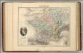
France Physique.
1 : 3700000 Migeon, J.
Nouvelle carte itinéraire de la France par départements et divisions militaires ...
From France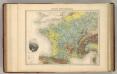
France Hypsometrique.
1 : 3700000 Migeon, J.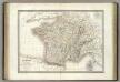
France.
1 : 3000000 Lapie, M. (Pierre), 1779-1850
CHARTE von FRANKREICH nach der neuesten Eintheilung in 22. Militair-Divisionen 86. Departemente mit Beziehung auf die alte Eintheilung in Provinzen entworfen
Elba (Itálie)
Charte von Frankreich nach der neuesten Eintheilung in 22. Militair-Divisionen 86. Departemente mit Beziehung auf die alte Eintheilung in Provinzen entworfen
Elba (Itálie)
Sprachkarte von Frankreich.
1 : 3700000 Berghaus, Heinrich
Jak vzniká mapa

Gallia [Karte], in: Gerardi Mercatoris Atlas, sive, Cosmographicae meditationes de fabrica mundi et fabricati figura, S. 213.
1 Karte aus Atlas Mercator, Gerhard Montanus, Petrus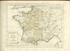
France en 1789.
1 : 2950000 Picquet, C.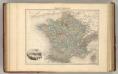
France Politique.
1 : 3700000 Migeon, J.
A new and accurate map of France with its aquisitions / composed from the latest surveys assited by the most approved maps & charts & regulated by astrol. Observations by Eman. Bowen
Bowen, Emmanuel
Gallia Vetus, Ad Iulii Caesaris commentaria [...] [Karte], in: Theatrum orbis terrarum, S. 371.
1 Karte aus Atlas Ortelius, Abraham
Carte de la France protestante / dressée sous la dir. de la Commission des Publications de la Fédération Protestante de France ; dressée par L. Hermann
1 : 1500000 Hermann, L.; Fédération Protestante de France. Commission des Publications Paris : Fischbacher