Maps of Metropolitan France

CHARTE von FRANKREICH nach der neuesten Eintheilung in 22. Militair-Divisionen 86. Departemente mit Beziehung auf die alte Eintheilung in Provinzen entworfen
Elba (Itálie)
Charte von Frankreich nach der neuesten Eintheilung in 22. Militair-Divisionen 86. Departemente mit Beziehung auf die alte Eintheilung in Provinzen entworfen
Elba (Itálie)
Frankreich
Hypsometrischer Atlas Ziegler, Jakob Melchior Topogr. Anstalt v. J. Wurster u. Comp.
Frankreich
Gallia Vetus Ad Iulii Caesaris commentaria. [Karte], in: Gerardi Mercatoris et I. Hondii Newer Atlas, oder, Grosses Weltbuch, Bd. 2, S. 152.
1 Karte aus Atlas Mercator, Gerhard und Hondius, Jodocus Jansson, Jan
Charte von Frankreich in Departements eingetheilt
1 : 2500000 Francie Joh. Walch
Nouvelle carte itinéraire de la France par départements et divisions militaires ...
From France
Frankreich
Geographischer Atlas über alle Theile der Erde Ziegler, Jakob Melchior Verlag von Dietrich Reimer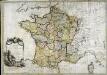
La France
1 Karte : Kupferdruck ; 54 x 77 cm Brion de la Tour; Le Campion; Le Campion chez les Campions freres rue St. Jacques à la ville de Rouen no. 8
La France au commencement de la 3eme. race (987-996)
1 : 1
Empire Francais et Royaume d'Italie en 1809.
1 : 6000000 Houze, Antoine Philippe
Gallia Vetus, Ad Iulii Caesaris commentaria [...] [Karte], in: Theatrum orbis terrarum, S. 371.
1 Karte aus Atlas Ortelius, Abraham
Frankreich und Umgebungen von Paris
Hand-Atlas über alle Theile der Erde nach dem neuesten Zustande und über das Weltgebäude Stieler, Adolf bei Justus Perthes
Frankreich
[Allgemeiner Atlas über alle Theile der Erde in 29 Blättern] Ziegler, Jakob Melchior Top. Anstalt v. J. Wurster u. Comp.
[Neuer Atlas der ganzen Erde nach den neuesten Bestimmungen ... : IX.] Frankreich
Berichtigt und ergänzt im Jahr 1830 von Dr. F.W. Streit Leipzig : J.C. Hinrichs'sche Buchhandlung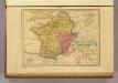
Carte des Gaules.
1 : 6000000 Malte-Brun, Conrad, 1775-1826
Gallia Vetus Ad Iulii Caesaris commentaria. [Karte], in: Novus atlas absolutissimus, Bd. 4, S. 23.
1 Karte aus Atlas Janssonius Offizin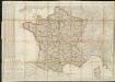
Carte de France divisée en 86 departemens
1 : 2060000
Carte de France
1 Karte : Kupferdruck ; 54 x 65 cm Klinger J. G. Klinger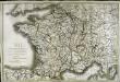
Carte de France
1 Karte : Kupferdruck ; 51 x 77 cm Brion de la Tour; Basset; Basset chez Basset m.d d'estampes rue St. Jacques au coin de celle des Mathurins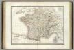
France.
1 : 3000000 Lapie, M. (Pierre), 1779-1850
La France 1643 a 1715.
1 : 6000000 Houze, Antoine Philippe
Charte von Frankreich
1 : 1650000 Francie Seidel, G. E. F. Cassini, Jean-Dominique Christoph Fembo
[Frankreich nach dem Friedensschluss von Paris vom 30. Mai 1814, in Départements eingetheilt]
Neuester Schul-Atlas Walch, Johann im Verlag bei Joh. Walch
La France 1350 a 1364.
1 : 6000000 Houze, Antoine Philippe
La France 1422 a 1461.
1 : 6000000 Houze, Antoine Philippe
La France 843 a 987.
1 : 5800000 Houze, Antoine Philippe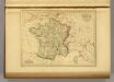
France in 1789.
1 : 5900000 Malte-Brun, Conrad, 1775-1826
La France 1814 a 1840.
1 : 6000000 Houze, Antoine Philippe


