Maps of Hauts-de-France

[Geologische Profile von Deutschland im Allgemeinen u. vom Riesengebirge im besondern]
Erster Band, enthaltend in vier Abtheilungen die Erscheinungen der anorganischen Natur: 1. Meteorologie und Klimatographie. 2. Hydrologie und Hydrographie. 3. Geologie. 4. Tellurischer Magnetismus Humboldt, Alexander von Verlag von Justus Perthes
Geologische Profile von Deutschland im Allgemeinen.
1 : 3870000 Berghaus, Heinrich
Théatre de la guerre, ou carte des frontières de la république française et de l'empire d'Allemagne, 1
1 Teil : Delamarche
Nordost-Frankreich und Belgien
1 : 750000 Belgie Justus Perthes
Der Canal mit den Englischen und Französischen Küsten
Geologischer Atlas zur Naturgeschichte der Erde Leonhard, Carl Cäsar von E. Schweizerbart'sche Verlagsbuchhandlung
Gallia Belgica et Germania Vtraqve Cisrhenana Svperior et Inferior excvsa
1 : 26000000 Mollova mapová sbírka Weigel, Christoph Weigel, Christoph I.
Les gouvernements de Flandre, de Picardie, d'Artois, de l'Isle de France, et de Champagne
1 : 5840000 Artois (Francie) Bonne, Rigobert André
La Seine.
1 : 1400000 Buache, Philippe, 1700-1773
Carte géographique et physique du bassin terrestre de la Seine
1 Karte : Kupferdruck ; 27 x 34 cm, Blattgrösse 46 x 61 cm Buache Philippe Buache
Severovýchodní Francie

Panoramatic View of the frontier between France and Germany
1 : 771000 Francie Meinhard, R. Julius Abelsdorff
Paasche's Frontenkarte, Nr.4. Der Krieg gegen Russland


Paasche's Frontenkarte, Nr.17. Der Krieg gegen Russland

Paasche's Frontenkarte, Nr.13. Der Krieg gegen Russland

A map of the seat of war in France, with the country divided into its several departments
1 : 2600000
Karte von Frankreich in XVI Blättern, No. 2 und [No. 6]
2 Blätter : 52 x 34 cm Königl. Preuss. Academischen Kunst und Buchhandlung
Reliefkarte des Kanals von Cherbourg bis zur Scheldemündung
Anglie jihovýchodní Franckh'sche Verlagshandlung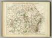
Carte Physique et Militaire de la Frontiere du Nord-Est.
1 : 1000000 Jouvet et Cie.
France 2.
1 : 1774080 Letts, Son & Co.
Région Nord comprenant les XI departements du Nord de la France
1 Karte : Kupferdruck ; 53 x 46 cm Lotter; Lotter Lotter
France, Picardie, Champaigne
1 Karte : Kupferdruck ; 18 x 24 cm Mercator Cloppenburgh
France, Picardie Champaigne
1 Karte : Kupferdruck ; 34 x 38 cm Mercator; Hondius Henricus Hondius
France, Picardie Champaigne
1 Karte : Kupferdruck ; 34 x 38 cm Hondius; Mercator Jodocus Hondius
France, Picardie Champaigne
1 Karte : Kupferdruck ; 34 x 37 cm Mercator s.n.
Carte des gouvernements de Flandre françoise, d'Artois, de Picardie et du Boulenois
1 Karte : Kupferdruck ; 42 x 55 cm Bonne; Santini; Remondini chez Mr. Remondini
France Picardie Champaigne cum regionibus adiacentibus. [Karte], in: Gerardi Mercatoris Atlas, sive, Cosmographicae meditationes de fabrica mundi et fabricati figura, S. 232.
1 Karte aus Atlas Mercator, Gerhard Montanus, Petrus
Ile de France, Orleanois.
1 : 930000 Bonne, Rigobert, 1727-1794
Carte de France, 3
2 Blätter : Kupferdruck ; 54 x 45 cm Crepy
![[Geologische Profile von Deutschland im Allgemeinen u. vom Riesengebirge im besondern]](https://images-0.georeferencer.com/images/iiif/785761277338/full/,300/0/native.jpg)

