Maps of Hauts-de-France

Théatre de la guerre, ou carte des frontières de la république française et de l'empire d'Allemagne, 1
1 Teil : Delamarche
[Geologische Profile von Deutschland im Allgemeinen u. vom Riesengebirge im besondern]
Erster Band, enthaltend in vier Abtheilungen die Erscheinungen der anorganischen Natur: 1. Meteorologie und Klimatographie. 2. Hydrologie und Hydrographie. 3. Geologie. 4. Tellurischer Magnetismus Humboldt, Alexander von Verlag von Justus Perthes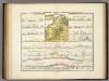
Geologische Profile von Deutschland im Allgemeinen.
1 : 3870000 Berghaus, Heinrich
Les gouvernements de Flandre, de Picardie, d'Artois, de l'Isle de France, et de Champagne
1 : 5840000 Artois (Francie) Bonne, Rigobert André
Paasche's Frontenkarte, Nr.4. Der Krieg gegen Russland


Panoramatic View of the frontier between France and Germany
1 : 771000 Francie Meinhard, R. Julius Abelsdorff
Paasche's Frontenkarte, Nr.17. Der Krieg gegen Russland

Paasche's Frontenkarte, Nr.13. Der Krieg gegen Russland

Région Nord comprenant les XI departements du Nord de la France
1 Karte : Kupferdruck ; 53 x 46 cm Lotter; Lotter Lotter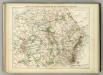
Carte Physique et Militaire de la Frontiere du Nord-Est.
1 : 1000000 Jouvet et Cie.
La Seine.
1 : 1400000 Buache, Philippe, 1700-1773
Carte géographique et physique du bassin terrestre de la Seine
1 Karte : Kupferdruck ; 27 x 34 cm, Blattgrösse 46 x 61 cm Buache Philippe Buache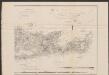
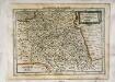
France Picardie Champaigne cum regionibus adiacentibus. [Karte], in: Gerardi Mercatoris Atlas, sive, Cosmographicae meditationes de fabrica mundi et fabricati figura, S. 232.
1 Karte aus Atlas Mercator, Gerhard Montanus, Petrus
The Western Front. June 1918.
1 : 600000 First World War map of the Western Front. June 1918. Front Line June 12th, June 5th and March 20th. War Office
Western Front. Front line on March 20th, Aug.16th, Sept. 18th 1918.
1 : 600000 First World War map of the Western Front. Front line on March 20th, Aug.16th, Sept. 18th 1918. Shows limits of German advance in 1918. War Office
Einsatz der 1./Pz. Rgt. 2 im Westen vom 10. 5. - 6. 9. 1940
Francie Veit Carl Kaestner
Nova et Accuratißima Galliae Tabula, Vulgo Royaume De France
1 : 920000 Mollova mapová sbírka Danckerts, Justus Danckerts, Justus
Provinciae Belgii regii
1 : 760000 Belgie Danckerts, Justus Iusto Danckerts
PROVINCIAE BELGII REGII
1 : 760000 Belgie Danckerts, Justus Iusto Danckerts
Kriegs Atlas 36 Karten von den Schauplätzen des Weltkrieges 1914/1915

France, Picardie, Champaigne
1 Karte : Kupferdruck ; 18 x 24 cm Mercator Cloppenburgh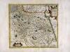
France, Picardie Champaigne
1 Karte : Kupferdruck ; 34 x 38 cm Mercator; Hondius Henricus Hondius
France, Picardie Champaigne
1 Karte : Kupferdruck ; 34 x 38 cm Hondius; Mercator Jodocus Hondius
France, Picardie Champaigne
1 Karte : Kupferdruck ; 34 x 37 cm Mercator s.n.
Carte des gouvernements de Flandre françoise, d'Artois, de Picardie et du Boulenois
1 Karte : Kupferdruck ; 42 x 55 cm Bonne; Santini; Remondini chez Mr. Remondini
Carte de France, 3
2 Blätter : Kupferdruck ; 54 x 45 cm Crepy
Ile de France, Orleanois.
1 : 930000 Bonne, Rigobert, 1727-1794


