Maps of France

Le Ponant
1 Karte auf 2 Blättern : Kupferdruck ; 80 x 81 cm Dicquemare; Patry; Nicollet chez. J. B. Patry M.d libraire
Brittische Übermacht zur See wider Franckreich a.o 1759, in denen Unternehmungen derer Engelländer auf die französisch Küsten, nach denen besten Engl. u. Französischen Original Berichten und durch kostbahre Correspondence erhaltene Gewissheit
1 : 2500000 gezeichnet u. historisch erklähret durch Christian Fried. von der Heyden designée fort exactement et explicque par Chrétien Frédéric de Heyden ; gravé par M. A. Lotter, le fis in Augsp : verlegt von Tob. Conr. Lotter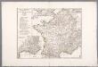
Gallia Antiqua ex aevi Romani monumentis eruta, et serenissimi Carnutum ducis munificentia publici juris facta / auctor d'Anville ; [gravé par] De-la-Haye
1 : 2500000 Annotatie: Met lijst van Romeinse provincies: I-XVII; In: [Atlas du Sr. d'Anville], bl. 7; Annotatie geografische gegevens: Met schaalstokken Jean-Baptiste Bourguignon d' Anville 1697-1782; Guillaume Nicolas Delahaye 1727-1802 [Paris : apud auctorem]
Regnum Galliæ
1 Karte : Kupferdruck ; 46 x 58 cm Valck; Valck G. und L. Valck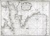
Carte de la Manche des costes de France
1 Karte : Kupferdruck ; 52 x 72 cm Huc; Ch chez le Sr. Huc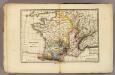
France physique.
1 : 4400000 Vincent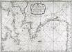
Carte de la Manche des costes de France
1 Karte : Kupferdruck ; 52 x 72 cm Huc; Ch chez le Sr. Huc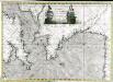
Carte de la Manche des costes de France
1 Karte auf 2 Blättern : Kupferdruck ; 51 x 72 cm Probst; Jäck; Ch chez Iean Michel Probst
Regnum Galliae divisum in duodecim gubernationes Piccardiae, Normandiae, Insulae Franciae, Britanniae, Aureliae, Burgundiae, Lugdini, Aquitaniae, Languedoci, Delphinatus et Provintiae
1 : 250000 [...] et hac tabula expressum a Gerardo et Leonardo Valk [Amsterdam] : [Gerardus et Leonardus Valk]
Gallia Antiqua.
1 : 5500000 Anville, Jean Baptiste Bourguignon d, 1697-1782
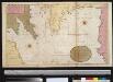
A large chart of the BAY OF BISCAY
from The sea-atlas : containing an hydrographical description of most of the sea-coasts of the known parts of the world.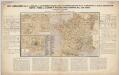
Nieuwe aardrijkskundige kaart van Frankrijk met geschiedkundig overzicht van den Duitsch-Franschen oorlog 1870-71 en aanteekening der Duitsche legerbewegingen, benevens de plannen der slagvelden om Weissenburg, Wörth, Saarbruggen, Metz, Sedan en Parijs / bewerkt door F.E.L.A. Abel ...
1 : 2400000 Annotatie: Met omringende tekst en tabellen; Annotatie geografische gegevens: Legenda F.E.L.A. Abel 's Hage : lithographie en uitgave van J. Smulders & Co ...
Brittische Übermacht zur See wider Franckreich a.o 1759
1 Karte : Kupferdruck ; 46 x 36 cm, Bildgrösse 48 x 47 cm Heyden; Lotter; Lotter verlegt von Tob: Conr: Lotter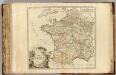
France postes.
1 : 2400000 Robert de Vaugondy, Gilles, 1688-1766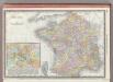
France.
1 : 3040000 Rand McNally and Company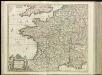
[13][13] Accuratissima Galliae tabula, uit: Atlas sive Descriptio terrarum orbis
Annotatie: Gedigitaliseerde versie. Amsterdam. Heiloo : Picturae (vervaardiger), 2015. tiff-bestand. Gedigitaliseerd: 07-01-2015; Origineel: Universiteitsbibliotheek Vrije Universiteit (XL.05127.-) ; Netherlands; Titelpagina ontbreekt Wit, Frederik de Amsterdam : Frederick de Wit
Landtaflen
1 Atlas [von Johannes Stumpf] Christoffel Froschower, Zürych
Die durch die Engellænder beunruhigte französische Küsten a.o 1758
1 Karte : Kupferdruck ; 47 x 49 cm, Bildgrösse 48 x 59 cm Heyden; Lotter; Lotter verlegt von Tobias Conrad Lotter
De Bocht van Vranckryck oock 't Canaal aen te doen, comende uyten Westen [Karte], in: De Nieuwe Groote Vermeerderde Zee-Atlas ofte Water-Werelt, S. 47.
1 Karte aus Atlas Doncker, Hendrick

Die Reiche der Franken in Gallien unter den Merovingern.
1 : 3800000 Spruner von Merz, Karl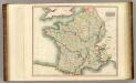
France.
1 : 2300000 Thomson, John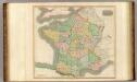
France, provinces.
1 : 2300000 Thomson, John
Homannův atlas světa
1 : 2350000

France.
1 : 2800000 Buache, Philippe, 1700-1773
France provinces.
1 : 5000000 Bowen, Frances
France departments.
1 : 5000000 Bowen, Frances
Cartes des terrains d ́atterrissage de France