Maps of New Aquitaine

Brittische Übermacht zur See wider Franckreich a.o 1759
1 Karte : Kupferdruck ; 46 x 36 cm, Bildgrösse 48 x 47 cm Heyden; Lotter; Lotter verlegt von Tob: Conr: Lotter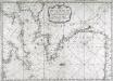
Carte de la Manche des costes de France
1 Karte : Kupferdruck ; 52 x 72 cm Huc; Ch chez le Sr. Huc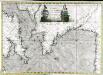
Carte de la Manche des costes de France
1 Karte auf 2 Blättern : Kupferdruck ; 51 x 72 cm Probst; Jäck; Ch chez Iean Michel Probst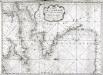
Carte de la Manche des costes de France
1 Karte : Kupferdruck ; 52 x 72 cm Huc; Ch chez le Sr. Huc
Brittische Übermacht zur See wider Franckreich a.o 1759, in denen Unternehmungen derer Engelländer auf die französisch Küsten, nach denen besten Engl. u. Französischen Original Berichten und durch kostbahre Correspondence erhaltene Gewissheit
1 : 2500000 gezeichnet u. historisch erklähret durch Christian Fried. von der Heyden designée fort exactement et explicque par Chrétien Frédéric de Heyden ; gravé par M. A. Lotter, le fis in Augsp : verlegt von Tob. Conr. Lotter
Le Ponant
1 Karte auf 2 Blättern : Kupferdruck ; 80 x 81 cm Dicquemare; Patry; Nicollet chez. J. B. Patry M.d libraire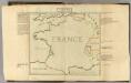
Confins (de la France)
1 : 2900000 Dangeau, abbe de, 1643-1723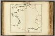
Confins (de la France - outline)
1 : 2900000 Dangeau, abbe de, 1643-1723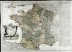
La France
1 Karte auf 2 Blättern : Kupferdruck ; 70 x 81 cm Janvier; Lattré; Arrivet chez Lattré graveur ruë St. Jacques près la fontaine S. Severin à la ville de Bordeaux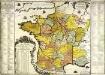
La France
1 Karte : Kupferdruck ; 48 x 49 cm Fer; Danet chez le Sr. Danet gendre de l'auteur sur le Pont N. Dame a la sphere royale
Cartes des terrains d ́atterrissage de France

France.
1 : 3484800 Letts, Son & Co.
La France et ses acquisitions par la paix
1 Karte : Kupferdruck ; 50 x 55 cm Duval; Somer chez l'autheur proche le for l'Evesque
Gallia Augustiniana in suas Provincias divisa
1 : 2500000 Mollova mapová sbírka Seutter, Matthäus Seutter, Matthäus
Die Konigreiche Frankreich und Arelat bis 1180.
1 : 3800000 Spruner von Merz, Karl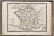
France.
1 : 3900000 Monin, C.V.
Frankreich von 1610 bis 1790.
1 : 3800000 Spruner von Merz, Karl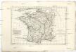
Royaume de France, divisé en gouvernements
1 : 4360000 Francie Bonne, Rigobert André
Totius regni Galliæ sive Franciæ tabula
1 Karte : Kupferdruck ; 47 x 55 cm Homann J. B. Homann
Totius regni Galliæ sive Franciæ tabula
1 Karte : Kupferdruck ; 47 x 55 cm Homann J. B. Homann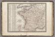
France, en 86 Departemens.
1 : 3900000 Monin, C.V.
Northwestern France
1 : 2350000 Relief shown by shading. "Base map No. 2995 (free)." "January 14, 1944." Oriented with north to the bottom. United States. Office of Strategic Services. Research and Analysis Branch [Washington, D.C.] : R & A, OSS
Neueste Charte von Frankreich
1 : 1900000 Francie Homanns Erben
France divided into circles and departments
1 : 3333000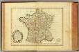
France, carte generale.
1 : 3500000 Bonne, Rigobert, 1727-1794
GALLIA Vulgo LA FRANCE
1 : 2400000 Francie Visscher, Nicolaes Jansz. ex officina Nicolai Visscher
Novissima totius regni Galliae sive Franciae
1 : 2500000 Francie Funck, David Homann, Johann Baptist per Davidem Funcke
France I.
1 : 1800000 Society for the Diffusion of Useful Knowledge (Great Britain)
Der Nord-Westliche Theil von Frankreich
Hand-Atlas über alle Theile der Erde nach dem neuesten Zustande und über das Weltgebäude Stieler, Adolf bei Justus Perthes


