Maps of France

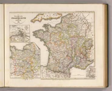
Die Konigreiche Frankreich und Arelat bis 1180.
1 : 3800000 Spruner von Merz, Karl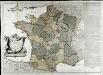
La France
1 Karte auf 2 Blättern : Kupferdruck ; 70 x 81 cm Janvier; Lattré; Arrivet chez Lattré graveur ruë St. Jacques près la fontaine S. Severin à la ville de Bordeaux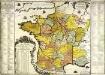
La France
1 Karte : Kupferdruck ; 48 x 49 cm Fer; Danet chez le Sr. Danet gendre de l'auteur sur le Pont N. Dame a la sphere royale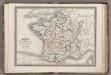
France.
1 : 3900000 Monin, C.V.
Frankreich von 1610 bis 1790.
1 : 3800000 Spruner von Merz, Karl
Frankreich von 1461 bis 1610.
1 : 3800000 Spruner von Merz, Karl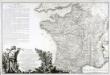
Carte elémentaire de la navigation du royaume
1 Karte : Kupferdruck ; 46 x 70 cm Fer de la Nouerre; Dupuis chez l'auteur rue Guénégaud n.o 30
Postcharte von Franckreich auf das Iahr 1787
1 Karte : Kupferdruck ; 62 x 61 cm Jaillot s.n.
Carte des postes de France pour l'année 1783
1 Karte : Kupferdruck ; 63 x 63 cm Desnos; Jaillot chez Desnos ingénieur-géographe et libraire de Sa Majesté danoise rue St. Jacques au globe et à la sphére
Carte du royaume de France où sont tracées exactement les routes des postes
1 Karte : Kupferdruck ; 46 x 50 cm Robert de Vaugondy; Haussard s.n.
Gallia
1 : 3800000 Alpy francouzské Spruner, Karl von Justus Perthes
Totius regni Galliæ sive Franciæ tabula
1 Karte : Kupferdruck ; 47 x 55 cm Homann J. B. Homann
Totius regni Galliæ sive Franciæ tabula
1 Karte : Kupferdruck ; 47 x 55 cm Homann J. B. Homann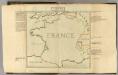
Confins (de la France)
1 : 2900000 Dangeau, abbe de, 1643-1723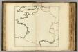
Confins (de la France - outline)
1 : 2900000 Dangeau, abbe de, 1643-1723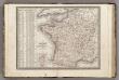
France, en 86 Departemens.
1 : 3900000 Monin, C.V.
France.
1 : 3484800 Letts, Son & Co.
La France et ses acquisitions par la paix
1 Karte : Kupferdruck ; 50 x 55 cm Duval; Somer chez l'autheur proche le for l'Evesque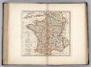
France Divided into Circles and Departments.
1 : 3300000 Carey, Mathew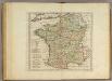
France Divided into Circles and Departments.
1 : 3300000 Carey, Mathew
France Divided into Circles and Departments.
1 : 3421440 Carey, Mathew
France Divided into Circles and Departments.
1 : 3484800 Carey, Mathew
France Divided into Circles and Departments.
1 : 3484800 Carey, Mathew
France divided into circles and departments
1 : 3333000
Communications Rapie du Territoire Francais.
Jouvet et Cie.
Frankreich von 1180 bis 1461, Zeitraum der Albigenser- und englischen Kriege.
1 : 3800000 Spruner von Merz, Karl
Frankreich's aeltere kirchliche Eintheilung bus zum Jahre 1322.
1 : 3800000 Spruner von Merz, Karl
Neueste Charte von Frankreich
1 : 1900000 Francie Homanns Erben
Carte de France
Francie