Maps of Pays de la Loire

France I.
1 : 1800000 Society for the Diffusion of Useful Knowledge (Great Britain)
La Manche, ou le Canal, entre la France et l'Angleterre
1 Karte : Kupferdruck ; 49 x 59 cm Jaillot; Goere H. Jaillot
Der Nord-Westliche Theil von Frankreich
Hand-Atlas über alle Theile der Erde nach dem neuesten Zustande und über das Weltgebäude Stieler, Adolf bei Justus Perthes
Northwestern France
1 : 2350000 Relief shown by shading. "Base map No. 2995 (free)." "January 14, 1944." Oriented with north to the bottom. United States. Office of Strategic Services. Research and Analysis Branch [Washington, D.C.] : R & A, OSS
Brittische Übermacht zur See wider Franckreich a.o 1759
1 Karte : Kupferdruck ; 46 x 36 cm, Bildgrösse 48 x 47 cm Heyden; Lotter; Lotter verlegt von Tob: Conr: Lotter
Frankreich NW.
1 : 1700000 Handtke, Friedrich H.

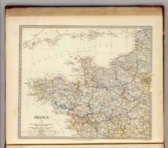
France 1.
1 : 1774080 Letts, Son & Co.

[Frankreich, Blatt 1]
Adolf Stieler's Handatlas über alle Theile der Erde und über das Weltgebäude Stieler, Adolf Justus Perthes
[Frankreich in 4 Blättern, Blatt 1]
Handatlas über alle Theile der Erde und über das Weltgebäude Stieler, Adolf Justus Perthes
[Frankreich in 4 Blättern, Nordwestliches Frankreich]
Hand-Atlas über alle Theile der Erde und über das Weltgebäude Stieler, Adolf Justus Perthes
Le royaume de la France occidentale dit autrement Neustrie
1 Karte : Kupferdruck ; 39 x 49 cm, Bildgrösse 41 x 56 cm Duval chez l'auteur en l'isle du Palais sur le quay de l'Orloge
La Manche
1 Karte : Kupferdruck ; 50 x 61 cm Jefferys; Le Rouge chez Le Rouge géographe du roi rue des g.ds Augustins
Carte de la France, 1
2 Blätter : mehrfarbig ; 72 x 81 cm de Belleyme
La Manche
1 Karte : Kupferdruck ; 50 x 61 cm Jefferys; Le Rouge chez Le Rouge géographe du roi rue des g.ds Augustins
Carte de la Manche
1 Karte : Kupferdruck ; 50 x 66 cm Lattré chéz Lattré graveur ordinaire du roi de M. le duc d'Orléans et de la ville rue St. Jacques la porte cochère en face de la rue de la Parcheminerie
Der Nord-Westliche Theil von Frankreich
Stieler's Hand-Atlas Stieler, Adolf bei Justus Perthes
Frankreich In 4 Blattern, Blatt 1.
1 : 1500000 Vogel, C.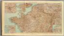
32-34. Francia nord.
1 : 1500000 Touring club italiano
France.
1 : 4400000 Vivien de St Martin, L.
Canalis inter Angliæ et Galliæ littora
1 Karte : Kupferdruck ; 48 x 55 cm Renard gedruckt by L. Renard
A chart of the British Channel.
1 : 1780000 Jefferys, Thomas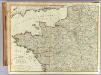
N.W. France.
1 : 1000000 Robert Laurie & James Whittle

Der Nord-Westliche Theil von Frankreich
Hand-Atlas über alle Theile der Erde nach dem neuesten Zustande und über das Weltgebäude Stieler, Adolf bei Justus Perthes
Manica, gallis la Manche, et belgis het Canaal, pars oceani inter Angliam et Gallicam
1 Karte : Kupferdruck ; 46 x 55 cm Visscher; Gouwen Nicolaes Visscher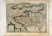
Breta[n]nia et Normandia cum confinijs
1 Karte : Kupferdruck ; 17 x 24 cm Mercator Cloppenburgh
France Régionale France de l’Ouest Normandie-Bretagne-Charentes carte physique
Gallois, Lucien