Maps of Normandy


France.
1 : 4400000 Vivien de St Martin, L.
La Manche, ou le Canal, entre la France et l'Angleterre
1 Karte : Kupferdruck ; 49 x 59 cm Jaillot; Goere H. Jaillot
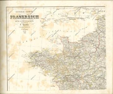
[Frankreich in 4 Blättern, Nordwestliches Frankreich]
Hand-Atlas über alle Theile der Erde und über das Weltgebäude Stieler, Adolf Justus Perthes
Frankreich NW.
1 : 1700000 Handtke, Friedrich H.
[Frankreich in 4 Blättern, Blatt 1]
Handatlas über alle Theile der Erde und über das Weltgebäude Stieler, Adolf Justus Perthes
[Frankreich, Blatt 1]
Adolf Stieler's Handatlas über alle Theile der Erde und über das Weltgebäude Stieler, Adolf Justus Perthes
Der Nord-Westliche Theil von Frankreich
Hand-Atlas über alle Theile der Erde nach dem neuesten Zustande und über das Weltgebäude Stieler, Adolf bei Justus Perthes
France N.O.
1 : 1615000 Migeon, J.
France I.
1 : 1800000 Society for the Diffusion of Useful Knowledge (Great Britain)
Northwestern France
1 : 2350000 Relief shown by shading. "Base map No. 2995 (free)." "January 14, 1944." Oriented with north to the bottom. United States. Office of Strategic Services. Research and Analysis Branch [Washington, D.C.] : R & A, OSS
Frankreich In 4 Blattern, Blatt 1.
1 : 1500000 Vogel, C.
Manica, gallis la Manche, et belgis het Canaal, pars oceani inter Angliam et Gallicam
1 Karte : Kupferdruck ; 46 x 55 cm Visscher; Gouwen Nicolaes Visscher
France 1.
1 : 1774080 Letts, Son & Co.
Carte de la Manche
1 Karte : Kupferdruck ; 50 x 66 cm Lattré chéz Lattré graveur ordinaire du roi de M. le duc d'Orléans et de la ville rue St. Jacques la porte cochère en face de la rue de la Parcheminerie
A chart of the British Channel.
1 : 1780000 Jefferys, Thomas
Carte de la République française, 1
1 Blatt : 42 x 51 cm P.G. Chanlaire

La Manche
1 Karte : Kupferdruck ; 50 x 61 cm Jefferys; Le Rouge chez Le Rouge géographe du roi rue des g.ds Augustins
La Manche
1 Karte : Kupferdruck ; 50 x 61 cm Jefferys; Le Rouge chez Le Rouge géographe du roi rue des g.ds Augustins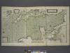
A new and correct draught of the CHANNELL between ENGLAND and FRANCE
from The sea-atlas : containing an hydrographical description of most of the sea-coasts of the known parts of the world.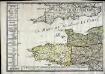
Le royaume de la France occidentale dit autrement Neustrie
1 Karte : Kupferdruck ; 39 x 49 cm, Bildgrösse 41 x 56 cm Duval chez l'auteur en l'isle du Palais sur le quay de l'Orloge
Canalis inter Angliæ et Galliæ littora
1 Karte : Kupferdruck ; 48 x 55 cm Renard gedruckt by L. Renard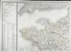
Carte de la France, 1
1 Blatt : 61 x 83 cm de Belleyme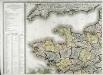
Carte de la France, 1
1 Blatt : 61 x 82 cm de Belleyme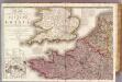
France 1.
1 : 1170000 Herisson, Eustache, b. 1759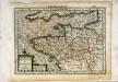
Breta[n]nia et Normandia cum confinijs
1 Karte : Kupferdruck ; 17 x 24 cm Mercator Cloppenburgh
France

Pas caart van de canaal tusschen Engeland en Vrancrijck
1 Karte : Kupferdruck ; 43 x 53 cm Doncker by Hendrick Doncker boeckverkoper en graedbooghmaecker inde Nieuwbrugsteegh in 't Stuurmans gereedschap