Maps of Metropolitan France

[13][13] Accuratissima Galliae tabula, uit: Atlas sive Descriptio terrarum orbis
Annotatie: Gedigitaliseerde versie. Amsterdam. Heiloo : Picturae (vervaardiger), 2015. tiff-bestand. Gedigitaliseerd: 07-01-2015; Origineel: Universiteitsbibliotheek Vrije Universiteit (XL.05127.-) ; Netherlands; Titelpagina ontbreekt Wit, Frederik de Amsterdam : Frederick de Wit
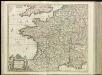
France.
1 : 2300000 Thomson, John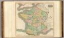
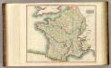
France, provinces.
1 : 2300000 Thomson, John
France.
1 : 5000000 Carey, Mathew
France.
1 : 4900000 Carey, Mathew
GALLIA | LE | ROYAVME | DE | FRANCE.
I. vanden Ende fec. Amsterodami | Excudebat Guilielmus | Blaeuw Sub Signo Solarii
Landtaflen
1 Atlas [von Johannes Stumpf] Christoffel Froschower, Zürych
Homannův atlas světa
1 : 2350000
Gallia transalpina in suas quatuor provincias, Narbonensem, Aqvitaniam, Lvgvdensem et Belgicam descripta
1 Karte : Kupferdruck ; 30 x 37 cm Weigel excudit C. Weigelius
Gallia vetus
1 Karte : Kupferdruck ; 30 x 38 cm Weigel ap. Chri. Weigel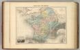
Gaule sous les Romains.
1 : 3700000 Migeon, J.
Die Reiche der Franken in Gallien unter den Merovingern.
1 : 3800000 Spruner von Merz, Karl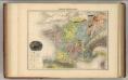
France Geologique.
1 : 3700000 Migeon, J.
France.
1 : 2800000 Buache, Philippe, 1700-1773
Galliae supra omnes in hac forma editiones locupletißima et exatißima descriptio. [Karte], in: Gerardi Mercatoris et I. Hondii Newer Atlas, oder, Grosses Weltbuch, Bd. 2, S. 16.
1 Karte aus Atlas Mercator, Gerhard und Hondius, Jodocus Jansson, Jan
Carte du royaume de France
1 Karte : Kupferdruck ; 32 x 40 cm Bourgoin chez Bourgoin graveur rue de la Harpe vis-a-vis le passage des Jacobins a côté du caffé de Condé
Gallia Antiqua.
1 : 5500000 Anville, Jean Baptiste Bourguignon d, 1697-1782
Le royaume de France
1 : 2670000 Francie Seutter, Matthäus Matthieu Seutter

Gallia [Karte], in: Gerardi Mercatoris Atlas, sive, Cosmographicae meditationes de fabrica mundi et fabricati figura, S. 213.
1 Karte aus Atlas Mercator, Gerhard Montanus, Petrus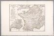
Gallia Antiqua ex aevi Romani monumentis eruta, et serenissimi Carnutum ducis munificentia publici juris facta / auctor d'Anville ; [gravé par] De-la-Haye
1 : 2500000 Annotatie: Met lijst van Romeinse provincies: I-XVII; In: [Atlas du Sr. d'Anville], bl. 7; Annotatie geografische gegevens: Met schaalstokken Jean-Baptiste Bourguignon d' Anville 1697-1782; Guillaume Nicolas Delahaye 1727-1802 [Paris : apud auctorem]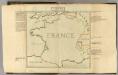
Confins (de la France)
1 : 2900000 Dangeau, abbe de, 1643-1723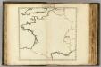
Confins (de la France - outline)
1 : 2900000 Dangeau, abbe de, 1643-1723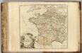
France postes.
1 : 2400000 Robert de Vaugondy, Gilles, 1688-1766
Gallia Le Royaume De France. [Karte], in: Theatrum orbis terrarum, sive, Atlas novus, Bd. 2, S. 10.
1 Karte aus Atlas Blaeu, Joan Blaeu, Willem Janszoon
Jak vzniká mapa

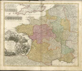
Totius regni Galliæ, sive Franciæ et Navarræ novissima tabula
1 Karte : Kupferdruck ; 47 x 55 cm Homann edita à Io. Bapt. Homann