Maps of France
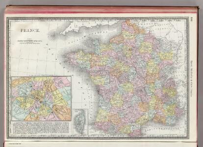
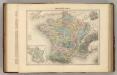
France.
1 : 3040000 Rand McNally and Company
France postes.
1 : 2400000 Robert de Vaugondy, Gilles, 1688-1766
Die Reiche der Franken in Gallien unter den Merovingern.
1 : 3800000 Spruner von Merz, Karl
Homannův atlas světa
1 : 2350000
Regnum Galliae divisum in duodecim gubernationes Piccardiae, Normandiae, Insulae Franciae, Britanniae, Aureliae, Burgundiae, Lugdini, Aquitaniae, Languedoci, Delphinatus et Provintiae
1 : 250000 [...] et hac tabula expressum a Gerardo et Leonardo Valk [Amsterdam] : [Gerardus et Leonardus Valk]
La Gaule.
1 : 3900000 Monin, C.V.
Frankreich von 1180 bis 1461, Zeitraum der Albigenser- und englischen Kriege.
1 : 3800000 Spruner von Merz, Karl
France Feodale.
1 : 3300000 Migeon, J.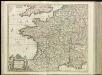
[13][13] Accuratissima Galliae tabula, uit: Atlas sive Descriptio terrarum orbis
Annotatie: Gedigitaliseerde versie. Amsterdam. Heiloo : Picturae (vervaardiger), 2015. tiff-bestand. Gedigitaliseerd: 07-01-2015; Origineel: Universiteitsbibliotheek Vrije Universiteit (XL.05127.-) ; Netherlands; Titelpagina ontbreekt Wit, Frederik de Amsterdam : Frederick de Wit
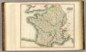
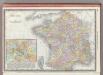
France.
1 : 2300000 Thomson, John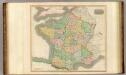
France, provinces.
1 : 2300000 Thomson, John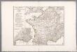
Gallia Antiqua ex aevi Romani monumentis eruta, et serenissimi Carnutum ducis munificentia publici juris facta / auctor d'Anville ; [gravé par] De-la-Haye
1 : 2500000 Annotatie: Met lijst van Romeinse provincies: I-XVII; In: [Atlas du Sr. d'Anville], bl. 7; Annotatie geografische gegevens: Met schaalstokken Jean-Baptiste Bourguignon d' Anville 1697-1782; Guillaume Nicolas Delahaye 1727-1802 [Paris : apud auctorem]
Gallia Antiqua.
1 : 5500000 Anville, Jean Baptiste Bourguignon d, 1697-1782
Regnum Galliæ
1 Karte : Kupferdruck ; 46 x 58 cm Valck; Valck G. und L. Valck
La France divisée en provinces et en généralités, dont le plan est celui de l'ancienne Gaul
1 : 2500000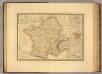
Gaule.
1 : 3300000 Picquet, C.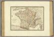
France a l'epoque de 1789.
1 : 2950000 Brue, Adrien Hubert, 1786-1832
Landtaflen
1 Atlas [von Johannes Stumpf] Christoffel Froschower, Zürych
Frankreich von 1461 bis 1610.
1 : 3800000 Spruner von Merz, Karl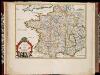
La France en toute son estendue sous le Roy Louis le Grand l'an 1682 / par P. du Val
1 : 2500000 Annotatie: Origineel is Blad 13 in atlas factice Duval, Pierre A Paris : chez l'auteur
France.
1 : 2800000 Buache, Philippe, 1700-1773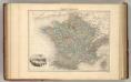
France Politique.
1 : 3700000 Migeon, J.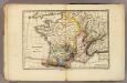
France physique.
1 : 4400000 Vincent
France, departments.
1 : 10000000 Fenner, Rest.
France, provinces.
1 : 10000000 Fenner, Rest.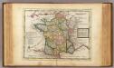
France.
1 : 5000000 Moll, Herman, d. 1732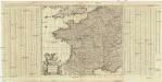
Accuratissima Galliae tabula vulgo royaume de France
1 : 2400000 Francie Danckerts, Justus I. Danckerts
France.
1 : 3350000 Mitchell, Samuel Augustus
France.
1 : 3350000 Mitchell, Samuel Augustus
France.
1 : 3350000 Mitchell, Samuel Augustus Jr.
France provinces.
1 : 5000000 Bowen, Frances