Maps of Grand Est


Théatre de la guerre actuelle, en Allemagne, en Pologne et en Turquie. n9
1 : 900000 Chanlaire, Pierre Grégoire 1758-1817 Paris : chez l'auteur P. G. Chanlaire
Deuxieme feuille contenant la Flandre francoise, Picardie, Artois, Isle de France, Champagne, Lorraine et Alsace
1 Blatt : 39 x 57 cm Bourgoin

Neueste Generalkarte von Frankreich, 2
1 Blatt : 55 x 78 cm F.A. Schrämbl
N. France.
1 : 680000 Faden, William, 1750?-1836
Carte de la république de France, no. 2
1 Blatt : 41 x 58 cm s.n.
A map of the northern part of France to facilitate the knowledge of the operations carried out by the allied armies against the French Conventional troops
1 : 640000 London : William Faden
Flemmings Spezialkarte für den deutsch-französischen Krieg
1 : 600000 Evropa západní Carl Flemming
France Flle. N.E.
1 : 1000000 Vivien St Martin, L.
Allgemeine Uebersicht des Kriegsschauplazes am Rhein, der Mosel, Maas, Marne, Seine, Schelde [et].c.c
1 Karte : Kupferdruck ; 48 x 58 cm Güssefeld bey d. Homann. Erben
Skizze zur Orientirung ϋber den Feldzug 1807

Belgii sive Germaniae accuratissima tabula
Mollova mapová sbírka Hondius, Henricus Janssonius, Johannes I
[Nordostfrankreich]
1 Karte : Kupferdruck ; 37 x 56 cm Chanlaire chez l'auteur P. G. Chanlaire rue Geoffroy-Langevin no. 7
Einsatz der 1./Pz. Rgt. 2 im Westen vom 10. 5. - 6. 9. 1940
Francie Veit Carl Kaestner
1:500,000 Europe (Air) G.S.G.S. No. 4072, Paris
Sheet NE48-2 from the map series: 1:500,000 Europe (Air) G.S.G.S. No. 4072.
Teatre de la Guerre sur le Rhein, Moessele, Mayn & Necker
1 : 420000 Mollova mapová sbírka Sanson, Guillaume Covens, Johannes I
Netherlands, Germany W. of Rhine.
1 : 1620000 Darton, William
Carte des Pays-Bas Autrichiens
1 : 800000 Belgie Mentelle, Edme Tardieu, Pierre François
La Lorraine, qui comprend Les Duchés De Lorraine Et De Bar, Et Les Balliages Des Eveschés, Et Des Villes De Metz, Toul, Et Verdun. [Karte], in: Atlas nouveau, contenant toutes les parties du monde [...], Bd. 1, S. 144.
1 Karte aus Atlas Sanson, Nicolas Jaillot, Alexis Hubert und Mortier, Pieter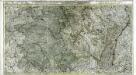
Le Duché de Lorraine & de Bar; le gouvern.t de Champagne et une partie de celui de l'Isle de France &c
1 Karte auf 2 Blättern : Kupferdruck ; 46 x 85 cm Ottens; Ottens chez Rein. et Ios. Ottens
Belgii regii tabula
1 : 822000 Belgie Visscher, Nicolaes Jansz. per Nicolaum Visscher
Germania inferioris sive Belgii pars meridionalis exhibens X. provincias catholic. cum confiniis Galliae Germ. Hollandiae
Belgie Pinas, Carl Graf Vasquez Lotter, Tobias Conrad Tob. Conr. Lotter
Nova totius Belgii regii tabula
1 : 762000 Belgie Wit, Frederick de Frederick de Wit
[20][20] Champaigne et Brie etc., uit: Atlas sive Descriptio terrarum orbis
Annotatie: Gedigitaliseerde versie. Amsterdam. Heiloo : Picturae (vervaardiger), 2015. tiff-bestand. Gedigitaliseerd: 07-01-2015; Origineel: Universiteitsbibliotheek Vrije Universiteit (XL.05127.-) ; Netherlands; Titelpagina ontbreekt Wit, Frederik de Amsterdam : Frederick de Wit
Champaigne et Brie etc. [Karte], in: Novus atlas absolutissimus, Bd. 4, S. 65.
1 Karte aus Atlas Janssonius Offizin
Champaigne et Brie
1 : 850000 par Mr Samson Geographe du Roy [S.l.] : [s.n.]
The Netherlands and the countries to the left bank of the Rhine.
1 : 655000 Pinkerton, John, 1758-1826
Belgic provinces.
1 : 900000 Lizars, Daniel


