Maps of Lorraine

Le Duché de Lorraine & de Bar le Gouvernt: de Champagne et une Partie de celui de l'Isle de France &c.
1 : 590000 Mollova mapová sbírka Allard, Carel Allard, Carel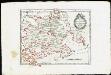
Das Herzogthum Würtemberg : Nro. 185
Reilly, Franz Johann Joseph von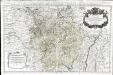
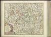
La Lorraine, qui comprend les duchés de Lorraine et de Bar et les balliages des eveschés et des villes de Metz, Toul, et Verdun
1 Karte auf 2 Blättern : Kupferdruck ; 53 x 86 cm Jaillot; Dezauche chez Dezauche rue des Noyers pres celle des Anglois
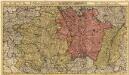
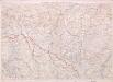
Champagne
1 Karte : Kupferdruck ; 36 x 48 cm Hondius; Mercator Henricus Hondius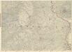
Ravensteins Deutsche Kriegskarten: Ost-Frankreich mit Beikarte Umgegend Paris

Gouvernements de Lorraine et des trois evêchés
1 Karte auf 4 Blättern : Kupferdruck ; 61 x 82 cm Mentelle; Tardieu; Aubert Mentelle
Deutsch - Französischen Kriegsschauplatzes
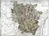
[21][21] Generalis Lotharingiae Ducatus tabula, ..., uit: Atlas sive Descriptio terrarum orbis
Annotatie: Gedigitaliseerde versie. Amsterdam. Heiloo : Picturae (vervaardiger), 2015. tiff-bestand. Gedigitaliseerd: 07-01-2015; Origineel: Universiteitsbibliotheek Vrije Universiteit (XL.05127.-) ; Netherlands; Titelpagina ontbreekt Wit, Frederik de Amsterdam : Frederick de Wit
Les duchés de Lorraine et de Bar les evechés de Metz Toul et Verdun
1 Karte : Kupferdruck ; 48 x 62 cm Desnos; Le Rouge chez le Sr. Desnos ingénieur géo. rue St. Jacques au globe
Les duchés de Lorraine et de Bar les evechés de Metz Toul et Verdun
1 Karte : Kupferdruck ; 48 x 62 cm Le Rouge Le Rouge rue des grands Augustins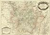
La Lorraine qui comprend Les Duchés de Lorraine et de Bar et les Balliages des Eveschés et des Villes de Metz, Toul, et Verdun
1 : 490000 Mollova mapová sbírka Sanson, Guillaume Jaillot, Alexis Hubert
Charte von Lothringen und Barr nebst den drey Bisthümern Metz, Toul und Verdun
1 : 505000 Lotrinsko (Francie) Güssefeld, Franz L. bey den Homann. Erben
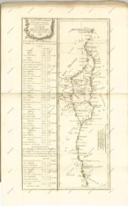
Western Front from Argonne to Vosges
1 : 250000 First World War map of the Western Front from Argonne to Vosges. 1918. War Office
Lotharingiae tabula generalis in qua ducatus Lotharingiae et Barri nec non Metensis, Tullensis et Verdunenis episcopatus cum insertis et finimitis ditionibus
1 : 500000 Lotrinsko (Francie) Homann, Johann Baptist a Ioh. Bapt. Homanno
LOTHARINGIAE TABULA GENERALIS
1 : 500000 Lotrinsko (Francie) Homann, Johann Baptist a Ioh. Bapt. Homanno
Lotharingiae tabula generalis
1 : 500000 Lotrinsko (Francie) Homann, Johann Baptist J. B. Homann
Lotharingiae tabula generalis in qua ducatus Lotharingiae et Barri nec non Metensis, Tullensis et Verdunenis episcopatus cum insertis et finimitis ditionibus
1 : 500000 Bar-le-Duc (Francie) Homann, Johann Baptist a Ioh. Bapt. Homanno
Lotharingae tabula generalis
1 : 500000 Lotrinsko (Francie) Homann, Johann Baptist a Ioh. Bapt. Hommano
Generalis Lotharingiæ ducatus tabula
1 Karte : Kupferdruck ; 45 x 56 cm Visscher N. Visscher
Lotharingia cum contiguis
1 : 860000 Mollova mapová sbírka Weigel, Christoph Weigel, Christoph I.
Charte von Lothringen und Barr nebst den drey Bisthümern Metz, Toul und Verdun
1 Karte : Kupferdruck ; 45 x 56 cm Güssefeld bey den Homann. Erben
Mappa geographica, in qua ducatus Lotharingiae et Barr ut et episcopatuum Metens. Tullens. Verdunens. territoria, tractusque finitimi, in suos quiq. ditiones disterminati
1 : 499000 Bar-le-Duc (Francie) Lotter, Tobias Conrad Tob Conrad Lotter
Mappa geographica, in qua ducatus Lotharingiae et Barr ut et episcopatuum Metens. Tullens. Verdunens. territoria, tractusque finitimi, in suos quiq. ditiones disterminati
1 : 499000 Bar-le-Duc (Francie) Lotter, Tobias Conrad Tob Conrad Lotter
Mappa geographica, in qua ducatus Lotharingiae et Barr ut et episcopatuum Metens. Tullens. Verdunens. territoria, tractusque finitimi, in suos quiq. ditiones disterminati
1 : 499000 Bar-le-Duc (Francie) Lotter, Tobias Conrad Tob Conrad Lotter
Les Duchez de Lorraine et de Bar.
1 : 450000 Mollova mapová sbírka Nolin, Jean-Baptiste Nolin, Jean-Baptiste I.
Lotharingiae Tabula Generalis
1 : 500000 Mollova mapová sbírka Homann, Johann Baptist Homann, Johann Baptista
Mappa geographica, in qua ducatus Lotharingiæ et Barr ut et episcopatuum Metens. Tullens. Verdunens. territoria
1 Karte : Kupferdruck ; 48 x 57 cm Lotter Tobias Konrad Lotter