Maps of Belgium

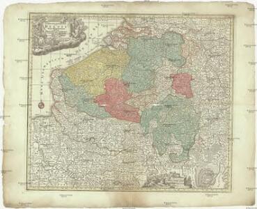
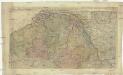
Germania inferioris sive Belgii pars meridionalis exhibens X. provincias catholic. cum confiniis Galliae Germ. Hollandiae
Belgie Pinas, Carl Graf Vasquez Lotter, Tobias Conrad Tob. Conr. Lotter
Netherlands, Germany W. of Rhine.
1 : 1620000 Darton, William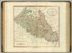
Netherlands, part of Germany.
1 : 880000 Cary, John, ca. 1754-1835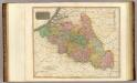
Belgium.
1 : 820000 Thomson, John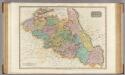
The Netherlands and the countries to the left bank of the Rhine.
1 : 655000 Pinkerton, John, 1758-1826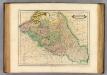
Belgic provinces.
1 : 900000 Lizars, Daniel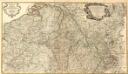
Frontieres de France et des Pais Bas
1 : 585000 Mollova mapová sbírka Fer, Nicolas de Fer, Nicolas de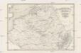
Kriegsschauplatz der Niederlande eines Theils von Holland und am Rhein
Nizozemsko Lehnhardt
Zu den Feldzügen 1708 in den Niederlanden und am Rhein
Lille (Francie) Coxe, William K.k. Generalstabes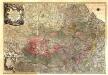
Theatrum Belli Serenissimae Domus Austriacae, Contra Gallos, Confine Limitibus Sacri Romani Imperii et Belgii
1 : 400000 Mollova mapová sbírka Oettinger, Johann Friedrich Lotter, Tobias Conrad Seutter, Matthäus
Les Provinces Apellées Pais Bas Connues Sous Les Noms De Flandre Et De Hollande
1 : 600000 Mollova mapová sbírka Fer, Nicolas de Loon, Herman van Fer, Nicolas de
Kaart van de Nederlanden, Belgie, Luxemburg, Noordelijk Frankrijk en Westelijk Duitschland : ten gebruike van algemeene besturen, touristen, handelsreizigers, kantoren, instituten, enz. / vervaardigd ... onder toezicht en met medew. van J.A. van Voorthuijsen ; door A.A. en A.C. Nunnink
1 : 400000 J.A. van Voorthuijsen 1869 fl.; Albertus Anthonius Nunnink; Adolf Carel Nunnink 1813-1894 Brussel [etc.] : C. Muquardt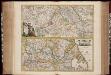
Totius fluminis Rheni : novissima descriptio / ex. officina N. Visscher
1 : 950000 Annotatie: Origineel is Blad 116 in atlas factice; Annotatie geografische gegevens: 2 schaalstokken op kaart met de schaalaanduidingen: Milliaria Germanica com:, Gemeene Duytsche Mylen, en: Milliaria Gallica communia, en: Uren gaans; Zuidwest boven Nicolaes Jansz. Visscher jr. 1649-1702 [Amsterdam : Nicolaes Visscher]
Germaniae inferioris sive Belgii pars meridionalis
1 : 853800 Belgie Lotter, Tobias Conrad M. Tob Conr. Lotter
Germaniae inferioris sive Belgii pars meridionalis
1 : 853800 Belgie Lotter, Tobias Conrad M. Tob Conr. Lotter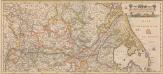
Totius Fluminis Rheni Novissima Descriptio [Karte, Teil 2], in: Novus atlas absolutissimus, Bd. 2, S. 150.
1 Karte aus Atlas Janssonius Offizin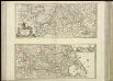
[37][37] Totius fluminis Rheni novissima descriptio, uit: Atlas sive Descriptio terrarum orbis
Annotatie: Gedigitaliseerde versie. Amsterdam. Heiloo : Picturae (vervaardiger), 2015. tiff-bestand. Gedigitaliseerd: 07-01-2015; Origineel: Universiteitsbibliotheek Vrije Universiteit (XL.05127.-) ; Netherlands; Titelpagina ontbreekt Wit, Frederik de Amsterdam : Frederick de Wit
Patriae Antique Inter Iuly et Caroli Magni Caesarum Romanorum Tempora Descriptio
1 : 1100000 Mollova mapová sbírka Ewich, Hermann Saevry, S.
Niederlande und Belgien
Geographischer Atlas über alle Theile der Erde Ziegler, Jakob Melchior Verlag von Dietrich Reimer
Carte historique de la Belgique au moyen age / par Louis Delgeur
1 : 1135400 Delgeur, Louis [Bruxelles : Vandermaelen]
Niederland und Belgien
Geographischer Atlas über alle Theile der Erde Ziegler, Jakob Melchior Verlag von Joh. Wurster um Comp.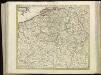
[104][107] Belgii Regii accuratissima tabula pluribus locis, uit: Atlas sive Descriptio terrarum orbis
Annotatie: Gedigitaliseerde versie. Amsterdam. Heiloo : Picturae (vervaardiger), 2015. tiff-bestand. Gedigitaliseerd: 07-01-2015; Origineel: Universiteitsbibliotheek Vrije Universiteit (XL.05127.-) ; Netherlands; Titelpagina ontbreekt Wit, Frederik de Amsterdam : Frederick de Wit

Belgii Regii accuratissima Tabula. [Karte], in: Novus atlas absolutissimus, Bd. 3, S. 25.
1 Karte aus Atlas Janssonius Offizin
Arena martis in Belgio, qua provinciae X. catholicae inferioris Germaniae
1 : 850000 Belgie Homann, Johann Baptist J. B. Homann
Niederlande u. Belgien
[Allgemeiner Atlas über alle Theile der Erde in 29 Blättern] Ziegler, Jakob Melchior Top. Anstalt v. J. Wurster u. Comp.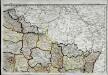
Carte de la république de France, no. 2
1 Blatt : 41 x 58 cm s.n.
Novissima et accuratissima decem Austriacarum in Belgio provinciarum tabula
1 : 590000 Belgie Ottens, Josua Ottens, Reinier R.& I. Ottens