Maps of Dinaric Alps
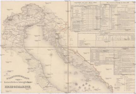
Etablissements der kaiserlichen königlichen Kriegsmarine
Jaderské moře-oblast
[Österreich-Ungarn, Blatt 3]
Adolf Stieler's Handatlas über alle Theile der Erde und über das Weltgebäude Stieler, Adolf Justus Perthes
Pohraničí Rakousko-Italské

Pohraničí rakousko-italské
1 : 1250000 Itálie severní Machát, František V. Neubert
Mortalità per infezione malarica in ciascun comune del Regno d'Italia nei tre anni 1890-91-92
1 : 1000000 Nordblatt R. Stab. Carto-Lit. C. Virano e C
Charte von der Provintz Venedig und den oestereichischen Küstenlaendern Istrien und Dalmatien dann von dem Adriatischen Meere
1 : 1540000 Benátsko (Itálie) Liechtenstern, Joseph Marx von Hohlgartt, Ludwig Grafen von Kunst und Industrie Comptoirs
Partie, l'Italie. Europe 20.
1 : 1641836 Vandermaelen, Philippe, 1795-1869
Carta novissima della Dalmazia, Albania, Croazia, Bosnia
1 : 760000 Albánie Capellaris, Giovanni Antonio nel contojo delle arti e dell'industria
[Italien, Blatt 2]
Adolf Stieler's Handatlas über alle Theile der Erde und über das Weltgebäude Stieler, Adolf Justus Perthes
Karte des Oesterreichisch - ungarischen Reiches

Carta delle provincie Illiriche co'loro diversi stabilimenti e con una parte degli stati limitrofi
1 : 500000 Ilýrie Bordiga, Benedetto
Generalkarte von Zentraleuropa
Italie, Suisse, Illyrie sud.
1 : 2100000 Brue, Adrien Hubert, 1786-1832
Rajon dějstvīj russkago flota v vojnu s Francīej 1806-1807 gg. v Adrīatikě
Südeuropa Adria Seeschlacht
Tabula Itineraria Vienna Austriae Metropoli ad Orbis Urbem Romam
Mollova mapová sbírka Lidl, Johann Jakob Lidl, Johann Jacob
Carta d'Italia alla scala di 1 a 1 000 000
1 : 1000000 Nordost-Blatt Istituto Geografico Militare (Firenze) Istituto Geografico Militare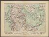
L'Etat De La Republique De Venise [...] Partie Orientale De La Republique De Venise [Karte] [Gebiet um Bergamo, Republique De Venise] [Nebenkarte] , in: Atlas nouveau, contenant toutes les parties du monde [...], Bd. 2, S. 158.
1 Karte aus Atlas Sanson, Nicolas Jaillot, Alexis Hubert und Mortier, Pieter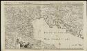
L'état de la République de Vénise
1 : 670000 par le Sr. Sanson A Amsterdam : chez Pierre Mortier & Cie

X, uit: General-Karte von Mittel-Europa in 12 Blättern, im Masse 1:1.200.000 / entworfen, bearb. und hrsg. von Josef Schlacher
1 : 1200000 Annotatie: Blad 6 ontbreekt; Annotatie geografische gegevens: 21 maatstokken op blad 9; Legenda op blad 9 Wien : K.K. Militär Geografisches Institut
Zu den Ereignissen in Neapel und Spanisch-Tascana und zur Occupation des Kirchenstaates
Neapol (Itálie : oblast) K.k. Generalstabes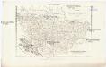
Charte von Bosnien und Servien
1 : 1767000 Bosna a Hercegovina Herz, W. Gleditsch
Die Südslavenländer
1 : 2500000 Chorvatsko Ed. Hölzel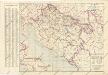
Nezavisna država hrvatska željezničkamreža i ostali prometni putovi

Fo. 2, uit: Carta geologica d'Italia
1 : 1000000 Rome : R. Ufficio Geologico
Dalmatia et regiones adjacentes, Croatia, Bosnia, Slavonia, Servia, Albania, accurate descriptae
1 : 1260000 Albánie Monath, Peter Konrad Petr Conr. Monath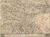
Schlavoniae, Croatie, Carniae, Istriae, Bosniae, Finitimarumque Regionum Nova Descriptio [Karte], in: Theatrum orbis terrarum, S. 353.
1 Karte aus Atlas Ortelius, Abraham Vrients, Jan Baptista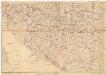
Verkehrskarte von Bosnien-Hercegovina und den angrenzenden Ländern
1 : 1000000 Albánie K. u. k. Militärgeographisches Institut
Austrian Dominions III.
1 : 1760000 Society for the Diffusion of Useful Knowledge (Great Britain)