Maps of Alps

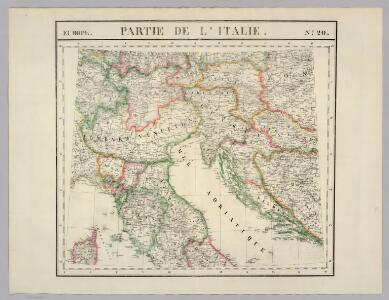
Partie, l'Italie. Europe 20.
1 : 1641836 Vandermaelen, Philippe, 1795-1869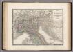
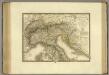
Italie partie Nord.
1 : 2090000 Levasseur, E.
Carta postale ed itineraria dell'Italia
Itálie Botte, A. F. Deyé A.F. Botte
Carta postale ed itineraria dell' Italia
Chorvatsko Botte, A.F.
Carta postale e stradale dell'Italia
1 : 1050000 Itálie Pinneti, G. A. F. Artaria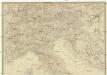
Italien
Itálie severní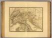
Italie, Suisse, Illyrie nord.
1 : 2100000 Picquet, C.
Pohraničí rakousko-italské
1 : 1250000 Itálie severní Machát, František V. Neubert
Ethnographical map (Eastern Europe). Northern Italy 1918
1 : 1500000 First World War ethnographical map (Eastern Europe). 1918. Four sheets, covering Germany, Poland, Northern Italy and South eastern Europe. To illustrate the post-WW1 settlement. War Office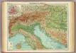
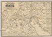
Northern Italy, Austria, &c.
1 : 2000000 John Bartholomew and Son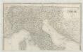
Italia
1 : 1140000 Sacchi, Ferd. Ditta Artaria di Ferd.o Sacchi e figli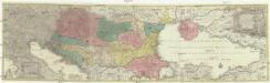
Tabula synoptica totius fluminis Danubii a fontibus usque ad ostia
1 : 2000000 Besarábie (Moldavsko a Ukrajina) Lotter, Tobias Conrad Tobias Conrad Lotter
Carte Generale de L'Italie.
1 : 2800000 Vivien de St Martin, L.
Pohraničí Rakousko-Italské
Italie, Suisse, Illyrie sud.
1 : 2100000 Brue, Adrien Hubert, 1786-1832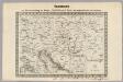
Key Sheet: Karte Des Oesterreichischen Kaiserstaates.
1 : 576000 Scheda, Josef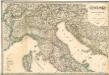
Italia settentrionale e centrale

Strassen Karte der Alpen und des nördlichen Apennin
1 : 1850000 Alpy (pohoří) Berghaus, Hermann Justus Perthes
Exactissima Tabula, qua tam Danubii Fluvii Pars Superior
1 : 2100000 Mollova mapová sbírka Visscher, Nicolaes Jansz. Visscher, Nicolaus
Exactissima Tabula, qua tam Danubii Fluvii Pars Superior
1 : 2100000 Mollova mapová sbírka Visscher, Nicolaes Jansz. Visscher, Nicolaus
Das Gebiet der Alpen
Alpy Benecke Bormann, E. Ignaz Fuchs
Danubii fluminis (à fontibus prope Doneschingam usq[ue] Posonium urbem designati) pars superior
1 Karte : Kupferdruck ; 46 x 54 cm Homann Johann Baptist Homann
Danubii fluminis (à fontibus prope Doneschingam usq[ue] Posonium urbem designati) pars superior
1 Karte : Kupferdruck ; 46 x 54 cm Homann Johann Baptist Homann
Carta postale e stradale dell'Italia
1 : 1000000 Pinneti, G.A.F. Artaria & Comp.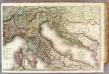
France 4.
1 : 1170000 Brue, Adrien Hubert, 1786-1832; Herisson, Eustache, b. 1759
Permanente Befestigungen
Győr (Maďarsko) K.k. Generalstabes
Italien nordliche Halfte.
1 : 2600000 Andree, Richard
Karte des Oesterreichisch - ungarischen Reiches
Carta postale et itineraria dell'Italia
Itálie severní Botte, A. F. Deyé A.F. Botte