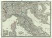
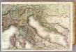
Maps of Italy
France 4.
1 : 1170000 Brue, Adrien Hubert, 1786-1832; Herisson, Eustache, b. 1759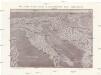
Plastická mapa Italie a přímořských zemí rakouských
Itálie Batěk, J. Emil Šolc
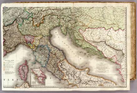
Carta postale e stradale dell'Italia
1 : 1050000 Itálie Pinneti, G. A. F. Artaria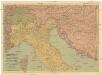
Pohraničí rakousko-uhersko-italské
1 : 1250000 Itálie Machát, František V. Neubert
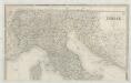
TABULA ITALIAE, Corsicae, Sardiniae, et adjacentium Regnorum, nec non viva praecipuarum Urbium, Locorum, Insignium, et Vestituum
1 : 2640000 Benátky (Itálie) Visscher, Claes Jansz. Goos, Abraham Nicolai Johannis Visscher
ITALIAE ANTIQUAE Novissima Tabula
Itálie Clüver, Philipp Visscher, Nicolaes Jansz. ex officina Nicolai Visscher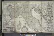
A new map of the upper part of Italy, containing ye principality of Piemont ye Dutchies of Savoy, Milan, Parma, Mantua, Modena, Tuscany, the dominions of ye Pope &c., the Republiques of Venice, Genoa, Lucca &c.
from The world described, or, A new and correct sett of maps : shewing the kingdoms and states in all the known parts of the earth, with the principal cities, and most considerable towns in the world ... / ... by Herman Moll, geographer ...
Illyricum Occidentis
1 : 3000000 Mollova mapová sbírka Sanson, Nicolas Covens, Johannes I
Illyrivcum Occidentis
1 : 1300000 Mollova mapová sbírka Sanson, Nicolas Cordier, Louis
Italia [Karte], in: Gerardi Mercatoris Atlas, sive, Cosmographicae meditationes de fabrica mundi et fabricati figura, S. 425.
1 Karte aus Atlas Mercator, Gerhard Montanus, Petrus
Italien nordliche Halfte.
1 : 2600000 Andree, Richard
Carta postale e stradale dell'Italia
1 : 1000000 Pinneti, G.A.F. Artaria & Comp.
Carte de l'Italie et des pais circonuoisins
1 : 2490000 Itálie Sanson, Nicolas Magini, Giovanni Antonio par Melchior Tauernier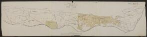
Italia Antiqua Philippo Cluvero Borusso Designatore [Karte], in: Gerardi Mercatoris et I. Hondii Newer Atlas, oder, Grosses Weltbuch, Bd. 2, S. 212.
1 Karte aus Atlas Mercator, Gerhard und Hondius, Jodocus Jansson, Jan
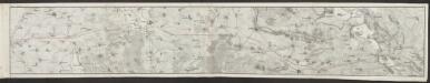
Ethnographical map (Eastern Europe). Northern Italy 1918
1 : 1500000 First World War ethnographical map (Eastern Europe). 1918. Four sheets, covering Germany, Poland, Northern Italy and South eastern Europe. To illustrate the post-WW1 settlement. War Office
Italia
1 : 1140000 Sacchi, Ferd. Ditta Artaria di Ferd.o Sacchi e figli
Carte d'une partie de l'Italie, pour servir à l'itinéraire d'un voyage fait dans ce pays, par Petit-Radel, en 1811 et 1812
1 : 2500000 [S.l.] : [s.n.]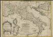
L'Italie, divisée en ses estats
1 : 2650000 tirée des memoires du Sr. Cantel geographe et de plusieurs autres corr. et augm. par le Sr. de Tillemont A Paris : chez J. B. Nolin sur le quay de l'Horloge du Palais vers le Pont Neuf a l'enseigne de la place des Victoires
Tabula Italiae Antiquae geographica.
1 : 2050000 Anville, Jean Baptiste Bourguignon d, 1697-1782
Tabula Italiae
1 : 2900000 Mollova mapová sbírka Visscher, Nicolaes Visscher, Nicolaus I.
Tabula Moderna Italie [Karte], in: [Clavdii Ptholomei Cosmographi ...], S. 272.
1 Karte aus Atlas Nicolaus Germanus [und Ptolemaeus, Claudius]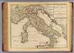
Italiae Antiquae in regiones XI ab Augusto divisae.
1 : 2200000 L'Isle, Guillaume de, 1675-1726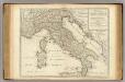
Tabula Italiae Antiquae in regiones XI ab Augusto divisae.
1 : 2200000 L'Isle, Guillaume de, 1675-1726
Nova et exactissima totius Italiae Sardiniae et Corsicae delineatio
1 : 2400000 Itálie Seutter, Matthäus impensis Matth. Seutteri
Nova et exactissima totius Italiae Sardiniae et Corsicae delineatio
1 : 2400000 Itálie Seutter, Matthäus impensis Matth. Seutteri
L'Italie Divisée en ses Estats
1 : 2600000 Mollova mapová sbírka Tralage, Jean-Nicolas de Nolin, Jean-Baptiste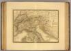
Italie, Suisse, Illyrie nord.
1 : 2100000 Picquet, C.