Maps of Croatia

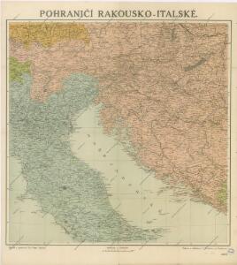
Pohraničí Rakousko-Italské

Pohraničí rakousko-italské
1 : 1250000 Itálie severní Machát, František V. Neubert
Carta postale e stradale dell'Italia
1 : 1050000 Itálie Pinneti, G. A. F. Artaria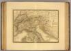
Italie, Suisse, Illyrie nord.
1 : 2100000 Picquet, C.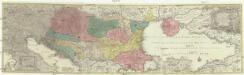
Tabula synoptica totius fluminis Danubii a fontibus usque ad ostia
1 : 2000000 Besarábie (Moldavsko a Ukrajina) Lotter, Tobias Conrad Tobias Conrad Lotter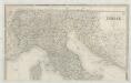
Italia
1 : 1140000 Sacchi, Ferd. Ditta Artaria di Ferd.o Sacchi e figli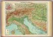
Northern Italy, Austria, &c.
1 : 2000000 John Bartholomew and Son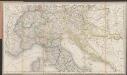
[Post und Reisekarte von Italien und den nördlich angrenzenden Alpenländern]
1 : 1800000 Roost, Johann Baptist J.G. Cotta
Partie, l'Italie. Europe 20.
1 : 1641836 Vandermaelen, Philippe, 1795-1869
Carte Generale de L'Italie.
1 : 2800000 Vivien de St Martin, L.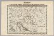
Key Sheet: Karte Des Oesterreichischen Kaiserstaates.
1 : 576000 Scheda, Josef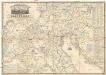
Carta postale ed itineraria dell'Italia
Itálie Botte, A. F. Deyé A.F. Botte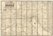
Carta postale ed itineraria dell' Italia
Chorvatsko Botte, A.F.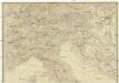
Italien
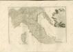
Itálie severní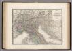
Italie partie Nord.
1 : 2090000 Levasseur, E.
Ethnographical map (Eastern Europe). Northern Italy 1918
1 : 1500000 First World War ethnographical map (Eastern Europe). 1918. Four sheets, covering Germany, Poland, Northern Italy and South eastern Europe. To illustrate the post-WW1 settlement. War Office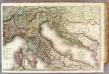
France 4.
1 : 1170000 Brue, Adrien Hubert, 1786-1832; Herisson, Eustache, b. 1759
Pannoniae, Et Illyrici Veteris Tabula. [Karte], in: Theatrum orbis terrarum, S. 383.
1 Karte aus Atlas Ortelius, Abraham
Italien nordliche Halfte.
1 : 2600000 Andree, Richard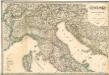
Italia settentrionale e centrale

Pannoniae, Et Illyrici Veteris Tabula. [Karte], in: Theatrum orbis terrarum, S. 484.
1 Karte aus Atlas Ortelius, Abraham Vrients, Jan Baptista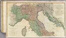
Italy N.
1 : 1010000 Faden, William, 1750?-1836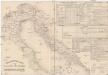
Etablissements der kaiserlichen königlichen Kriegsmarine
Jaderské moře-oblast
Tabula Itineraria Vienna Austriae Metropoli ad Orbis Urbem Romam
Mollova mapová sbírka Lidl, Johann Jakob Lidl, Johann Jacob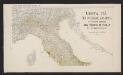
Mortalità per infezione malarica in ciascun comune del Regno d'Italia nei tre anni 1890-91-92
1 : 1000000 Nordblatt R. Stab. Carto-Lit. C. Virano e C
[Österreich-Ungarn, Blatt 3]
Adolf Stieler's Handatlas über alle Theile der Erde und über das Weltgebäude Stieler, Adolf Justus Perthes
Carta delle provincie Illiriche co'loro diversi stabilimenti e con una parte degli stati limitrofi
1 : 500000 Ilýrie Bordiga, Benedetto
Charte von der Provintz Venedig und den oestereichischen Küstenlaendern Istrien und Dalmatien dann von dem Adriatischen Meere
1 : 1540000 Benátsko (Itálie) Liechtenstern, Joseph Marx von Hohlgartt, Ludwig Grafen von Kunst und Industrie Comptoirs
Carta postale e stradale dell'Italia
1 : 1000000 Pinneti, G.A.F. Artaria & Comp.