Maps of Croatia

[Italien, Blatt 2]
Adolf Stieler's Handatlas über alle Theile der Erde und über das Weltgebäude Stieler, Adolf Justus Perthes
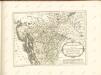
Dalmatia Sclavonia, Croatia, Bosnia, Servia et Istria
1 : 1400000 Mollova mapová sbírka Valk, Gerhard Valck, Gerard
Rajon dějstvīj russkago flota v vojnu s Francīej 1806-1807 gg. v Adrīatikě
Südeuropa Adria Seeschlacht
Carta delle provincie Illiriche co'loro diversi stabilimenti e con una parte degli stati limitrofi
1 : 500000 Ilýrie Bordiga, Benedetto
Reiseskizze der 12. Termifahrt S.M.S. Najade
Jaderské moře Cori, Carl J. K. u. k. Kriegsmarine
Skelettkarte des Adriatischen-Meeres für Kursskizzen
Jaderské moře K. u. k. Kriegsmarine
Carta novissima della Dalmazia, Albania, Croazia, Bosnia
1 : 760000 Albánie Capellaris, Giovanni Antonio nel contojo delle arti e dell'industria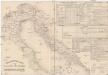
Etablissements der kaiserlichen königlichen Kriegsmarine
Jaderské moře-oblast
Pannonia Illyricum et Quadorum Iazygumque Regiones
1 : 6500000 Mollova mapová sbírka
Dalmatia, Sclavonia, Croatia, Bosnia, Servia et Istria distributa in singulares ditiones et dioeceses una cum republica Ragusana et circumjacentibus regionibus Hungaria, Venetiis, statu Eccleciastico, Neapoli et Macedonia
1 : 400000 Dalmácie (Chorvatsko) Valk, Gerhard Gerard et Leonard Valk
Karta o dubljinama Jadranskoga mora
Jaderské moře
Dalmatia et regiones adjacentes, Croatia, Bosnia, Slavonia, Servia, Albania, accurate descriptae
1 : 1260000 Albánie Monath, Peter Konrad Petr Conr. Monath
Carta d'Italia alla scala di 1 a 1 000 000
1 : 1000000 Nordost-Blatt Istituto Geografico Militare (Firenze) Istituto Geografico Militare
[Österreich-Ungarn, Blatt 3]
Adolf Stieler's Handatlas über alle Theile der Erde und über das Weltgebäude Stieler, Adolf Justus Perthes
Dalmatia et regiones adjacentes, Croatia, Bosnia, Slavonia, Servia, Albania, accurate descriptae
1 : 1250000 Mollova mapová sbírka Monath, Peter Konrad Monath, Peter Konrad
Illyricum in Dalmatiam Chrobatiam Slavoniam et Serbliam divisum
1 : 4800000 Mollova mapová sbírka
Die Südslavenländer
1 : 2500000 Chorvatsko Ed. Hölzel
Charte von Bosnien und Servien
1 : 1767000 Bosna a Hercegovina Herz, W. Gleditsch
Verkehrskarte von Bosnien-Hercegovina und den angrenzenden Ländern
1 : 1000000 Albánie K. u. k. Militärgeographisches Institut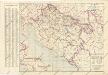
Nezavisna država hrvatska željezničkamreža i ostali prometni putovi
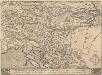
Schlavoniae, Croatie, Carniae, Istriae, Bosniae, Finitimarumque Regionum Nova Descriptio [Karte], in: Theatrum orbis terrarum, S. 353.
1 Karte aus Atlas Ortelius, Abraham Vrients, Jan Baptista
Fo. 2, uit: Carta geologica d'Italia
1 : 1000000 Rome : R. Ufficio Geologico
General-Karte von Dalmatien, Bosnien, der Hercegovina und Montenegro
1 : 750000 Bosna R. Lechner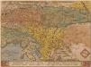
Schlavoniae, Croatiae, Carniae, Istriae, Bosniae, Finitimarumque Regionum Nova Descriptio [Karte], in: Theatrum orbis terrarum, S. 97.
1 Karte aus Atlas Ortelius, Abraham
Generalkarte von Bosnien und der Hercegovina nebst Dalmatien
1 : 864000 Bosna Peucker, Karl Artaria
Generalkarte von Zentraleuropa

Illyricum. [Karte], in: Theatrum orbis terrarum, S. 350.
1 Karte aus Atlas Ortelius, Abraham Vrients, Jan Baptista
Austrian Dominions III.
1 : 1760000 Society for the Diffusion of Useful Knowledge (Great Britain)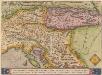
![[Italien, Blatt 2]](https://images-2.georeferencer.com/images/iiif/655171824322/full/,300/0/native.jpg)

