Maps of Netherlands

Noord Zee van beoosten Amelant Bos totdoor de Hoofden [Karte], in: De Nieuwe Groote Vermeerderde Zee-Atlas ofte Water-Werelt, S. 29.
1 Karte aus Atlas Doncker, Hendrick
S. North Sea ports.
1 : 1500000 Philip, George
[129][132] Pascaert van de Noord Zee ... Mare Germanicum ..., uit: Atlas sive Descriptio terrarum orbis
Annotatie: Gedigitaliseerde versie. Amsterdam. Heiloo : Picturae (vervaardiger), 2015. tiff-bestand. Gedigitaliseerd: 07-01-2015; Origineel: Universiteitsbibliotheek Vrije Universiteit (XL.05127.-) ; Netherlands; Titelpagina ontbreekt Wit, Frederik de Amsterdam : Frederick de Wit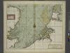
A chart of the Seacoasts of ENGLAND FLANDERS and HOLLAND shewong all the sand shoals Rocks and Dangers The Bayes Roads Harbours Buoyes and semarks on the said coasts.
from The sea-atlas : containing an hydrographical description of most of the sea-coasts of the known parts of the world.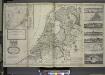
A new and exact map of the United Provinces, or Netherlands &c.
from The world described, or, A new and correct sett of maps : shewing the kingdoms and states in all the known parts of the earth, with the principal cities, and most considerable towns in the world ... / ... by Herman Moll, geographer ...
Holland or the United Provinces.
from A new systeme of the mathematicks: containing I. Arithmetick, as well natural and decimal, as in species, or the principles of algebra. II. Practical geometry, together with the first six books of Euclid's Elements, as also the eleventh and twelfth, symbo
Hollanda
[Giralomo Porro] [Venetië] : Simon Galignani ; Giralomo Porro]
De groote Nederlandse stedenwyzer, vertoonende met een opslag des oogs, de afgelegentheden tussen 108 steden der XVII. provintien, of Beantwoording op 5786 vragen, hoe veel uuren gaans de eene plaats van den ander is gelegen = La grande echelle des Pais-Bas, qui montre du premier coup d’oeil, la distence de 108 villes, des XVII. provinces, ou Reponce sur 5786. demandes, pour savoir de quelle distence une ville est eloignée de l’autre
te samen gesteld en int ligt gegeeven door Jan de Lat kaart en boekverkoper tot Deventer. Deventer : Jan de Lat
Neue und richtige Land Tafel der XVII. Niederländische Provincien
1 : 1233000 Belgie Sandrart, Jakob von J. Sandrart
Summaria descriptio Fresiae Universae, cum latissime patuit nomen post emigrationem Francorum, Saxonumq. accessionem
auctore Mensone Alting Gerard de Broen fecit Amstelodami. [Amstelaedami] : [apud Henricum Wetstenium]
Belgii Veteris Typus
1 : 1400000 Mollova mapová sbírka Ortelius, Abraham Visscher, Claes Jansz.
Belgii Veteris Typus
1 : 1400000 Mollova mapová sbírka Ortelius, Abraham Visscher, Claes Jansz.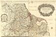
Les Dix-Sept Provinces des Pays-Bas
1 : 1050000 Mollova mapová sbírka Sanson, Guillaume Jaillot, Alexis Hubert
Postkarte von dem Vereinigten Niederlanden
Belgie Stenger, Johann im von Reillyschen Landkarten und Kunstwerke Verschleiss Komptoir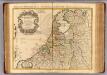
Provinces Unies des Pays Bas.
1 : 690000 L'Isle, Guillaume de, 1675-1726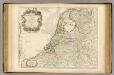
Provinces Unies des Pays Bas.
1 : 690000 L'Isle, Guillaume de, 1675-1726
NOVA XVII PROVINCIARVM Germaniae Inferioris tabula, Leonis effigie, accurate delineata
1 : 100000 Belgie Visscher, Claes Jansz. bij Claes Ianß Visscher
Descriptio veteris agri Batavi et Frisii omnisque regionis quae hodie est in dicione VII. Foederatorum cis et ultra Rhenum
1 : 950000 auctore Mensone Alting. [Amstelaedami] : [apud Henricum Wetstenium]
Les XVII provinces du Pais-Bas
1 : 264000 Belgie Aa, Pieter van der George P. van der Aa
Belgium & Holland.
1 : 1000000 John Bartholomew and Son
La republica Battava
1 : 2400000 Nizozemsko Zatta, Antonio Zatta
Carte des Provinces unies des Pays Bas : tirée des cartes les plus correcte qui en ont été faites sur les lieux, rectifiées par les observations et opérations géometriques de Snellius et par celles que Mr. Cassini y a faites en dernier lieu
1 : 700000 par G. de l'Isle geographe de l'Academie Royale des Sciences. A Amsterdam : chez Iean Còvens et Corneille Mortier
Britanniae sive Angliae regnum
Anglie Seutter, Matthäus Vilém Oranžský sumtibus Matthaei Seutteri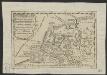
Oud Nederland zo als het zelve door de Batavieren, Marezaaten, Sturien, Frisiabonen ... en andere volkeren oudtijds bewoond wierd, naar de plaatsing der beste schrijveren.
1 : 3500000 Te Amsterdam : bij Arend Fokke Simonsz.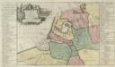
Descriptio veteris Agri Batavi et Frisi omnisque regionis quae hodie est in dicione VII. Foederatorvm cis et ultra Rhenvm
1 : 1100000 Mollova mapová sbírka Alting, Menso
Carte des XVII. Provinces des Pays Bas
1 : 640000 Mollova mapová sbírka Inselin, Charles Jaillot, Alexis Hubert
Magnae Britanniae pars meridionalis, in qua regnum Angliae tam in septem antiqua Anglo-saxonum regna quam in omnes hodiernas regiones accurate divisum hic ostenditur
Anglie Homann, Johann Baptist Visscher, Nicolaes Jansz. Ioh. Bapt. Homan[n
Carte de la république de France, 8
1 Blatt : 35 x 59 cm s.n.
Carte des Provinces Unies des Pays Bas
1 : 1000000 Mollova mapová sbírka Chatelain, Zacharias Chatelain, Zacharias II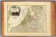
![Noord Zee van beoosten Amelant Bos totdoor de Hoofden [Karte], in: De Nieuwe Groote Vermeerderde Zee-Atlas ofte Water-Werelt, S. 29.](https://images-2.georeferencer.com/images/iiif/391480050105/full/,300/0/native.jpg)

