Maps of Netherlands

[129][132] Pascaert van de Noord Zee ... Mare Germanicum ..., uit: Atlas sive Descriptio terrarum orbis
Annotatie: Gedigitaliseerde versie. Amsterdam. Heiloo : Picturae (vervaardiger), 2015. tiff-bestand. Gedigitaliseerd: 07-01-2015; Origineel: Universiteitsbibliotheek Vrije Universiteit (XL.05127.-) ; Netherlands; Titelpagina ontbreekt Wit, Frederik de Amsterdam : Frederick de Wit
A chart of the Seacoasts of ENGLAND FLANDERS and HOLLAND shewong all the sand shoals Rocks and Dangers The Bayes Roads Harbours Buoyes and semarks on the said coasts.
from The sea-atlas : containing an hydrographical description of most of the sea-coasts of the known parts of the world.
Noord Zee van beoosten Amelant Bos totdoor de Hoofden [Karte], in: De Nieuwe Groote Vermeerderde Zee-Atlas ofte Water-Werelt, S. 29.
1 Karte aus Atlas Doncker, Hendrick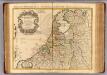
Provinces Unies des Pays Bas.
1 : 690000 L'Isle, Guillaume de, 1675-1726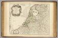
Provinces Unies des Pays Bas.
1 : 690000 L'Isle, Guillaume de, 1675-1726
NOVA XVII PROVINCIARVM Germaniae Inferioris tabula, Leonis effigie, accurate delineata
1 : 100000 Belgie Visscher, Claes Jansz. bij Claes Ianß Visscher
Les XVII provinces du Pais-Bas
1 : 264000 Belgie Aa, Pieter van der George P. van der Aa
Carte des Provinces unies des Pays Bas : tirée des cartes les plus correcte qui en ont été faites sur les lieux, rectifiées par les observations et opérations géometriques de Snellius et par celles que Mr. Cassini y a faites en dernier lieu
1 : 700000 par G. de l'Isle geographe de l'Academie Royale des Sciences. A Amsterdam : chez Iean Còvens et Corneille Mortier
Nieuwe Paskaart van Het Tuyderste Gedeelte der Noord-Zee Sirekkende van Texel tot aande Hoofden Begrypende in Sigh de Zeekusten van Vriesland Holland Zeeland Vlaanderen ookeen Gedeelte van d'Oostkust van Engeland
1 : 400000 Mollova mapová sbírka Keulen, Gerard van
Algemeene kaart der Vereenigde Nederlanden : getrokken uyt de aller naauwkeurigsten kaarten, opde plaatsen selve gemaakt, en geschikt volgens de beste en nieuwste waarnemingen en aanteekeningen.
1 : 1000000 Zacharias Châtelain t' Amsterdam : by Zacharias Châtelain
Neue und richtige Land Tafel der XVII. Niederländische Provincien
1 : 1233000 Belgie Sandrart, Jakob von J. Sandrart
Carte des Provinces Unies des Pays Bas
1 : 700000 Mollova mapová sbírka Delisle, Guillaume Covens, Johannes I
Carte Des Provinces Unies Des Pays-Bas
1 : 690000 Mollova mapová sbírka Delisle, Guillaume L'Isle, Guillaume de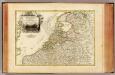
Pays Bas septentrionale.
1 : 1130000 Janvier, Jean
Novissima et accuratissima XVII provinciarum Germaniae inferioris tabula
1 : 960000 Belgie Danckerts, Justus Munter, Johan ex officina Iusti Danckers
Circulus Burgundicus, integer secundum fines antiquos, qui fuerunt aetate Maximil. I.
1 : 2600000 Mollova mapová sbírka Franz, Johann Michael Homann, Johann Baptista - dědici
La republica Battava
1 : 2400000 Nizozemsko Zatta, Antonio Zatta
Belgii Veteris Typvs
1 : 1375000 Mollova mapová sbírka Ortelius, Abraham Ortelius, Abraham
Les Dix-Sept Provinces Des Pays-Bas
1 : 760000 Mollova mapová sbírka Sanson, Guillaume Sanson, Guillaume
The Seven United Provinces of Holland, Groningen, Gelders, Friesland, Overyssel, Utrecht, and Zealand.
1 : 1180000 Melish, John
Carte des Provinces Unies des Pays Bas
1 : 1000000 Mollova mapová sbírka Chatelain, Zacharias Chatelain, Zacharias II
Provinces-Unies des Pays-Bas
1 : 625000 Mollova mapová sbírka Sanson, Guillaume Jaillot, Alexis Hubert
Nova et accurata descriptio XVII provinciarvm Germaniae inferiroris nec non teritorii embdensis
1 : 902400 Nizozemsko Galle, Johannes apud Ioannem Galleum
Belgicarum XVII Provinciarum Tabula
1 : 875000 Mollova mapová sbírka Danckerts, Justus Danckerts, Justus
Provinces-Unies des Pays-Bas : avec leurs acquisitions dans la Flandre, le Brabant, le Limbourg et le Lyege
1 : 700000 par le Sr. Sanson, Géographe ordinaire du Roy Cordier, sculp. Paris : H. Jaillot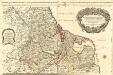
Les Dix-Sept Provinces des Pays-Bas
1 : 1050000 Mollova mapová sbírka Sanson, Guillaume Jaillot, Alexis Hubert
Les Provinces Apellées Pais Bas Connues Sous Les Noms De Flandre Et De Hollande
1 : 880000 Mollova mapová sbírka Fer, Nicolas de Starckman, P. Fer, Nicolas de
Belgica foederata complectens septem provincias, ducatum Geldriae, comitatus Hollandiae et Zelandiae, dioeceses Trajectum, Transisulaniam, Groningam et Frisiam et circumjacentes provincias.
1 : 650000 Amsterdam : venalis habent Ger. et Leon Valk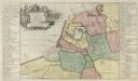
Descriptio veteris Agri Batavi et Frisi omnisque regionis quae hodie est in dicione VII. Foederatorvm cis et ultra Rhenvm
1 : 1100000 Mollova mapová sbírka Alting, Menso
Holland, Friesland, Groningen, Overyssel, Gelders, Utrecht and Zealand.
1 : 2471040 Carey, Mathew
The Seven United Provinces of Holland, Groningen, Gelders, Friesland, Overyssel, Utrecht and Zealand.
1 : 2407680 Carey, Mathew
![[129][132] Pascaert van de Noord Zee ... Mare Germanicum ..., uit: Atlas sive Descriptio terrarum orbis](https://images-0.georeferencer.com/images/iiif/833810947751/full/,300/0/native.jpg)

