Maps of Netherlands

Pays-Bas, Belgique, Luxembourg.
1 : 1000000 Levasseur, E.
Das Koenigreich der Niederlande nebst dem Grossherzogthume Luxemburg
1 : 925000 Belgie Weiland, Karl Ferdinand Geographisches Institut

Holland and Belgium.
1 : 1110000 Sharpe, J.
The Kingdom of the Netherlands
1 : 1500000 engraved by J. & C. Walker. London : Baldwin & Cradock
Das Königreich der Niederlande. Das Königreich Belgien und das Grossherzogthum Luxemburg

Das Königreich der Niederlande, das Königreich Belgien und das Groszherzogthum Luxemburg
1 : 950000 entworfen und gezeichnet von C.F. Weiland. Weimar : im Verlage des Geogr. Instituts
Netherlands.
1 : 1237000 Teesdale, Henry
Belgique et de Hollande, 1812.
1 : 3500000 Malte-Brun, Conrad, 1775-1826
44. Belgio e Olanda.
1 : 1500000 Touring club italiano
Belgium and Holland.
1 : 1500000 Schonberg & Co.
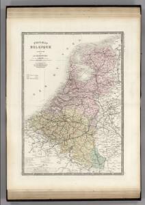
Pays-Bas.
1 : 1000000 Brue, Adrien Hubert, 1786-1832
Holland and Belgium.
1 : 1290000 Colton, G.W.
Hollande, Belgique.
1 : 1070000 Andriveau-Goujon, J.
Niederlande und Belgien
Volksschul-Atlas über alle Teile der Erde Lange, Henry Druck und Verlag von Georg Westermann
The Kingdom of the Netherlands
1 : 1495000 Belgie Walker, C. Baldwin & Gradock
Holland & Belgium.
1 : 792000 Arrowsmith, John
Nieuwe kaart van het Koningryk der Nederlanden en het Groot-hertogdom Luxemburg
1 : 600000 Belgie Weygand, F. J. Baarsel, Cornelis van
Nieuwe kaart van het Koningrijk der Nederlanden en het Groot-Hertogdom Luxemburg, benevens geheel België : verdeeld in provincien volgens de jongste bepalingen, verrijkt met de post & andere groote wegen
1 : 1000000 zamengest. & gegraveerd door W.C. van Baarsel. Te Zalt-Bommel : bij Joh. Noman en Zoon
Království Hollandské (Nizozemsko), Království Belgické
Belgie Hynek Fuchs
Karte der Niederlande
1 : 980000 Belgie C. Hennigs Verlag
Karte der Niederlande
1 : 1000000 Belgie C. Hennig
Pays-Bas et Belgique.
1 : 1180000 Migeon, J.
Königreich Niederland und Königreich Belgien dann das Herzgth. Luxemburg
1 : 1200000 Belgie T. Mollo
Belgique, Hollande, Limbourg, Luxembourg.
1 : 1000000 Picquet, C.
Belgique et Hollande
1 : 1300000 Thuillier, Louis; Hachette. Bibliothèque géographique. Firme Paris : Hachette et cie.

[Kaart], uit: Orandakoku zenzu / Senseki Takami
1 : 600000 Annotatie: Facs. van de uitg.: Furukawa : Kakindō, 1850; Lit.: The world in Japanese maps until the mid-19th century, p. 207; Annotatie geografische gegevens: West boven Takami, Senseki [Tokyo : Noma Kakagu Igaku Kenyu Shiryokan]
Neueste Karte von Holland, Belgien und Luxemburg
Grosser Hand-Atlas über alle Theile der Erde in 170 Karten Meyer, J. Verlag des Bibliographischen Instituts