Maps of Netherlands

Das Königreich der Niederlande. Das Königreich Belgien und das Grossherzogthum Luxemburg


Hollande, Belgique.
1 : 1070000 Andriveau-Goujon, J.
Niederlande und Belgien
Volksschul-Atlas über alle Teile der Erde Lange, Henry Druck und Verlag von Georg Westermann
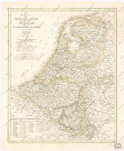
Das Königreich der Niederlande, das Königreich Belgien und das Groszherzogthum Luxemburg
1 : 950000 entworfen und gezeichnet von C.F. Weiland. Weimar : im Verlage des Geogr. Instituts

Das Koenigreich der Niederlande nebst dem Grossherzogthume Luxemburg
1 : 925000 Belgie Weiland, Karl Ferdinand Geographisches Institut
Neueste Karte von Holland, Belgien und Luxemburg
Grosser Hand-Atlas über alle Theile der Erde in 170 Karten Meyer, J. Verlag des Bibliographischen Instituts
Niederlande und Belgien
E. von Sydow's Schul-Atlas in sechs und dreissig Karten Sydow, Emil von bei Justus Perthes
Pays-Bas.
1 : 1000000 Brue, Adrien Hubert, 1786-1832
The Kingdom of the Netherlands
1 : 1495000 Belgie Walker, C. Baldwin & Gradock
Nieuwe kaart van het Koningrijk der Nederlanden en het Groot-Hertogdom Luxemburg, benevens geheel België : verdeeld in provincien volgens de jongste bepalingen, verrijkt met de post & andere groote wegen
1 : 1000000 zamengest. & gegraveerd door W.C. van Baarsel. Te Zalt-Bommel : bij Joh. Noman en Zoon
Netherlands, Belgium.
1 : 792000 Stanford, Edward
Pays-Bas, Belgique, Luxembourg.
1 : 1000000 Levasseur, E.
Holland and Belgium.
1 : 1290000 Colton, G.W.
Belgique, Hollande.
1 : 1000000 Lapie, M. (Pierre), 1779-1850
Niederlande u. Belgien
[Allgemeiner Atlas über alle Theile der Erde in 29 Blättern] Ziegler, Jakob Melchior Top. Anstalt v. J. Wurster u. Comp.
Holland and Belgium.
1 : 1330560 Colton, G.W.
Holland & Belgium.
1 : 950400 Fullarton, A. & Co.
Holland And Belgium.
1 : 1900800 Mitchell, Samuel Augustus
Belgium And Holland.
1 : 1520640 Burr, David H., 1803-1875
Netherlands.
1 : 3350000 Fenner, Rest.
Netherlands, Belgium, Spain, Portugal.
Goodrich, S.G.
Netherlands.
1 : 1480000 Society for the Diffusion of Useful Knowledge (Great Britain)
Niederlande, Belgien.
1 : 1470000 Flemming, Carl
XVII PROVINCIAE BELGII accurate delineatae
Belgie
44. Belgio e Olanda.
1 : 1500000 Touring club italiano
Belgium And Holland.
1 : 1500000 Greenleaf, Jeremiah
Belgium And Holland.
1 : 1500000 Greenleaf, Jeremiah