Maps of Netherlands

Niederlande und Belgien
Volksschul-Atlas über alle Teile der Erde Lange, Henry Druck und Verlag von Georg Westermann
Netherlands, Belgium.
1 : 792000 Stanford, Edward
Hollande, Belgique.
1 : 1070000 Andriveau-Goujon, J.
Holland And Belgium.
1 : 1900800 Mitchell, Samuel Augustus
Belgium And Holland.
1 : 1520640 Burr, David H., 1803-1875
Netherlands.
1 : 3350000 Fenner, Rest.
Netherlands, Belgium, Spain, Portugal.
Goodrich, S.G.
Netherlands.
1 : 1480000 Society for the Diffusion of Useful Knowledge (Great Britain)
Niederlande und Belgien
E. von Sydow's Schul-Atlas in sechs und dreissig Karten Sydow, Emil von bei Justus Perthes
Königreich Niederland und Königreich Belgien dann das Herzgth. Luxemburg
1 : 1200000 Belgie T. Mollo
Niederland und Belgien
Geographischer Atlas über alle Theile der Erde Ziegler, Jakob Melchior Verlag von Joh. Wurster um Comp.
Holand and Belgium.
1 : 1290000 Colton, G.W.
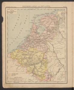
Niederlande und Belgien
Adolf Stieler's Handatlas über alle Theile der Erde und über das Weltgebäude Stieler, Adolf Justus Perthes
Das Königreich der Niederlande. Das Königreich Belgien und das Grossherzogthum Luxemburg


Belgium and Holland.
1 : 1500000 Schonberg & Co.
Niederlande und Belgien
Geographischer Atlas über alle Theile der Erde Ziegler, Jakob Melchior Verlag von Dietrich Reimer
Das Königreich Niederlande, das Königreich Belgien, und das Grossherzogthum Luxemburg
1 : 925000 Belgie Schmitfeldt, Georg Mollo, Tranquillo Tranquillo Mollo
Carte routière du Royaume des Pays-Bas, comprenant la Hollande et la Belgique, aux quelles on a joint le grand Duché de Luxembourg : avec l'indication des archevêchés et evêcheés, ainsi que les batailles et les distances d'un lieu à un autre en lieues de poste de 281⁄2 au degré
1 : 650000 par Hérisson, géographe gravé par Berthe. Paris : Basset
Pays-Bas.
1 : 1000000 Brue, Adrien Hubert, 1786-1832
The Kingdom of the Netherlands
1 : 1495000 Belgie Walker, C. Baldwin & Gradock


Niederlande und Belgien
Plastischer Schul-Atlas über alle Theile der Erde : in 24 Karten Woldermann, G Verlag von P. Eckerlein
Niederlande, Luxemburg.
1 : 1900000 Reichard, C. G.
Holland and Belgium.
1 : 2060000 Mitchell, Samuel Augustus
Holland and Belgium.
1 : 2060000 Mitchell, Samuel Augustus
Belgique, Hollande.
1 : 1000000 Lapie, M. (Pierre), 1779-1850
Niederlande u. Belgien
[Allgemeiner Atlas über alle Theile der Erde in 29 Blättern] Ziegler, Jakob Melchior Top. Anstalt v. J. Wurster u. Comp.