Maps of Netherlands

Hollande, Belgique.
1 : 1070000 Andriveau-Goujon, J.
Niederlande und Belgien
E. von Sydow's Schul-Atlas in sechs und dreissig Karten Sydow, Emil von bei Justus Perthes
Holland And Belgium.
1 : 1900800 Mitchell, Samuel Augustus
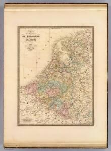
Belgium And Holland.
1 : 1520640 Burr, David H., 1803-1875
Netherlands.
1 : 3350000 Fenner, Rest.
Netherlands, Belgium, Spain, Portugal.
Goodrich, S.G.
Netherlands.
1 : 1480000 Society for the Diffusion of Useful Knowledge (Great Britain)
Niederlande und Belgien
Volksschul-Atlas über alle Teile der Erde Lange, Henry Druck und Verlag von Georg Westermann
Belgique, Hollande.
1 : 1000000 Lapie, M. (Pierre), 1779-1850
Netherlands, Belgium.
1 : 792000 Stanford, Edward


Das Königreich der Niederlande. Das Königreich Belgien und das Grossherzogthum Luxemburg

Niederlande und Belgien
Adolf Stieler's Handatlas über alle Theile der Erde und über das Weltgebäude Stieler, Adolf Justus Perthes


Pays-Bas.
1 : 1000000 Brue, Adrien Hubert, 1786-1832
Das Königreich Niederlande, das Königreich Belgien, und das Grossherzogthum Luxemburg
1 : 925000 Belgie Schmitfeldt, Georg Mollo, Tranquillo Tranquillo Mollo
The Kingdom of the Netherlands
1 : 1495000 Belgie Walker, C. Baldwin & Gradock
Nieuwe kaart van het Koningrijk der Nederlanden en het Groot-Hertogdom Luxemburg : met aanwijzing der nieuwe postwegen = Nouvelle carte du Royaume des Pays-Bas et du Grand-Duché de Luxembourg : avec les routes de poste / dressé et gravé par C. van Baarsel et Fils
1 : 580000 Baarsel, C. van La Haye : F.J. Weygand
[Historisch-geographischer Atlas zu den allgemeinen Geschichtswerken von C. v. Rotteck, Pölitz u. Becker] : Die Niederlande zur Uebersicht der Hauptbegebenheiten
von Julius Loewenberg Lithographie von B. Herder zu Freiburg im Breisgau [Freiburg im Breisgau] : [Herder]
Niederland und Belgien
Geographischer Atlas über alle Theile der Erde Ziegler, Jakob Melchior Verlag von Joh. Wurster um Comp.
Niederlande, Belgien.
1 : 1470000 Flemming, Carl
Belgium and Holland.
1 : 1500000 Schonberg & Co.
Novus XVII Inferioris Germaniae Procinviarum Typus [Karte], in: Theatrum orbis terrarum, sive, Atlas novus, Bd. 1, S. 323.
1 Karte aus Atlas Blaeu, Joan Blaeu, Willem Janszoon
Niederlande u. Belgien
[Allgemeiner Atlas über alle Theile der Erde in 29 Blättern] Ziegler, Jakob Melchior Top. Anstalt v. J. Wurster u. Comp.
Königreich Niederland und Königreich Belgien dann das Herzgth. Luxemburg
1 : 1200000 Belgie T. Mollo
Carte routière du Royaume des Pays-Bas, comprenant la Hollande et la Belgique, aux quelles on a joint le grand Duché de Luxembourg : avec l'indication des archevêchés et evêcheés, ainsi que les batailles et les distances d'un lieu à un autre en lieues de poste de 281⁄2 au degré
1 : 650000 par Hérisson, géographe gravé par Berthe. Paris : Basset
Niederlande und Belgien
Geographischer Atlas über alle Theile der Erde Ziegler, Jakob Melchior Verlag von Dietrich Reimer
Holland And Belgium.
1 : 2100000 Tanner, Henry S.