Maps of Netherlands

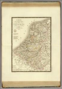
Pays-Bas.
1 : 1000000 Brue, Adrien Hubert, 1786-1832

The Kingdom of the Netherlands
1 : 1495000 Belgie Walker, C. Baldwin & Gradock
Hollande, Belgique.
1 : 1070000 Andriveau-Goujon, J.
Niederlande und Belgien
E. von Sydow's Schul-Atlas in sechs und dreissig Karten Sydow, Emil von bei Justus Perthes
Niederlande und Belgien
Volksschul-Atlas über alle Teile der Erde Lange, Henry Druck und Verlag von Georg Westermann
Netherlands, Belgium.
1 : 792000 Stanford, Edward
Belgique, Hollande.
1 : 1000000 Lapie, M. (Pierre), 1779-1850
Das Königreich der Niederlande. Das Königreich Belgien und das Grossherzogthum Luxemburg

Holland and Belgium.
1 : 1290000 Colton, G.W.

Holland And Belgium.
1 : 1900800 Mitchell, Samuel Augustus
Belgium And Holland.
1 : 1520640 Burr, David H., 1803-1875
Netherlands.
1 : 3350000 Fenner, Rest.
Netherlands, Belgium, Spain, Portugal.
Goodrich, S.G.
Netherlands.
1 : 1480000 Society for the Diffusion of Useful Knowledge (Great Britain)
[Historisch-geographischer Atlas zu den allgemeinen Geschichtswerken von C. v. Rotteck, Pölitz u. Becker] : Die Niederlande zur Uebersicht der Hauptbegebenheiten
von Julius Loewenberg Lithographie von B. Herder zu Freiburg im Breisgau [Freiburg im Breisgau] : [Herder]
Das Königreich der Niederlande, das Königreich Belgien und das Groszherzogthum Luxemburg
1 : 950000 entworfen und gezeichnet von C.F. Weiland. Weimar : im Verlage des Geogr. Instituts
Belgium and Holland.
1 : 1500000 Schonberg & Co.
Nieuwe kaart van het Koningrijk der Nederlanden en het Groot-Hertogdom Luxemburg, benevens geheel België : verdeeld in provincien volgens de jongste bepalingen, verrijkt met de post & andere groote wegen
1 : 1000000 zamengest. & gegraveerd door W.C. van Baarsel. Te Zalt-Bommel : bij Joh. Noman en Zoon
Das Koenigreich der Niederlande nebst dem Grossherzogthume Luxemburg
1 : 925000 Belgie Weiland, Karl Ferdinand Geographisches Institut
Pays-Bas, Belgique, Luxembourg.
1 : 1000000 Levasseur, E.
Nieuwe kaart van het Koningrijk der Nederlanden en het Groot-Hertogdom Luxemburg : met aanwijzing der nieuwe postwegen = Nouvelle carte du Royaume des Pays-Bas et du Grand-Duché de Luxembourg : avec les routes de poste / dressé et gravé par C. van Baarsel et Fils
1 : 580000 Baarsel, C. van La Haye : F.J. Weygand
Königreich Niederland und Königreich Belgien dann das Herzgth. Luxemburg
1 : 1200000 Belgie T. Mollo
44. Belgio e Olanda.
1 : 1500000 Touring club italiano
Belgique et de Hollande, 1812.
1 : 3500000 Malte-Brun, Conrad, 1775-1826
Holland and Belgium.
1 : 1300000 Colton, G.W.
Holland and Belgium.
1 : 1110000 Sharpe, J.
Carte du Royaume des Pays-Bas.
1 : 1360000 Vivien de St Martin, L.