Maps of Netherlands

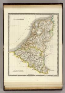
Netherlands.
1 : 1237000 Teesdale, Henry
Belgique et de Hollande, 1812.
1 : 3500000 Malte-Brun, Conrad, 1775-1826
44. Belgio e Olanda.
1 : 1500000 Touring club italiano
Pays-Bas et Belgique.
1 : 1180000 Migeon, J.
The Kingdom of the Netherlands
1 : 1500000 engraved by J. & C. Walker. London : Baldwin & Cradock
Belgique, Hollande, Limbourg, Luxembourg.
1 : 1000000 Picquet, C.
Pays-Bas, Belgique, Luxembourg.
1 : 1000000 Levasseur, E.
Holland and Belgium.
1 : 1290000 Colton, G.W.
Das Koenigreich der Niederlande nebst dem Grossherzogthume Luxemburg
1 : 925000 Belgie Weiland, Karl Ferdinand Geographisches Institut
Karte der Niederlande
1 : 980000 Belgie C. Hennigs Verlag
Karte der Niederlande
1 : 1000000 Belgie C. Hennig
Das Königreich der Niederlande, das Königreich Belgien und das Groszherzogthum Luxemburg
1 : 950000 entworfen und gezeichnet von C.F. Weiland. Weimar : im Verlage des Geogr. Instituts
Holland and Belgium.
1 : 1110000 Sharpe, J.
Niederlande und Belgien
Handatlas über alle Theile der Erde und über das Weltgebäude Stieler, Adolf Justus Perthes
Království Hollandské (Nizozemsko), Království Belgické
Belgie Hynek Fuchs
Niederlande, Belgien, Luxemburg
Hand-Atlas über alle Theile der Erde nach dem neuesten Zustande und über das Weltgebäude Stieler, Adolf bei Justus Perthes
Nieuwe kaart van het Koningryk der Nederlanden en het Groot-hertogdom Luxemburg
1 : 600000 Belgie Weygand, F. J. Baarsel, Cornelis van
Niederlande und Belgien
Hand-Atlas über alle Theile der Erde und über das Weltgebäude Stieler, Adolf Justus Perthes
Holland & Belgium.
1 : 792000 Arrowsmith, John
Holland and Belgium.
1 : 1330560 Colton, G.W.
[Niederlande, Belgien, Luxemburg]
Hand-Atlas über alle Theile der Erde nach dem neuesten Zustande und über das Weltgebäude Stieler, Adolf bei Justus Perthes
Holland, Belgium.
1 : 770000 Arrowsmith, John
The Kingdom of the Netherlands
1 : 1495000 Belgie Walker, C. Baldwin & Gradock
Belgium and Holland.
1 : 1500000 Schonberg & Co.
Holland and Belgium.
1 : 4000000 Colton, G.W.
Pays-Bas.
1 : 1000000 Brue, Adrien Hubert, 1786-1832
Nieuwe kaart van het Koningrijk der Nederlanden en het Groot-Hertogdom Luxemburg, benevens geheel België : verdeeld in provincien volgens de jongste bepalingen, verrijkt met de post & andere groote wegen
1 : 1000000 zamengest. & gegraveerd door W.C. van Baarsel. Te Zalt-Bommel : bij Joh. Noman en Zoon
Holland & Belgium.
1 : 950400 Fullarton, A. & Co.
Holland, Belgium, and Switzerland.
1 : 1360000 Johnson, A.J.