Maps of England

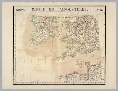
Partie, l'Angleterre. Europe 12.
1 : 1641836 Vandermaelen, Philippe, 1795-1869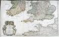
Les isles Britanniques, 2
2 Blätter : 53 x 85 cm Desnos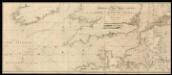
To the right honorable the Masters, Wardens and Eldeil Brother of the Trinity House, this chart of the English Channel: Downs and Margaret; Plysmouth; Falmouth; Portsmouth; Dartmouth
7 Carta nàutica. - Conté carta nàutica de: Dartmouth; Downs and Margate; Plymouth; Falmouth; The Owers Light; Portsmouth Heather, William W. Heather
Carte vom Canal zwischen dem Atlantischen Meere und der Nord=See
1 Karte : Kupferdruck ; 47 x 49 cm Saltzenberg s.n.
Feuille 23 (B IV), uit: Carte géologique internationale de l'Europe : la carte, votée au congrès géologique international de Bologne en 1881, est exécutée conformément aux décisions d'une commission internationale, avec le concours des gouvernements, sous le dir. de M.M. Beyrich et Hauchecorne
Annotatie: Blad 48 gamme des couleurs; blad 49: bladwijzer en titelblad Heinrich Ernst Beyrich 1815-1896; Wi. Hauchecorne Berlin : Reimer / (Berlin: Institut lithographique)
England.
from A new systeme of the mathematicks: containing I. Arithmetick, as well natural and decimal, as in species, or the principles of algebra. II. Practical geometry, together with the first six books of Euclid's Elements, as also the eleventh and twelfth, symbo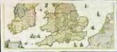
Nova totius Angliæ, Scotiæ, et Hiberniæ, tabula, 2
2 Blätter : 43 x 103 cm Danckerts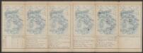
Anglia II. Nova Tabula [Karte], in: Claud. Ptolemaeus. Geographia lat. cum mappis [...], S. 335.
1 Karte aus Atlas Münster, Sebastian [und Ptolemaeus, Claudius]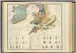
Palaeontological map (British Islands).
1 : 1550000 Johnston, Alexander Keith, 1804-1871
Carte des Iles Britanniques.
1 : 2600000 Vivien de St Martin, L.
Palaeontological Map
The physical atlas Johnston, Alexander Keith William Blackwood & Sons
Typus Angliae
This is a map of the British Isles by Jodocus Hondius, it dates from 1590 and was probably published in London where Hondius was resident for about 10 years from 1583. The map is dedicated to Robert, Earl of Essex in a small panel below Ireland. The outline of the England and Wales follows that of Saxton, with Ireland being a crude version of Ortelius's outline. Only a small section of Scotland is shown. Emphasis is placed on the decorative elements of the map. Surmounting the oval shaped map is a portrait of Queen Elizabeth I. She is flanked by text plaques on each side which contain biblical text praising the Queen and text hailing the prosperity of the realm. Contemporary costumed figures of an English nobleman and a citizen of London and their respective wives are displayed in opposite corners. Also included in the decorative scheme are symbolic compositions representing War (swords, spear, arrows) Art (musical instruments including a lute, viola, bagpipes) Industry (a chest and a sack of coins) and Husbandry (two sheep, a grain field and a bale of cloth) The map can be seen as a fore-runner of Hondius' large scale map of 1592 which shows an improved knowledge of the outline and interior of Ireland. Hondius, Jodocus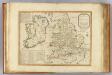
Invasions England, Ireland.
1 : 1770000 Robert Laurie & James Whittle
La Manche.
1 : 4300000 Desmarest, Nicolas, 1725-1815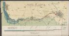
Anglia regnum [Karte], in: Atlas, sive, Cosmographicae meditationes de fabrica mundi et fabricati figura, S. 107.
1 Karte aus Atlas Mercator, Gerhard
Cartes et coupe du Canal de la Manche et d'une partie de la mer d'Allemagne qui présentent par une nouvelle méthode la pente du fonds de ces deux mers
1 Karte : Kupferdruck ; 16 x 23 cm, Blattgrösse 46 x 61 cm Buache Philippe Buache
Anglia regnum [Karte], in: Gerardi Mercatoris Atlas, sive, Cosmographicae meditationes de fabrica mundi et fabricati figura, S. 109.
1 Karte aus Atlas Mercator, Gerhard Montanus, Petrus
Carte de la Manche
1 Karte : Kupferdruck ; 47 x 68 cm Denis; Basset; Basset chés Basset rue St. Jacques au coin de celle des Mathurins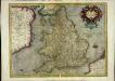
Anglia regnum
1 Karte : Kupferdruck ; 34 x 44 cm Mercator; Hondius Henricus Hondius
Anglia regnum
1 Karte : Kupferdruck ; 34 x 45 cm Mercator; Hondius Jodocus Hondius
Isles Britanniques
1 Karte : Kupferdruck ; 31 x 41 cm Mentelle; Tardieu; André Mentelle
Li regni d'Inghilterra e d'Irlanda
1 Karte : Kupferdruck ; 29 x 38 cm Zatta Antonio Zatta
Anglia Regnum / [Joannes Janssonius]
1 : 1800000 Annotatie: Oorspr. verschenen in: Gerardi Mercatoris et I. Hondii Appendix Atlas ... - Amsterdam : bey Johan Jansson, 1636; Origineel is Blad 23 in atlas factice Janssonius, Joannes (jr.) (1588-1664) Amstelodami : apud Ioannem Ianssonium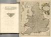

Anglia Regnum
1 : 1700000 Annotatie: Oorspr. verschenen in: Gerardi Mercatoris et I. Hondii Newer Atlas oder Grosses Weltbuch ... - Amsterdam : bey Johan Jansson, 1636 Amstelodami : apud Ioannem Ianssonium
Angliae Regni Florentissimi Nova Descriptio [...] [Karte], in: Theatrum orbis terrarum, S. 36.
1 Karte aus Atlas Ortelius, Abraham
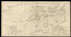
An exact trigonometrical survey of the British Channel, including the mouth of the Thames and Part of the German sea with the coast of Irland from Carnsore point to the Shannon Mouth
Laurie & Whittle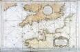
Carte reduite de la Manche
1 Karte : Kupferdruck ; 54 x 83 cm Bellin s.n.