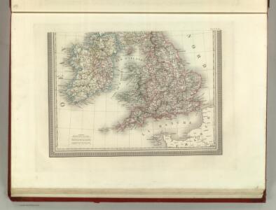
Maps of British Isles

Carte des Iles Britanniques.
1 : 2600000 Vivien de St Martin, L.
Li regni d'Inghilterra e d'Irlanda
1 Karte : Kupferdruck ; 29 x 38 cm Zatta Antonio Zatta
Typus Angliae
This is a map of the British Isles by Jodocus Hondius, it dates from 1590 and was probably published in London where Hondius was resident for about 10 years from 1583. The map is dedicated to Robert, Earl of Essex in a small panel below Ireland. The outline of the England and Wales follows that of Saxton, with Ireland being a crude version of Ortelius's outline. Only a small section of Scotland is shown. Emphasis is placed on the decorative elements of the map. Surmounting the oval shaped map is a portrait of Queen Elizabeth I. She is flanked by text plaques on each side which contain biblical text praising the Queen and text hailing the prosperity of the realm. Contemporary costumed figures of an English nobleman and a citizen of London and their respective wives are displayed in opposite corners. Also included in the decorative scheme are symbolic compositions representing War (swords, spear, arrows) Art (musical instruments including a lute, viola, bagpipes) Industry (a chest and a sack of coins) and Husbandry (two sheep, a grain field and a bale of cloth) The map can be seen as a fore-runner of Hondius' large scale map of 1592 which shows an improved knowledge of the outline and interior of Ireland. Hondius, Jodocus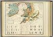
Palaeontological map (British Islands).
1 : 1550000 Johnston, Alexander Keith, 1804-1871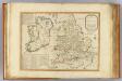
Invasions England, Ireland.
1 : 1770000 Robert Laurie & James Whittle
Nouvelle carte d'Angleterre, d'Ecosse et d'Irlande
1 Karte : Kupferdruck ; 44 x 49 cm Châtelain s.n.
Bradshaw's new railway map of Gt. Britain and Ireland shewing the stations-distance &c.
1 : 1560000 Bradshaw & Blacklock
Grossbritanien.
1 : 3900000 Haller von Hallerstein, Friedrich; Reichard, C. G.
Isles Britanniques.
1 : 2600000 Jouvet et Cie.
British Isles.
1 : 2661120 Letts, Son & Co.
Railway Map of the British Isles.
1 : 2217600 Fullarton, A. & Co.
The British Isles.
1 : 2700000 Society for the Diffusion of Useful Knowledge (Great Britain)
British Islands.
1 : 3484800 Burr, David H., 1803-1875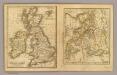
British Isles, Asia.
Adams, Daniel
British Isles.
1 : 1700000 Thomson, John
British Isles (outline)
1 : 4500000 Patteson, Edward
British Isles.
1 : 4500000 Patteson, Edward
Britische Inseln
Volksschul-Atlas über alle Teile der Erde Lange, Henry Druck und Verlag von Georg Westermann
Pascaart Vant Canaal [...] Tabula Hydrographica Freti seu Canalis [...] quod est Inter Angliam et Galliam, nec non Hiberniam et Scotiam [...] [Karte], in: Novus atlas absolutissimus, Bd. 9, S. 213.
1 Karte aus Atlas Janssonius Offizin
Geographische Carte von Gross-Britannien zum Gebrauch beim Studium der Geschichte
Historisch-genealogisch-geographischer Atlas von Le Sage Las Cases, Emmanuel Auguste Dieudonné Marius Joseph de Johann Velten, Kunsthändler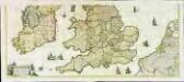
Nova totius Angliæ, Scotiæ, et Hiberniæ, tabula, 2
2 Blätter : 43 x 103 cm Danckerts
Pascaart Vant Canaal Tuẞchen Engelant en Vrancryck [...] [Karte], in: Het vijfde Deel Des Grooten Atlas : Vervatende De Water-Weereld, S. 160.
1 Karte aus Atlas Jansson, Jan Jansson, Jan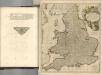

Géographie. croquis n12, Iles britanniques
1 : 2000000 Lambin, Capitaine 18..-.... [Paris] : Service Géographique de l'Armée
Grossbritannien u. Irland.
1 : 2500000 Stein, Christ. Gottfr. Dan.
Angliae Regni Florentissimi Nova Descriptio [...] [Karte], in: Theatrum orbis terrarum, S. 36.
1 Karte aus Atlas Ortelius, Abraham
BRITANNICARUM INSULARUM VETUS DESCRIPTIO - Map of Ireland, England and Wales
This map of the British Isles is the work of Abraham Ortelius. It dates from 1590 and was published in Antwerp. It appears in the fourth Additamentum to Ortelius's Theatrum Orbis Terrarum. Ortelius published these 'additions' to supplement editions of his atlas. The fourth Additamentum contained, in addition to new, more modern maps, a section devoted to classical history known as the Parergon. It is in this section that this map resides. Here the northern and southern parts of the British Isles are shown with British tribes, Roman town names and other information according to classical traditions. Key features such as Hadrian's Wall and the forts along its length, such as Segodunum and Longovicum, can be clearly seen. For this new map Ortelius based the outline of England and Wales on that of Christopher Saxton, which portrayed the proportions of the land mass more accurately than before, although Ireland and Scotland remain the same as the existing maps in the atlas. It is likely that the engraving was by Jan Wierix. Ortelius, Abraham
The British Isles. (with) inset map of the Shetland Islands.
1 : 3801600 Tallis, J. & F.
Great Britain, Ireland.
1 : 5500000 Huntington, Nathaniel G. (Nathaniel Gilbert), 1785-1848
British Isles.
1 : 6200000 Worcester, Joseph E.
Tabula novissima accuratissima regnorum Angliæ, Scotiæ Hiberniæ
1 Karte : Kupferdruck ; 56 x 48 cm Lotter Tobias Konrad Lotter
Tabula novissima accuratissima regnorum Angliæ, Scotiæ Hiberniæ
1 Karte : Kupferdruck ; 57 x 48 cm Seutter Matthäus Seutter
Carte du gouvernement militaire d'Angleterre
1 Karte : Kupferdruck ; 16 x 15 cm, Bildgrösse 35 x 46 cm Châtelain s.n.
Nouvelle carte pour introduire a la geographie et a la genealogie des rois d'Angleterre et d'Ecosse
4 Karten auf 2 Blättern : Kupferdruck ; Bildgrösse 38 x 92 cm Châtelain s.n.