Maps of Podolí

Orientační plán hlavního města Prahy s okolím

Orientační plán hlavního města Prahy s okolím
1 : 5000
Orientační plán Prahy a obcí sousedních List 21.

Podoll - c5920-1-002 - Kaiserpflichtexemplar der Landkarten des stabilen Katasters
1 : 2880
Podoll - c5920-1-001 - Kaiserpflichtexemplar der Landkarten des stabilen Katasters
1 : 2880
Orientační plán král. Hl. města Prahy
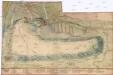
[Plán Vyšehradu]
Braník (Praha, Česko)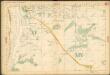
Auto-Praha : automobilní plán Velké Prahy a příručka pro automobilisty
1 : 50000
Environs de Hlubočep

Branik - c0461-1-002 - Kaiserpflichtexemplar der Landkarten des stabilen Katasters
1 : 2880
Branik - c0461-1-003 - Kaiserpflichtexemplar der Landkarten des stabilen Katasters
1 : 2880
Branik - c0461-1-001 - Kaiserpflichtexemplar der Landkarten des stabilen Katasters
1 : 2880
Unter Krtsch (Dolnj Krtč) - c1314-1-001 - Kaiserpflichtexemplar der Landkarten des stabilen Katasters
1 : 2880
Unter Krtsch (Dolnj Krtč) - c1314-1-002 - Kaiserpflichtexemplar der Landkarten des stabilen Katasters
1 : 2880
Nussle - c5330-1-002 - Kaiserpflichtexemplar der Landkarten des stabilen Katasters
1 : 2880
Nussle - c5330-1-001 - Kaiserpflichtexemplar der Landkarten des stabilen Katasters
1 : 2880
Orientační plán města Nuslí

Regulační plán spojených obcí Nusle a Pankrác

Stereofotogrammetrické zaměření... Vltavy, Otavy... pomocí Zeissova fototeodolitu

Potrubí a situace nové vodárny pražské (vyznačeno červeně)
1 : 14300 Praha (Česko)
Plan des südlichen Moldauthal ́s bei Prag
Praha, hlavní město ČSR : Fastrův obrázkový plán a průvodce
1 : 10000
Grundtriss der Prager Stätte

Plán královského hlavního města Prahy s okolím
Praha (Česko) Brož, Josef Grefnetter, Josef B. Rácová
Plán královského hlavního města Prahy

Kriegs-Expeditions-Karte in Böhmen I. Blatt, in welchem die Haubtstadt Prag mit der Französsischen und Saechsischen Belageruug und Eroberung, so den 26. Novembre 1741 geschehen, vorgestellet wird
1 : 21000 Praha (Česko) Homann Erben
Velký příruční plán hlav. města Prahy
1 : 12000 Praha (Česko) Brož, Josef A. Storch syn
Plán král. hlav. města Prahy a obcí sousedních
1 : 12000 Praha (Česko) Brož, Josef A. Storch syn
Orientační plán sídel. hlav. města Prahy
1 : 12000 Libeň (Praha, Česko) M. Král


