Maps of Praha

Stereofotogrammetrické zaměření... Vltavy, Otavy... pomocí Zeissova fototeodolitu

Orientační plán Prahy a obcí sousedních List 20.
1 : 5000
Orientační plán Prahy a obcí sousedních List 20.

Orientační plán hlavního města Prahy s okolím
1 : 5000
Orientační plán hlavního města Prahy s okolím
1 : 5000
Potrubí a situace nové vodárny pražské (vyznačeno červeně)
1 : 14300 Praha (Česko)
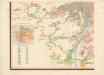
Plan des südlichen Moldauthal ́s bei Prag
Terrain für das 2te Feldmanoeuvre
1 : 60000 Praha (Česko)
Orientační plán sídel. hlav. města Prahy
1 : 12000 Libeň (Praha, Česko) M. Král
Praha, hlavní město ČSR : Fastrův obrázkový plán a průvodce
1 : 10000
Grundtriss der Prager Stätte

Neuester Plan von Prag mit seiner Umgebungen
1 : 18000 Praha (Česko) bei Gottl. Haase Söhne
Militaerisch Topographischer Plan von der Königl. Hauptstadt Prag nebst Umgebungen

Bez titulu: Plán hlavního města Prahy

Orientační plán hlavního města Prahy

Militærisch topographischer Plan von der königl. Hauptstadt Prag nebst Umgebungen

Plán královského hlavního města Prahy s okolím
Praha (Česko) Brož, Josef Grefnetter, Josef B. Rácová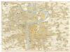
Prag
1 : 16000 Praha (Česko) Grgurič, V. Vilím, Jan Čedok
Praha : [II. celostátní spartakiáda 1960]
1 : 15000
Plán královského hlavního města Prahy

Militaerisch topographischer Plan von der königl. Hauptstadt Prag nebst Umgebungen
1 : 11600 Praha (Česko) Berra, Marco Artaria et Comp.
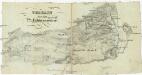
Kriegs-Expeditions-Karte in Böhmen I. Blatt, in welchem die Haubtstadt Prag mit der Französsischen und Saechsischen Belageruug und Eroberung, so den 26. Novembre 1741 geschehen, vorgestellet wird
1 : 21000 Praha (Česko) Homann Erben
Plán tratí elektrických drah král. Hlav. Města Prahy

Praha : [II. celostátní spartakiáda 1960]
1 : 15000
Velký příruční plán hlav. města Prahy
1 : 12000 Praha (Česko) Brož, Josef A. Storch syn
Plán král. hlav. města Prahy a obcí sousedních
1 : 12000 Praha (Česko) Brož, Josef A. Storch syn
Orientační plán hlavního města Prahy

Síť kanalisace Prahy
Praha (Česko)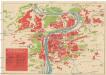
[Praha]
Praha (Česko) Včela