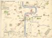
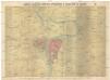
Maps of Smíchov
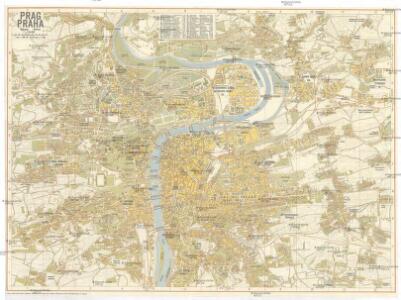
Prag
1 : 16000 Praha (Česko) Grgurič, V. Vilím, Jan Čedok
Síť kanalisace Prahy
Praha (Česko)
Velký příruční plán hlav. města Prahy
1 : 12000 Praha (Česko) Brož, Josef A. Storch syn
Plán král. hlav. města Prahy a obcí sousedních
1 : 12000 Praha (Česko) Brož, Josef A. Storch syn
Bez titulu: Plán Prahy

Orientační plán hlavního města Prahy

Praha : [II. celostátní spartakiáda 1960]
1 : 15000
Síť kanalisace Prahy

Praha : [II. celostátní spartakiáda 1960]
1 : 15000
[Plán Prahy]
Praha (Česko)
Plán král. hlav. města Prahy a obcí sousedních
1 : 12000
Plán král. Hlav. Města Prahy a obcí sousedních

Praha : informační plán
1 : 15000
Ichnographia et orthographia metropolis Pragensis
1 : 7200 Praha (Česko)
Ichnographia et orthographia metropolis Pragensis
1 : 7200 Praha (Česko)
Ichnographia et orthographia metropolis Pragensis
1 : 7200 Praha (Česko)
Plán tratí elektrických drah král. Hlav. Města Prahy

Plán královského hlavního města Prahy s okolím
Praha (Česko) Brož, Josef Grefnetter, Josef B. Rácová
Plán královského hlavního města Prahy
Král. hlavní město Praha s okolím r. 1848
1 : 10000 Praha (Česko)
Okolí Pražské

Plan der Stadt Prag mit denen umliegenden Gegenden wie es von der preussischen Armée unter comando des Königs von Preussen und des Feld Mareschal Keith von den 8 May biss den 19 Juny 1757 ist belagert worden
1 : 168000 Praha (Česko) Prasser, Baptist bey Herrn Baptist Prasser
Plán královského hlavního města Velké Prahy s okolím
1 : 20000 Praha (Česko : oblast) Brož, Josef Šolc a Šimáček
Plán královského hlavního města Velké Prahy s okolím
1 : 20000 Praha (Česko) Brož, Josef B. Racová
Praha : orientační plán
1 : 15000
Praha : orientační plán : Československá spartakiáda 1975
1 : 15000
Orientační plán hlavního města Prahy
1 : 15000
Plan der Stadt Prag = Plán Prahy : mit den neuesten Benennungen : s nejnovějším pojmenováním ulic
1 : 16000
Plán král. hlav. města Prahy a obcí sousedních
1 : 12000 Brož, Josef, 1844-1930 nákladem A. Štorcha Syna