Maps of Smíchov

Praha : informační plán
1 : 15000
Praha : [II. celostátní spartakiáda 1960]
1 : 15000
Orientační plán hlavního města Prahy
1 : 15000
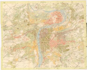
Prag
1 : 16000 Praha (Česko) Grgurič, V. Vilím, Jan Čedok
Plan der Stadt Prag mit denen umliegenden Gegenden wie es von der preussischen Armée unter comando des Königs von Preussen und des Feld Mareschal Keith von den 8 May biss den 19 Juny 1757 ist belagert worden
1 : 168000 Praha (Česko) Prasser, Baptist bey Herrn Baptist Prasser
Praha : [II. celostátní spartakiáda 1960]
1 : 15000
[Plán Prahy]
Praha (Česko)
Okolí Pražské

Orientační plán hlavního města Prahy

Síť kanalisace Prahy
Praha (Česko)
Ichnographia et orthographia metropolis Pragensis
1 : 7200 Praha (Česko)
Ichnographia et orthographia metropolis Pragensis
1 : 7200 Praha (Česko)
Ichnographia et orthographia metropolis Pragensis
1 : 7200 Praha (Česko)
Velký příruční plán hlav. města Prahy
1 : 12000 Praha (Česko) Brož, Josef A. Storch syn
Plán král. hlav. města Prahy a obcí sousedních
1 : 12000 Praha (Česko) Brož, Josef A. Storch syn
Bez titulu: Plán Prahy

Praha
Praha (Česko) Salač, Klement Metzeroth, Carl B. Kočí
Král. hlavní město Praha s okolím r. 1848
1 : 10000 Praha (Česko)
Síť kanalisace Prahy

Nejnovější a nejúplnější plán královského hlavního města Prahy a obcí sousedních
Praha (Česko) Brož, Josef Volk A. Štorch syn
Orientační automobilový plán Velké Prahy
Praha (Česko) Poláček, K. Wallenfels, F. cestovní oddělení Autoklubu Republiky Československé
Plan der Königlischen Hauptstadt Prag
Praha (Česko) Sommer, Lorenz
Praha : orientační plán
1 : 15000
Praha : orientační plán : Československá spartakiáda 1975
1 : 15000
Plan der Stadt Prag = Plán Prahy : mit den neuesten Benennungen : s nejnovějším pojmenováním ulic
1 : 16000
Plán tratí elektrických drah král. Hlav. Města Prahy

Praha, hlavní město ČSR : Fastrův obrázkový plán a průvodce
1 : 10000
Plán Prahy a obcí sousedních
Praha (Česko) Hurtig, Alfred Neudörfl, Jaroslav Jos. R. Vilímek
Plán král. Hlav. Města Prahy a obcí sousedních