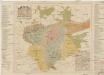
Maps of Podolí

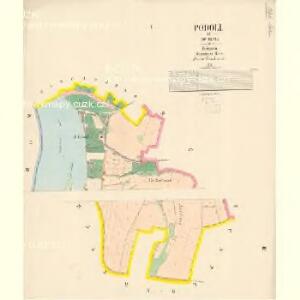
Podoll - c5920-1-002 - Kaiserpflichtexemplar der Landkarten des stabilen Katasters
1 : 2880
Podoll - c5920-1-001 - Kaiserpflichtexemplar der Landkarten des stabilen Katasters
1 : 2880
Orientační plán hlavního města Prahy s okolím

Orientační plán Prahy a obcí sousedních List 21.

Orientační plán hlavního města Prahy s okolím
1 : 5000
Orientační plán král. Hl. města Prahy
Auto-Praha : automobilní plán Velké Prahy a příručka pro automobilisty
1 : 50000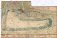
[Plán Vyšehradu]
Braník (Praha, Česko)
Nussle - c5330-1-002 - Kaiserpflichtexemplar der Landkarten des stabilen Katasters
1 : 2880
Nussle - c5330-1-001 - Kaiserpflichtexemplar der Landkarten des stabilen Katasters
1 : 2880
Orientační plán města Nuslí

Regulační plán spojených obcí Nusle a Pankrác

Plan von Wischehrad
Vyšehrad (Praha, Česko) Bittner, Joseph Pluth, Caspar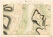
Plan von Wischohrad samt der gegenüberliegenden Gegend

Bez titulu: Praha

Abbildung deß weitberümbten Pragerischen allten Schlosses Wiserat, wie solches von ihr kayserl. und königl. May. Ferdi. III Ao. 1653 zu fortificiren angefangen, und von ihr kön. May. Leopoldo I. durch he. Obristen Joseph Priamii Freihe. von Rouorat, he. auf Lichna vollführet würt
Vyšehrad (Praha, Česko) Merian, Matthaeus M. Merian
Stereofotogrammetrické zaměření... Vltavy, Otavy... pomocí Zeissova fototeodolitu

Potrubí a situace nové vodárny pražské (vyznačeno červeně)
1 : 14300 Praha (Česko)
Plan des südlichen Moldauthal ́s bei Prag

Orientační plán sídel. hlav. města Prahy
1 : 12000 Libeň (Praha, Česko) M. Král
Praha, hlavní město ČSR : Fastrův obrázkový plán a průvodce
1 : 10000
Grundtriss der Prager Stätte

Bez titulu: Plán hlavního města Prahy

Militaerisch Topographischer Plan von der Königl. Hauptstadt Prag nebst Umgebungen

Militærisch topographischer Plan von der königl. Hauptstadt Prag nebst Umgebungen

Neuester Plan von Prag mit seiner Umgebungen
1 : 18000 Praha (Česko) bei Gottl. Haase Söhne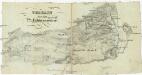
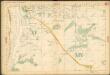
Terrain für das 2te Feldmanoeuvre
1 : 60000 Praha (Česko)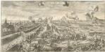
Bestürmbung der Prager Stätte

Plan of Prague
1 : 16000 V. Neubert a Synové V. Neubert a Synové