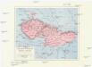
Maps of Poland
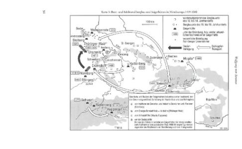
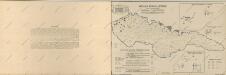
Bunt- und Edelmetallbergbau und Saigerhütten in Mitteleuropa 1419-1540
Mitteleuropa Bergbau, Hüttenindustrie
Obec českého národa
1 : 3400000 Evropa střední Kuffner, Hanuš
Austrian Dominions.
1 : 5200000 Arrowsmith, Aaron
Austrian Dominions.
1 : 1930000 Pinkerton, John, 1758-1826
Austrian Dominions.
1 : 5200000 Arrowsmith, Aaron
Reise und Influenz-Karte der Eil- Post- und Brancard-Wagen-Course in dem Oesterreichischen Kaiserstaate
Evropa střední Raffelsperger, Franz Bermann, J. Franz Raffelsperger
Reise und Influenz-Karte der Eil- Post- und Brancard-Wagen-Course in dem Oesterreichischen Kaiserstaate
Evropa střední Raffelsperger, Franz Haupt-Direction der k. k. Fahrposten
Základ zkázy nezvratné
1 : 5000000 Morava (Česko) Kuffner, Hanuš
Illustrirte politische Karte von Österreich und den angränzenden Ländern
Evropa jihovýchodní
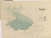
Československá republika

Die Haupt-Verkehrs-Richtungen auf deutschen Eisenbahnen hinsichtlich ihrer merkantilen Bedeutung durch Farben veranschaulicht
1 : 2000000 Loeben, W.K. von Weingartner
Vývoj Státu československého
1 : 2800000 Česko Hocke, Jan B. Kočí
[Habsburská monarchie]
1 : 4440000 Evropa jihovýchodní
[Habsburská monarchie]
1 : 4440000 Evropa jihovýchodní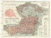
G. Freytags Karte von Deutschösterreich
1 : 1500000 Německo G. Freytag & Berndt
Ethnog. Austria-Hungary
1 : 4000000 Andree, Richard; Times (London, England)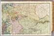
France 2.
1 : 1170000 Brue, Adrien Hubert, 1786-1832; Herisson, Eustache, b. 1759
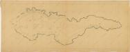
Czechoslovakia.
From Czechoslovakia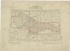
Přehled listů mapy generální 1:200 000, speciální 1:75 000 a původního vyměřování (topogr. sekcí) 1:25 000

Československo v mapách
Atlas d'industrie de la république tchécoslovaque
Atlas d'industrie de la république tchécoslovaque
Les Pays Tchéques
Morava (Česko) Conseil National Tschécoslovaque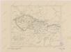
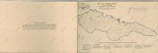
Sbírka map a diagramů použitých na mírových konferencích v Paříži v letech 1919 - 1920

Osterreichischen Kaisertums
1 : 1950000 Evropa střední Götze, Johann August Ferdinand im Verlage des Geogr. Instituts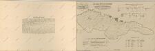
Atlas d'industrie de la république tchécoslovaque
Mapa historického vývoje Československého státu (od XIV. do XIX. století)
Bez titulu: Československo