Maps of Carpathian Mountains

Austrian Dominions.
1 : 5200000 Arrowsmith, Aaron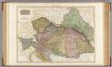
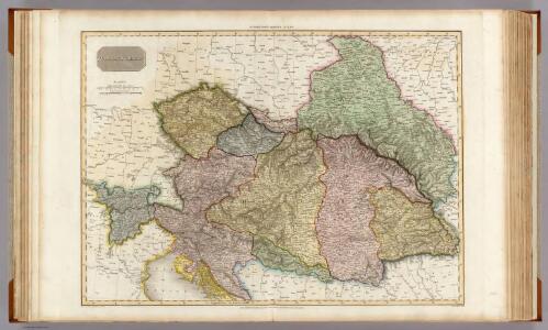
Austrian Dominions.
1 : 1930000 Pinkerton, John, 1758-1826
Austrian Dominions.
1 : 5200000 Arrowsmith, Aaron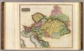
Austrian Dominions.
1 : 2400000 Thomson, John
Ethnog. Austria-Hungary
1 : 4000000 Andree, Richard; Times (London, England)
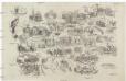
Neueste Postkarte der Saemtlichen K. k. teutsch und Ungarische Erblaender
Illustrirte politische Karte von Österreich und den angränzenden Ländern
Evropa jihovýchodní
Kaisertum Österreich 1809 nach dem Frieden von Schönbrunn
Österreich Wien-Schönbrunn / Friede Kunz, Andreas ; Moeschl, Joachim Robert

Kaisertum Österreich 6.8.1806 bei Ende des Heiligen Römischen Reiches
Österreich, Heiliges Römisches Reich Kunz, Andreas ; Moeschl, Joachim Robert
[Deutschland]
Historisch-genealogisch-geographischer Atlas von Le Sage Las Cases, Emmanuel Auguste Dieudonné Marius Joseph de Johann Velten, Kunsthändler
Kaisertum Österreich 1805 nach dem Frieden von Pressburg
Österreich Preßburg / Friede <1805> Kunz, Andreas ; Moeschl, Joachim Robert
Rakauské mocnářstwí
1 : 4440000 Evropa střední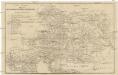
Neueste Postkarte der Oesterreichischen Monarchie
Evropa střední Rieder, Lorenz Otto Wigand
Germany general map.
1 : 4300000 Society for the Diffusion of Useful Knowledge (Great Britain)
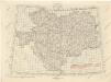
Germany.
1 : 6336000 Finley, Anthony
Germany.
1 : 6336000 Lucas, Fielding Jr.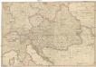
General Karte des Österreichischen Erb-Kaiserthums
1 : 2470000 Evropa jihovýchodní Mollo, Tranquillo T. Mollo
Vývoj državy rakousko - uherské
Übersichtblatt der Spezialkarte 1:75 000

Germany
A new general atlas of modern geography, consisting of a complete collection of maps of the four quarters of the globe Wyld, James James Wyld
Germany, Austria.
1 : 4118400 Letts, Son & Co.
Weltverkehrslinien Oesterreich-Ungarn's und deren Lücken
1 : 2371000 Rakousko-Uhersko
Sbírka map a diagramů použitých na mírových konferencích v Paříži v letech 1919 - 1920
Neue und vollkomene Postkarte durch ganz Teutschland
Francie Artaria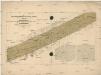
Karte der totalen Sonnenfinsterniss am 8. July 1842
Evropa střední Littrow, Carl Ludwig Lehmann, Jacob Heinrich Wilhelm Verlag der lithographischen Anstalt des Ludwig Mohn
Postkarte durch ganz Deutschland, Italien, Frankreich, Niederland, Preussen, Polen und Ungarn
Florencie (Itálie) Mollo, Tranquillo T. Mollo
Oesterreich
Österreich-Ungarn
Europe Centrale.
1 : 3500000 Picquet, C.