Maps of Germany

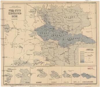
Vývoj Státu československého
1 : 2800000 Česko Hocke, Jan B. Kočí
Illustrirte politische Karte von Österreich und den angränzenden Ländern
Evropa jihovýchodní
Germania Antiqua.
1 : 2300000 Robert de Vaugondy, Gilles, 1688-1766
Germany, Austria, Bohemia.
1 : 2600000 Cary, John, ca. 1754-1835
Reise Karte von Deutschland
Evropa střední Julius, E. Vieweg, Friedrich Friedrich Vieweg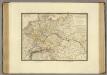
Empire d'Allemagne, Hongrie, Gallicie, Prusse, Provinces-Unies de Pays-Bas; en 1789.
1 : 3500000 Brue, Adrien Hubert, 1786-1832
Empire of Germany.
1 : 2450000 Johnson, A.J.
Empire of Germany.
1 : 2450000 Johnson, A.J.
Die Haupt-Verkehrs-Richtungen auf deutschen Eisenbahnen hinsichtlich ihrer merkantilen Bedeutung durch Farben veranschaulicht
1 : 2000000 Loeben, W.K. von Weingartner
Die deutsche Bundesstaaten
1 : 3500000 Evropa střední Raffelsperger, Franz in Typographischen Landkarte-Verlage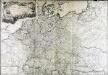
L'empire d'Allemagne
1 Karte auf 2 Blatt : Kupferdruck ; 72 x 103 cm Brion de la Tour; Longchamps chés Longchamps géographe rue St. Jacques à l'enseigne de la place des Victoires
Reise und Influenz-Karte der Eil- Post- und Brancard-Wagen-Course in dem Oesterreichischen Kaiserstaate
Evropa střední Raffelsperger, Franz Bermann, J. Franz Raffelsperger
Reise und Influenz-Karte der Eil- Post- und Brancard-Wagen-Course in dem Oesterreichischen Kaiserstaate
Evropa střední Raffelsperger, Franz Haupt-Direction der k. k. Fahrposten
Der Deutsche Bundesstaat in 23 Republiken nach Struve's Grundrechten des deutschen Volks
1 : 4500000 Lithogr. von F. Bruder in Basel Basel : [s.n.]
Základ zkázy nezvratné
1 : 5000000 Morava (Česko) Kuffner, Hanuš
(Villes Anseatiques)
1 : 2900000 Dangeau, abbe de, 1643-1723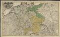
Imperii romano-germanici in suos status et circulos divisi tabula generalis
1 : 1750000 Ultraject : edita per Cornelium Kribber
Germania Augustiniana
1 : 3700000 Mollova mapová sbírka Seutter, Matthäus Seutter, Matthäus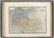
Europe Centrale.
1 : 3500000 Levasseur, E.
Deutschland ́s Eisenbahnen und Strassen - Netz
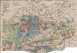
Mitteleuropa Bodenkarte
1 : 6000000 Mitteleuropa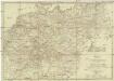
Neueste Post Karte von Deutschland und dessen angrenzenden Länder
Evropa střední Jättnig, Karl Simon Schropp
La Germanie, 275 de J.C.
1 : 6300000 Houze, Antoine Philippe
Deutschland
Plastischer Schul-Atlas über alle Theile der Erde : in 24 Karten Woldermann, G Verlag von P. Eckerlein
La Germanie 511 a 741.
1 : 6300000 Houze, Antoine Philippe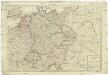
Deutschland nach seiner neuesten Grenz-Berichtigung
1 : 2350000 Evropa střední Mollo, Tranquillo T. Mollo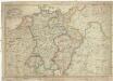
Deutschland nach seiner neuesten Grenz-berichtigung
1 : 2350000 Evropa střední Mollo, Tranquillo T. Mollo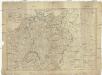
Deutschland nach seiner neuesten Grenz-Berichtigung
1 : 2370000 Evropa střední Mollo, Tranquillo bey T. Mollo
Empire of Germany.
1 : 2450000 Johnson, A.J.