Maps of Czech Republic
Sbírka map a diagramů použitých na mírových konferencích v Paříži v letech 1919 - 1920
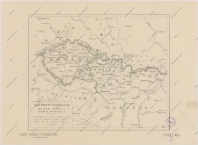
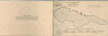
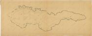
Les Pays Tchéques
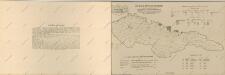
Morava (Česko) Conseil National Tschécoslovaque
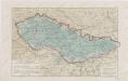
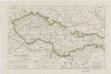
Československá republika
Bunt- und Edelmetallbergbau und Saigerhütten in Mitteleuropa 1419-1540
Mitteleuropa Bergbau, Hüttenindustrie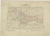
Přehled listů mapy generální 1:200 000, speciální 1:75 000 a původního vyměřování (topogr. sekcí) 1:25 000
59-60. Cecoslovacchia, Ungheria.
1 : 1500000 Touring club italiano
Československo v mapách

Obec českého národa
1 : 3400000 Evropa střední Kuffner, Hanuš
Základ zkázy nezvratné
1 : 5000000 Morava (Česko) Kuffner, Hanuš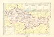
Historický atlas revolučního hnutí
Atlas d'industrie de la république tchécoslovaque
Přehled kladu mapových listů měř. 1:10 000, 25 000, 50 000, 100 000
Atlas d'industrie de la république tchécoslovaque

Československo v mapách
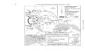
Sbírka map a diagramů použitých na mírových konferencích v Paříži v letech 1919 - 1920
Bez titulu: Československo

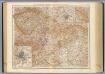
Parte Orientale della Germania Diuisa Ne Suoi Stati
1 : 2100000 Mollova mapová sbírka Coronelli, Vincenzo Maria
Parte Orientale della Germania Diuisa Ne Suoi Stati
1 : 2100000 Mollova mapová sbírka Coronelli, Vincenzo Maria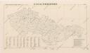
Republika Československá

Atlas d'industrie de la république tchécoslovaque
Sbírka map a diagramů použitých na mírových konferencích v Paříži v letech 1919 - 1920

Finland. Poland. Austria, Czechoslovakia, and Hungary. Yugoslavia.
1 : 4127000 Hammond, C.S.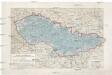
Pays Tcheques
1 : 1850000 Československo Larouse
Völker-, Telegrafen- und Eisenbahn- Karte des Keiserthumes Öesterreich

Historická mapa zemí Koruny České od XV. stol. a dnešní Slovensko
Bez titulu: Československo

Czechoslovakia.
From Czechoslovakia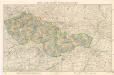
Mapa republiky Československé

Germany, E. sheet.
1 : 1400000 Rand McNally and Company