Maps of Poland

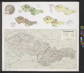
Czechoslovakia.
From Czechoslovakia
Mapa historického vývoje Československého státu (od XIV. do XIX. století)

Sbírka map a diagramů použitých na mírových konferencích v Paříži v letech 1919 - 1920

[XIII], uit: Geognostische Karte des Oesterreichischen Kaiserstaates mit einem grossen Theile Deutschland's u. Italien / hauptsachlich nach ... Haidinger's geognostischer Karte dieses Staates bearb. von Josef Scheda
1 : 3000000 titelvariant: General-Karte von Europa in 25 Blättern; Annotatie: Bijlage bij: General-Karte von Europa in 25 Blättern. - 1:2.592.000. - 1845-1847 Scheda, Joseph Wien : K.K. Militär. Geografisch. Institut
Obec českého národa
1 : 3400000 Evropa střední Kuffner, Hanuš
Partie, l'Allemagne. Europe 14.
1 : 1641836 Vandermaelen, Philippe, 1795-1869
Ideal Postcharte von Boehmen
Evropa střední Berka, Jan Wenzel Schwarz
Ideal Postcharte von Boehmen
Evropa střední Berka, Jan Wenzel Schwarz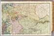
France 2.
1 : 1170000 Brue, Adrien Hubert, 1786-1832; Herisson, Eustache, b. 1759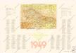
Československá republika

Mapa vývoje České koruny od XIV. století
1 : 3900000 Česko Hocke, Jan Kapras, Jan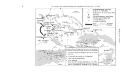
Bunt- und Edelmetallbergbau und Saigerhütten in Mitteleuropa 1419-1540
Mitteleuropa Bergbau, Hüttenindustrie
Kaart van het oostelijk front
1 : 1900000 [S.l. : s.n.]
Parte Orientale della Germania Diuisa Ne Suoi Stati
1 : 2100000 Mollova mapová sbírka Coronelli, Vincenzo Maria
Parte Orientale della Germania Diuisa Ne Suoi Stati
1 : 2100000 Mollova mapová sbírka Coronelli, Vincenzo Maria
III. vojenské mapování 3959
1 : 75000
Polen unter Boleslaw Chrobry und bis 1139
1 : 12000000 Polen Bolesław I., Polen, König
Eastern Germany, distribution of population.
1 : 2400000 Covers Poland, East Prussia, and border areas of Germany and Czechoslovakia. "From: Atlas des deutschen Lebensraumes in Mitteleuropa, plate 27. Data as of 1930-1934." "No. A-6287." United States. Office of Strategic Services. Research and Analysis Branch. [Washington, D.C.] : R & A, OSS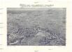
Plastická mapa zemí Sudetských a Karpatských
Evropa střední E. Šolc
Germany, E. sheet.
1 : 1400000 Rand McNally and Company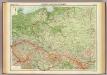
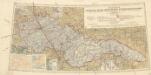
Poland & Czecho-Slovakia.
1 : 2000000 John Bartholomew and Son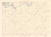
Letecká navigační mapa

Polen u. Nachbarländer 963 bis 992
1 : 12000000 Polen
Germany : International frontiers 1937 : internal boundaries 1944
1 : 1600000 [London] : [War Office]
87-88. Poland. The World Atlas.
1 : 1500000 USSR (Union of Soviet Socialist Republics).
Základ zkázy nezvratné
1 : 5000000 Morava (Česko) Kuffner, Hanuš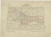
Přehled listů mapy generální 1:200 000, speciální 1:75 000 a původního vyměřování (topogr. sekcí) 1:25 000
Přehledná letecká mapa Republiky československé: Carte aéronautique d'ensemble de la République Tchécoslovaque
Vojenský zeměpisný ústav